Monday, August 16, 2010

Field Trip to Tahoe

Desolation Wilderness
Relaxing after a swim at Velma Lake.


This past weekend I went on a camping trip to Lake Tahoe at Sugar Pine Point State Park with the graduate students in the Earth & Planetary Science Department at Berkeley, my new department. It was a lot of fun and I had a chance to meet a lot of people I will be working with and taking classes with. The first day we spent half of it driving there. Then after setting up our tents and stuff, we went to the beach to take a swim in Lake Tahoe. The weather was beautiful and hot, but the water was kind of chilly. The next day we took a hike in the Eldorado National Forest in the Desolation Wilderness to Velma Lake. There is an upper and lower Velma Lake, and I'm not sure which one we actually hiked to. Once we got there, we took a swim and relaxed. It was a 10 mile round trip hike and a 2,000 ft elevation gain. Then the last full day we spent at Tahoe we took another hike to the peak of Mt Tallac, at 9,700 ft high, which was awesome! It was another 10 miles round trip hike but a 3,300 ft elevation gain. It was pretty steep in some areas but worth the hike to the top for the view alone. Near the top, which was above the tree line, there was a tundra like ecosystem with wildflowers blooming. It was so beautiful!

Lake Tahoe
The shores of Lake Tahoe at Sugar Pine Point.


Each night we left the campfire for a while and took a walk to the beach to see the stars and the milky way. Jupiter was also bright in the sky. The first night we were there, it was just after the peak of the Persieds meteor shower. But even so, we still saw a few shooting stars, and some were huge fireballs with tails that stayed glowing, streaking across the sky along the milky way. It was spectacular to see, especially since the sky was so dense with stars and the moon was rising pretty late. Well, here are some more pictures:

Sugar Pine Point
My tent in the forested area of the group campsite at the state park.


Desolation Wilderness
Eagle Lake, as seen from the trail to Velma Lake in the Desolation Wilderness.


Desolation Wilderness
High Sierra beauty in the Desolation Wilderness.


Mt Tallac Hike
Gaining elevation on the hike to summit Mt Tallac.


Mt Tallac Hike
High Sierra tundra and blooming wildflowers near the summit of Mt Tallac.


Mt Tallac Hike
Trees sculpted by the prevailing winds, nearing the tree-line!


Mt Tallac Hike
At the summit of Mt Tallac, with Lake Tahoe in the background.

Thursday, August 12, 2010

Norway part 2: Fjordin'

     I fell asleep on the ride between Oslo and Dombås, but it was kind of rainy and dull out, and I was tired.  However, having to switch trains from the cross country ho-hum type to the Rauma Rail line woke me up.  The train was much nicer, with large windows and slightly more comfortable seating.  We also only had about 3 minutes to switch trains, so there was a bit of an adrenaline rush.  The Rauma line took us through some spectacular scenery!  Almost immediately we crossed an awesome river with cliffs on either side.  Shortly thereafter we were passing through wonderous valleys and next to the Rauma river.  The weather was what I’ve been told is typical to the area – cloudy with a few breakthroughs of sun and some low hung fog in the valleys.  The train descends rapidly from something like 600m to sea level in a trip that took only an hour or so and wasn’t going very fast.  It crosses at least 30 bridges and goes through two hairpin tunnels.  Yes, hairpin tunnels.  As in the train does a U-turn in the mountain!  The train also passed by the Trollveggen (Troll’s wall), which is the highest cliff face in Europe at something like 1000m.  Unfortunately, we couldn’t see it due to the low clouds (but we saw it on the way back)..


View from the Rauma Rail 
A view from the Rauma Railway line. 


      We reached Åndalsnes and exited the train to the sound of Norwegian death metal!  Rauma Rock, an annual festival, happened to be occurring while we were there.  Before we went a-Rauma-rockin, we walked the 4km to the campground on the Rauma river.  We set up camp, and although we were tired, felt the rumble of hunger.  So back to the city we walked, to get some food and go Rauma Rockin!  We barely made it in time to get groceries, and with groceries in hand, walked over to the festival.  Unfortunately, they wanted 800 kroner (~$115) to get in!  Luckily, we didn’t have too much interest in actually seeing the performers, and instead grabbed a beer to listen.  At $10/beer, our wallets only allowed us 2 each, and our internal clocks were still partly on California time, so we soon walked back to our camp and crashed.


Rauma River view of the mountains 
This was taken right next to the campground at a small beach area, the morning we went to see the Trollstigen.


       Waking up the next day to somewhat dreary (but picturesque) surroundings, we got up and made breakfast sandwiches, did some emailing, and prepared for our trip to the Geirangerfjord.  The bus left at 8:30, the same time the café at the campground opened which just wouldn’t do.  Coffee was needed!  So a bit before the hour we hoofed it towards town to the gas station on the outskirts of town, and got some of the best gas station coffee I’ve ever had.  I mean, this stuff was excelent!  With epic coffee in hand, we waited at the bus station in front of the gas station and flagged down the bus to Geirangerfjord when it came by.  The bus driver looked pissed, but I think that was just his normal expression because he turned out to be a jolly fat man.  The bus took us back past our campsite, and onwards down the road to the Trollstigen and the fjord.  In my mind the fjord was the main attraction, but that idea was quickly discarded as we approached the Trollstigen.  The road ascends a ridiculous cliff, with many switchback, and a width I hardly thought wide enough for the huge bus we were in!  The jolly fat driver stopped a few time to exlaim ‘fotos!’, where all passengers would stumble out, too intent on looking at the massive cliffs to notice small things like stairs on a bus.  Seriously, two people did this.


The troll sign!
The official sign in Norway for Troll crossing!


Trollstigen
The Trollstigen (Troll's Ladder)


      The climb to the top of the Trollstigen was an impressive feat of driving, and the view from the top was amazing.  The fog was hung low in the valley, looking more like a painting than reality.  But it didn’t end there.  The terrain from this point down to the small town of Valldal was equally amazing.  I love the high mountain landscapes!  There are pictures on flickr, but none turned out too well through the windows of the bus. 
Arriving in Valldal, we were surprised to find ourselves boarding a ferry to cross from Valldal to Eidsdal.  Then we climbed back up and over a pass, descended another crazy steep and narrow road, and arrived in Geiranger.  We had a few minutes, which we used to make sandwiches while we waited for the ferry from Geiranger back to Valldal.  Mmm sandwiches.  The ferry arrived, and off we went.  The Geirangerfjord is one of the ‘to do’ fjords of Norway and it was definitely impressive.  The shear scale of it all was just massive. 


Overlook of Geiranger 
A view of Geiranger (and an apparently grumpy me) from near the pass we came over.


       The ferry took us past a few waterfalls, one of which is known as the 7 sisters and looked spectacular in the pictures we saw of it.  But this year has been a bit light on the rainfall and consequentially two of the sisters were on vacation.  It was still an awesome site, as well as the waterfall across from the 5 remaining sisters.
The ferry then went out of the Geirangerfjord and turned toward Valldal.  We passed farms that were situated on cliffs overlooking the fjord.  These farms had all been in use as late as the 1960s, and must have took determined farmers to work them!  There were no roads to them, no electricity, and snow melt streams for water.  They existed at elevations that were high enough to make the climb up strenous, but low enough that the winters were not too harsh on the inhabitants.  One farm was even moved down by 15 meters because they had originally built it too high and the winter was too harsh at that elevation!  Imagine moving your house 15 meters (50 ft) lower and all the sudden the winter is much milder!


A bit cold! 
The 7 (five) Sisters waterfall.


      The fjord widened and branched again as we turned towards Valldal and Eidsdal, and we watched the same ferry that had carried our bus over as it cruised away from Valldal with another bus on board.  This also signaled the end of our ferry ride, so we disembarked and found that we had 2 hours to wait until we could catch the bus back (we had just seen it crossing on the other ferry going the other way).  With time to spare, we bought some beer, made a few sandwiches, and explored Valldal.  There was a small church in town that was kind of cool – Andrew was running around trying to find old gravestones, but none were older than 150yrs.  We then found a little beach to relax on and wait for the bus.  People were swimming and the water was indeed warm, although we had no swim suits, so instead we skipped some stones and ate our sandwiches.  Soon the time had passed and we were boarding the bus again, bound for Åndalsnes with the jolly fat driver at the wheel again.


Valldal Beach 
The beach in Valldal where we had some sandwiches.


      This time the sun was shining, the sky was a deep blue, and the views were just great!  The driver stopped at a roadside stand for strawberries, and although expensive by US standards, they were excellent!  The Valldal area is known in Norway as a huge strawberry area, and it did not disappoint.  The trip back up to the Trollstigen was awesome; we were able to see much more this time around.  Again we stopped for ‘fotos!’ and got some great shots. 
      Arriving back at the campground we were surprisingly tired, so we showered and I went to sleep.  Andrew stayed up and drank beer with himself like a total alco.  I awoke the next day refreshed and spent it internetting and relaxing in Åndalsnes as we waited for the train to Trondheim.

Sunday, August 08, 2010

Norway part 1: Getting there and Oslo

Andrew and I left Oakland on Wednesday around 1pm, flying to Ontario first on our way to Norway. The flight was nice and comfortable, and I was surprised with how nice Air Canada was. We arrived in Ontario, hurried over to the other gate, and got on the much longer flight to Frankfurt, Germany, also on Air Canada. I think that airline is my new favorite – the airplane food was actually good and they had a choice of movies to watch. I tried to sleep on the flight, but think I only got about an hour. The plane landed about 20 minutes late, and for all the hurrying we could do, the damn Frankfurt airport is a labyrinth and we missed the flight to Oslo. So we had to re-navigate the labyrinth up to the customer service office to get another flight for 2.5hrs later, go through customs about 3 times, and finally get to the gate of departure, where we both promptly sat down and fell asleep. We almost missed the flight to Oslo because of that, but woke up just as the last people were boarding, and some Norwegian guy was laughing that we looked to comfortable to wake up. The flight to Oslo was uneventful I think – I don’t really know because I continued my nap. Landing in Oslo, we collected our luggage and took the train to the city center, which cost around $15 to go 20 miles – our first introduction to the Kroner vs. the $.
The train station was nice and close to our hostel, so we walked over to the 2 star 'hotel' we were staying at, located rather centrally in Oslo, checked in, dropped our crap, and headed out around 10pm while it was still light, accompanied by some random Japanese dude who was staying in one of the other bunks of the room (he was in Norway for the Orienteering competition in Trondheim). After 24 hours or so of travel, we really didn’t have all that much energy and ended up back at the hotel by midnight, stopping along the way for some beer at a local piano bar of all places. The singer did a rendition of Bohemian Rhapsody that was pretty awesome.
The following day (Friday by now), we awoke early to shower, eat, and get ready to see as much of Oslo as we could prior to our train to Åndalsnes leaving at 2ish. It was surprisingly easy to wake up, so we got an early start. We first walked over to the Vigeland Sculpture Park. This park has 200 some bronze and granite statues of people doing odd things. It was quite a sight really, and I didn’t really expect it to be as cool as it turned out to be. After the park, we headed back to the center area of town, intent on seeing the Akershus Fortress. The castle in this fortress was built in the late 13th century, and used until 17th or 18th century, when it was apparently allowed to ‘fall into decay’ as they put it, and not restored until the late 1800s. The restoration seemed to be more for function than historical accuracy, and it turns out that the fortress is actually used by the Norwegian military (as well as the tourist industry). It was also used as a prison for some time, where the prisoners could be rented out as a workforce!
After the fortress, we walked over to the Oslo Cathedral to see the main church of Oslo. I kind of expected a more gothic crazy building, with some viking influence or so (like a longboat for a roof), but was instead we saw a rather bland church, and only from the outside, since they were only open 3:30pm until midnight. So that left us with a bit of time to wander about, and Andrew bought some new shoes to replace the extremely worn out pair he had came with. After that, we collected our bags from the hotel and headed over to the train station, boarded our train, and started progressing up north.

Some pics:

Vigeland Sculpture Park Like I said, weird sculptures.

Vigeland Sculpture Park
Naked pissed little kid.

Vigeland Sculpture Park
It was a nice park, even for all the odd sculptures

Oslo marina areaThe touristy dock area of Oslo

Thursday, August 05, 2010

Visiting Lassen Volcanic National Park

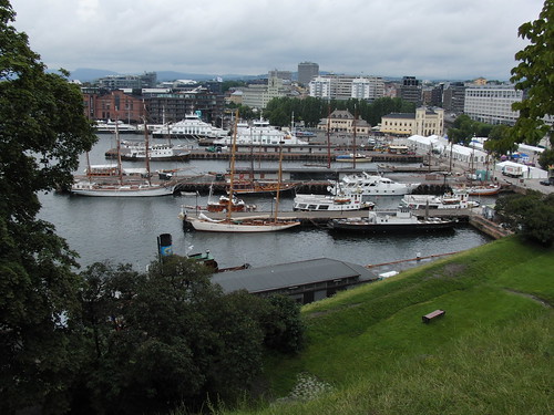
Lassen Volcanic National Park is in the southern section of the Cascade Mountain range which connects with the northern part of the Sierra Nevadas. It is snow-free only two or three months of the year! We figured that now was the time to go and visit it, since the road is usually closed more than it is open. It was kind of a last minute decision to go, which made it even more fun. We left Friday afternoon from Oakland and headed north along I-5 until we got to Red Bluff, which is just south of Redding. From there we took HWY 36 into the Lassen National Forest to camp for the night. It was pretty dark when we finally got to the forest boundary, so we just turned on our bright lights and turned off on the nearest forest road. The road kept climbing up a mountainside with pretty steep drops or walls to either side. Finally though, it leveled out and we found a spot to camp for the night where somebody already made a huge firepit! I had our fire permit in my purse, so we made a campfire and had some tortilla chips for dinner.

Lassen National Forest Camping
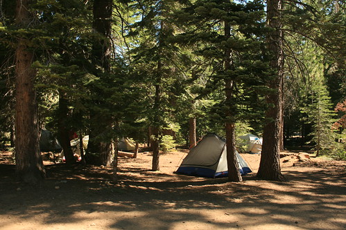
Our campsite in the Lassen National Forest.


The next morning we got up as early as we could (but we didn't get to sleep until about midnight the night before) because we wanted to see a lot of the park - as much as we could that day. But first, we had to stop for some coffee in the town of Mineral, just outside of the park. Then with coffee in hand, we were ready to enter the park, which only cost $10, but our year pass was still valid so we didn't have to pay. The first spot we hit was the geothermal area and Little Hot Springs Valley, which was once the interior of a huge volcano that blew itself up. The magma chamber was still feeding heat to some geothermal features, like boiling mud pots, fumaroles, and hot springs. It looked like a mini Yellowstone. On one of the signs, we saw a picture of Bumpass Hell, another geothermal area which was a 1.5 miles hike away, so we decided to go see that too.

Lassen National Park
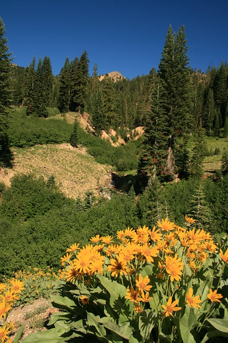
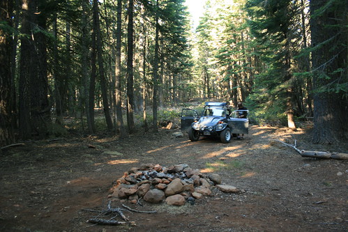
Yellow wildflowers in Little Hot Springs Valley in Lassen Volcanic National Park.


Mt Lassen
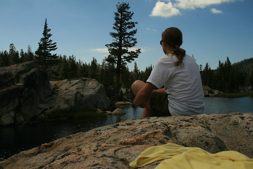
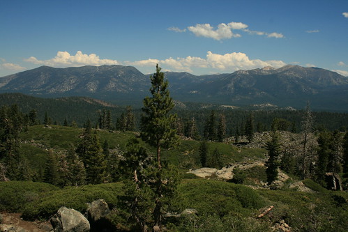
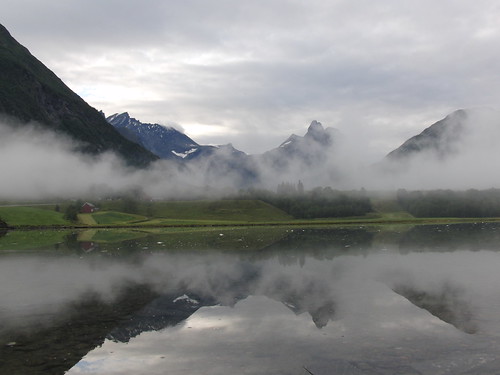
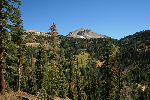
Mt Lassen lurks in the background and the eye.


The area got its name, Bumpass Hell, because there was a guide named Mr Bumpass, who used to take people to the area. One time he walked on the geothermal area when he was giving a tour, where the crust was too thin, and his leg broke through and fell into the boiling hot mud just below the surface. It was mud, so it stuck on him, but it was also boiling hot! He was severely burned and lost his leg as a consequence.

Bumpass Hell
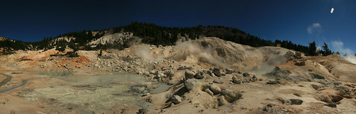
A panoramic photo of the Bumpass Hell area.


We saw a bunch of mud pots, fumaroles, and hot springs (again) but they were very colorful here. There was even a roaring fumarole which sounded like a quiet jet engine with a huge amount of steam gushing out of it. The whole area had a boardwalk so that you could walk and see everything elevated off of the thin fragile crust. In some areas, parts of the boardwalk were engulfed by the every changing hot springs. There was a lot of snow still on the trail to Bumpass Hell. We even found an informational sign (about the story of Mr. Bumpass) still almost completely covered by snow.

Snow Algae
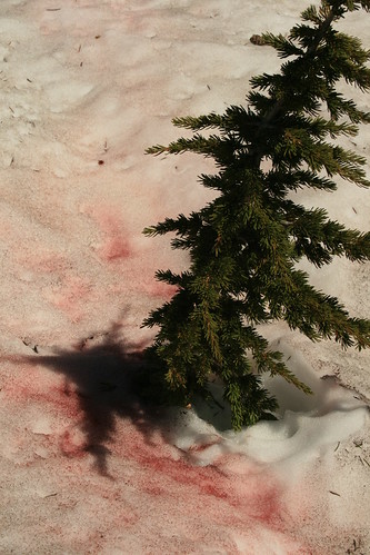
Pink snow algae is alive and lives on the frozen surface!


Next, we continued the drive through the park on Hwy 89, which took us past the base of Mt Lassen. There was even more snow there and along the side of the road we found snow algae growing on the surface. It is a type of extremeophile which lives quite contently on the snow during summer. It was bright pink! Aside from that, the rest of the road went past a lot of forest scenery and gave access to a lot of trailheads for hikers. Soon we were out of the park, but there were other things we still wanted to see. In the northeast section of the park was the Fantastic Lava Beds and the famous Cinder Cone trail and Painted Dunes. To get there, we had to first drive out of the park, and then drive down a forest road which took us back into the park. It was a bumpy gravel road, but no biggie in the baja.

Fantastic Lava Bed
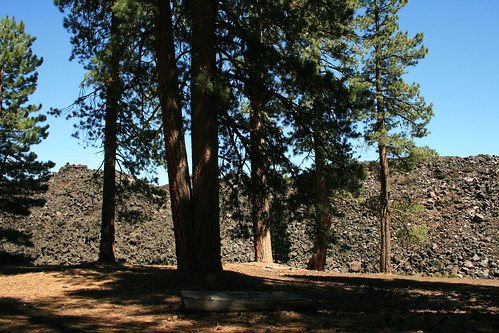
At the edge of the flow which created the Fantastic Lava Bed, along the trail to the cinder cone.


We found the trail that led to the cinder cone, which started from the Butte Lake campground area. Along the way, we hiked past the edge of the lava flow that created the Fantastic Lava Beds (I'm not making up the name!), which up close looked like a bunch of lava rocks piled on top of each other. The ground we were walking on began to get sandy, but it was black, like sand that was created from broken up lava, which was all around us.

Lassen National Park
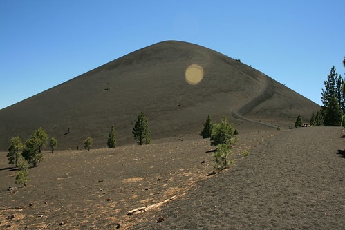
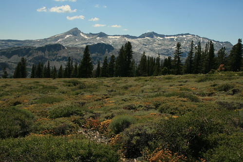
Approaching the cinder cone, which rises 700 ft above the lava beds.


Soon we reached the cinder cone and we started going up. Imagine climbing a huge dune. We were lucky that there was a nice strong cool breeze blowing because otherwise it would've been really hot, with all of the black lava under our feet. The cinder got in our shoes, in between our toes, and in our socks, which was a little annoying, but we were determined to get up. It took us about 1/2 hour to get all the way up because we climbed so slow and took a lot of breaks.

Lassen National Park
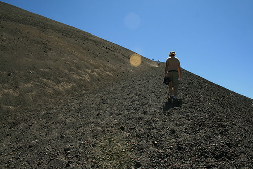
Climbing the cinder cone.


Finally, we got to the top. The cone's color was more reddish on top because of the rust that forms from the iron-rich cinder and lava. And the wind was even stronger! It blew my sun hat off many times. We took a walk around the entire top of the cinder cone and then found one of the only trees up there and sheltered ourselves from the wind for a break. We had a view to the east, over the painted dunes (colored from rust), Butte Lake, and of course, the Fantastic Lava Beds.

Lassen National Park
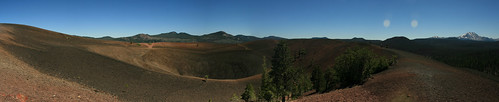
Panoramic photo of the top of the cinder cone. You can see Lassen to the right.


We were the only people on the top of the cinder cone, which was amazing for being Saturday afternoon. But that only lasted for about 45 minutes, and soon more people came up the steep trail. So we decided to go down, which was much easier than climbing up! When we got back down to the trail along the lava beds, we smelled a sweet vanilla scent in the air. It was the pine trees! The bark of some pine trees in the Sierras smell like vanilla cream soda. I think that is really cool!

Smelling Vanilla Cream Soda
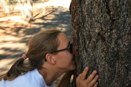
Some pine trees smell like vanilla cream soda when you smell their bark. It was so strong on the trail, it was carried by the breeze, almost like somebody cracked open a soda on the trail!


After hiking 4 miles round trip, we were pooped, so we headed out of the park and into the surrounding national forest to find a camping spot. We weren't very lucky finding a spot where somebody already camped before, so we picked a level area and had to build a new fire ring. After dragging all of the large rocks we could find in the area, we had to start collecting wood, which was no problem since there was downed wood everywhere. And the wood was extremely dry too so starting the fire was as easy as putting my lighter to a twig. No paper or anything needed. One lit twig started the entire pile of wood in the fire ring, which made me think of how easy it would be for somebody to accidentally start a whole forest fire. For example, if you were smoking and dropped your cigarette or something. Some national forests in California suspend campfire permits in the summer, but Lassen did not (yet) so we were allowed to have our fire that night. However, when we drove home the next day, all of the other forests we drove through had big signs reading "burning suspended."

That night we almost had another sasquatch encounter, but it turned out to be nothing. We were sitting around the fire, and it was starting to get dark. The birds were still singing. All of a sudden we heard a loud moan in the forest, but it sounded more like a trumpeting. All of the birds and even the chirping bugs stopped singing. It was dead quiet as everything in the forest paused to listen in confusion over what the heck that was. Even we turned our heads and listened to what might be lurking in the forest behind us. But it was nothing and we never heard anything unusual for the rest of the evening.

Toiyabe NF
Driving off road in the Toiyable National Forest.


The next morning we headed off east to get to Hwy 395. We decided that we had time to take a nice drive along my favorite highway from Susanville, CA, through Reno and Carson City, NV, back into California at Topaz Lake, and then over the Sierras on Hwy 89. Then from Hwy 89 we took the turnoff for Hwy 4, which we've never driven on before. It is one of the first highways to close when winter snow hits, and one of the last highways to open in the late spring (I don't think it opened until June this year). We figured it must be good if the snow plows don't even attempt to plow it. So off we went. But before we got to the highway turnoff, we were distracted by all the dirt roads that went off into the high country at Monitor Pass, which stands at 8,314 ft. Our excuse to go joy riding through the Toiyabe national forest was that we were scouting out yurting spots in the mountains. Its our plan to go relocate ourselves one summer for a couple of weeks and live out of the yurt. We are in the process of looking for solar panels that we could put on the roof so that we could power our laptops and still work on research while in the middle of nowhere in the yurt.

Toiyabe NF
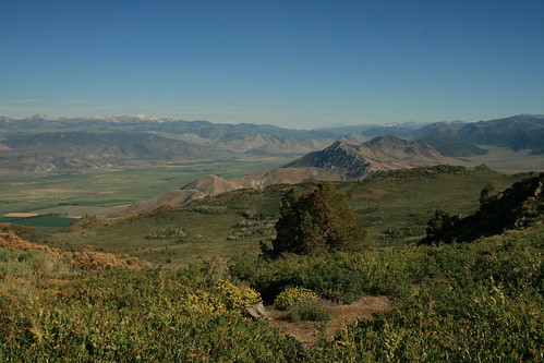
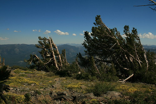
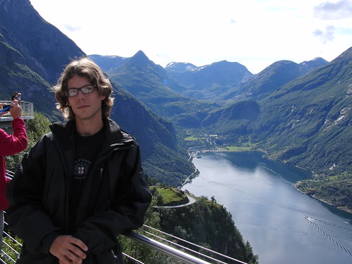
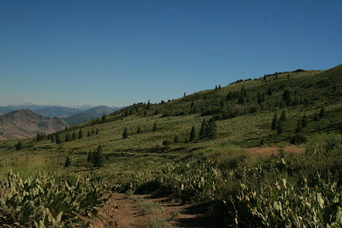
View south, towards Bridgeport. We want to put the yurt here one summer an have this view!


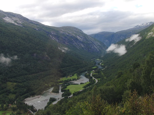
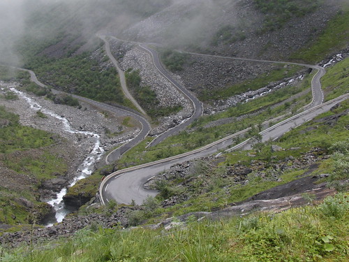
After close to an hour of exploring and stopping to take in the amazing views from the top of the mountains, we decided to finally get on Hwy 4. It followed a river for the beginning of it, and then it started climbing over the Sierras. Then the road turned into a one and a half lane road, with no center stripe! We couldn't believe that it was a real state route and not a paved forest road. There were thousand foot 'death-drops' sometimes to either side of the road, and nobody drove very fast for fear of missing on of the hairpin turns and falling off the Sierra Nevada mountains! We drove over huge granite domes and past small alpine lakes. There were awesome cabins secluded in the forest here and there, and I was sooooo jealous of whoever owned them!

CA HWY 4
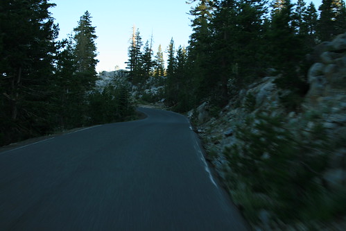
Driving down Hwy 4, which was one lane for most of the drive across the Sierras! It was so cool!


The sun was setting just as we got out of the mountains and into the valley. But I think the valley is boring so it didn't matter that it was dark already. In fact, maybe it was better that we didn't see Stockton while driving through it. We finally got home really late, and as always, I wished I was still in the Sierras! We want to go back again, of course. We always want to go back to the mountains as soon as we've left them!