Showing posts with label hot springs. Show all posts

Sunday, August 05, 2012

The Thermal Waters of Budapest, Hungary

As a treat to ourselves, we decided to fly out of a totally different city in Europe after we were done in Norway, and Romy was done with all his combustion conferences in Germany and Poland. We decided before we left, to pick a place we've never been to. Budapest was what we ended up going for. The reason we chose Budapest was because (A) it was cheap, being Eastern Europe, and (B) more importantly, it had numerous natural hot springs with several spas you can go to and soak in the thermal mineral waters!

Budapest
A lady working at Széchenyi baths lets us taste the mineral spring waters.


Our goal was to try as many of the spas (or bath houses) as we could in our 3 short days there. The interesting history about Budapest's bath houses is that many are very very very old, dating from the Turkish times (1541–1686 during Ottoman rule). The bath houses that have the Turkish style resemble domes, with the main bath under the dome. Some dry or wet saunas encircle the main hot bath under the dome, and cold or even hotter tubs also encircle it. But in the Turkish style bath house, the dome was the center of attraction. The inside of the bath house was kept dark and dim, and sometimes the dome has holes punched into it so that it resembles a starry sky when you look up. The rays of light beaming through the holes also make a cool laser effect when the beams hit the steamy air inside the bath house.

Budapest
Inside the pool rooms at Gellert Baths.


We went to one of the Turkish style bath houses the first night for the night swim. It was called Rudas and was originally built in 1550. As it was dark, we didn't get any pictures. But it was super relaxing and we were so excited to be there, it didn't matter that we stayed until about 2am. We weren't tired! We went that night because the late night bath time was co-ed. Normally, the bath houses separate genders. One day, only women can go. The next day, only men can go. Turkish bath houses were normally for men only, back during the Ottoman rule. Women just weren't allowed. Good thing we now live in modern times, otherwise I wouldn't be able to go!

Budapest
The Gellert Baths.


The rest of the bath houses are more modern. The funny thing is, when the political situation changed, and the Turks were no longer such a prominent influence on the culture, the Turkish bath houses went into ruin. They just started rotting and nobody gave a damn. Well, sometime in the late 1800s and early 1900s, there was a revival of spas and cleanliness, and bathing started anew! However, the culture had a different style, more extravagant and flashy. Some of the Turkish bath houses, which were very simple in style, were restored. But new ones were built over the old Turkish ones too, and they reflected the modern style. This is when Gellert Baths were built. Comparably, it was very ornate and had such detailed and beautiful ceramic tile work. The style was Art Nouveau, MY FAVORITE!!!!!

Budapest
The cold dipping pool at Gellert Baths.


The Gellert bath house was gigantic! It had a men's and a women's side. The day we decided to go (strategically) was when they had the co-ed bathing. Both men and women on that day could go into the men's and women's pools. I must say, the men's pools were much better looking. Structurally, they were the same, but the decoration and stuff was better looking. The women's pools were just kind of blah (comparatively). These baths were also popular with the tourists. We had to wait almost an hour to get into the pools. The staff only lets in a maximum amount of people in at one time. They don't want to over crowd the pools. So if 3 people go out, they let 3 people in. That's why we waited so long. But once we got in, we spent the whole afternoon there, until closing time (for the public).

Budapest
An old man spits out cold drinking water, to quench thirst.


The last bath house we visited on our 3rd day was called Kiraly, and it was an old Turkish bath. It was kind of hard to find, out of the way of the typical tourist route. While we were waiting in line to get in, we noticed a big difference in the clientele. A lot more regular folk, locals, but a few tourists mixed in. The price was the cheapest too! Being a Turksih bath, it had a predictable arrangement on the inside, so it was already familiar after going to Rudas. I think I liked the Turkish baths the best. They just focused on the hot water, and had a more simplistic but stylistic vibe. You could really relax in the dim light and geometrical patterns all around.

Budapest
The main hall at Gellert Baths.


Kiraly also had a mini museum when you got out of the baths. It also had a middle open outside section. It reminded me of the old hospitals or sanitariums. But it was nice to take a nap outside and hear the birds singing, even though you were in the middle of a city. There were a few weirdo tourists there, doing funny stuff. It all added to the entertainment. We went to so many hot springs that we never took a shower in our hostel while we stayed in Budapest!

Thursday, March 29, 2012

Nevada Hot Springs

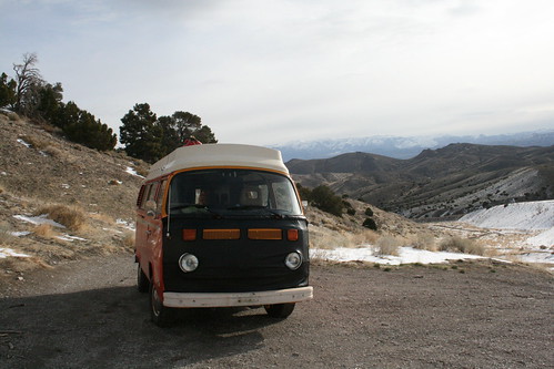
Nevada is a pretty interesting place, and we've only just driven through it most of the time. We wanted to do a trip dedicated just to driving around and exploring Nevada, where the state itself was the main attraction. So we decided that spring break would be the perfect opportunity to go see the desert and all it has to offer, since it would still be cool outside, but late enough in the season where snow on the mountain passes shouldn't be an issue. We wanted to take the bus so we could have the luxury of camping in comfort and still have a lot of mobility.

Earthquake Fault
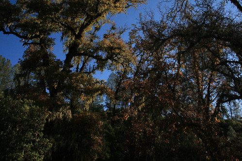
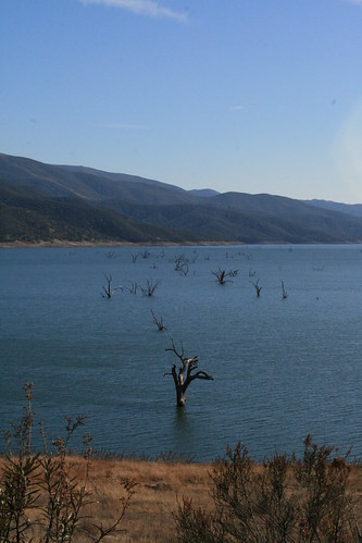
We camped near the 1954 earthquake fault in central Nevada.


We have a hot spring guide book (two actually) that give information on the natural hot springs in the state of Nevada. Because of it's geology, it has the most hot springs of any other state in the U.S. So far, over winter break (just about 2 months ago), was the first time we've ever ventured out to a hot spring in Nevada, although we've heard a lot about them. For this trip, one of our goals was to find as many as were possible in the short 1-week long break we had. With so many to chose from, where did we begin? Well, the easiest way for us to get over the Sierra Nevada mountains in the bus was to drive over Hwy 50, through South Lake Tahoe. From there, we continued on Hwy 50 out east into Nevada. This took us nearly all day, so we just barely got past Fallon, NV when it was time to camp for the night. We saw a brown sign (BLM) pointing us to a place called "Earthquake Fault." It was so dark we had no idea where we were going, but the sign said it was 6 miles away. So we drove down the road until we found a level spot and camped right there. The next morning, we continued to the fault line. It was actually really huge, but not what you would expect an earthquake fault to look like. There was no gaping crack in the ground. Instead, it was a steep step in the mountainside, and at parts the cliff, or scarp was about 20 feet tall! That's how much the earth shifted during the earthquake, which happened in 1954, and was of magnitude 7.2!

Valley of the Moon
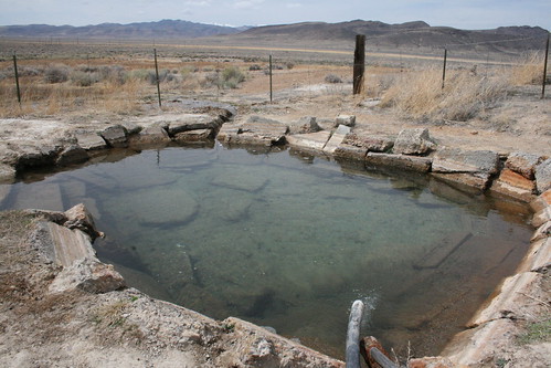
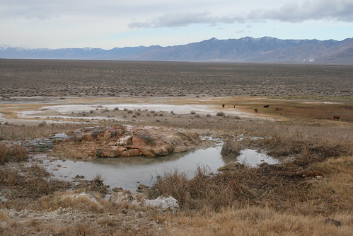
Valley of the Moon Hot Spring was hot hot hot!


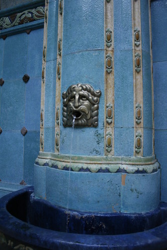
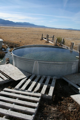
After exploring the fault scarp a bit, we continued east, back on Hwy 50. We passed through Austin to get some yummy cappuccinos at the Toiyabe Cafe, and then headed north up the Valley of the Moon, along NV 305. This was a really nice drive, and about half-way to Battle Mountain (which is on I-80), we stopped at a hot spring called Valley of the Moon. It is privately owned, but the rancher who owns it lets people come on his land and use the hot spring. However, you kind of need to know where it is ahead of time because there is no sign, only a gate which must be closed behind you to keep the cattle in place. We knew we were getting close when we started seeing the tell-tale signs, a big travertine mound and white soil. When we pulled in, nobody was there. The source of the hot spring was about 50-100 feet away from the pool, and it came pouring out of the mound along a giant crack in it. Near the pool, a pipe diverted most of the hot water into the rock bottom pool. The source was super hot, basically unbathable unless it was allowed to cool off. The people before us left the pipe fully flowing into the pool, which made the water unbearable when we got in, so we had to wait. We pulled the pipe out and let the water cool. This took quite a while (almost 2hrs) but we just pulled out our folding chairs and relaxed a while, reading all of the historic pamphlets we got from Austin at the Toiyabe Cafe.

Buffalo Valley Hot Springs
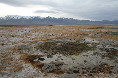
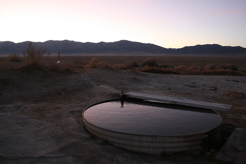
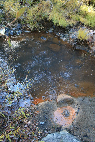
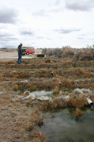
The Buffalo Valley Hot Springs were small, but plentiful.


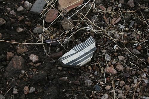
When we compared the state of the pool area to that of the picture in the guide book, the spring in its current condition was pretty trashed. Previously, somebody had placed a nice wooden bench at the side of the pool, and it looked like there used to be wooden platform mini decks all around the pool. Now what we saw was a partially burned bench, no decks, and two fire pits filled with empty booze bottles. We cleaned up as much as we could, but it is really horrible how people end up trashing such a nice place. Why? Why would you try and burn a picnic bench just to stay warm or make a fire when you have a super hot pool to bathe in? And why wouldn't you just take your trash out with you?

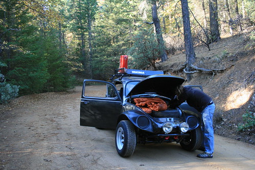
Anyways, after soaking in the pool for a little while after it finally cooled down to the point that it wasn't painful, we hopped back into the bus and continued north to Battle Mountain. At the city we filled up on gas. A few young and bored tweens saw us in our bus, and asked us if we had weed. Hahaha! I kind of felt sorry for them, all bored and growing up in a place like Battle Mountain, where the only thing to do is ride your bike from the McDonald's to the Burger King or whatever. During our little driving break at Battle Mountain, we looked at the map to see the nearest hot springs. There were a few on the map which weren't in the guide book, so we decided to check them out. This time, however, they were very far off the beaten path, a long ways down a gravel road where there were few if no people, and we would be very isolated. But the bus was running well, so we decided to go for it.

Hyder Hot Springs
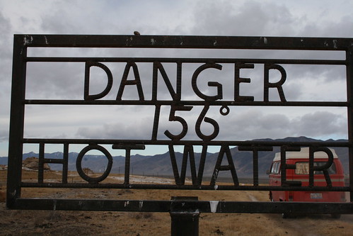
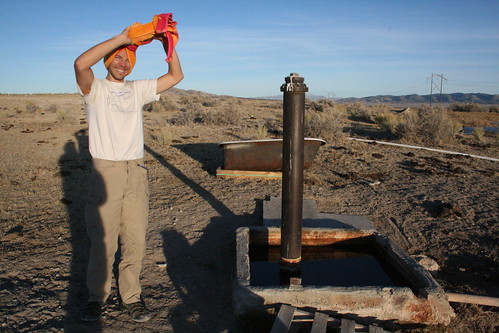
Hyder Hot Springs was so hot, we found a dead cow as we drove right past this sign!


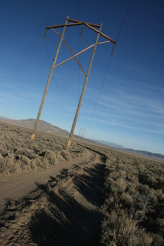
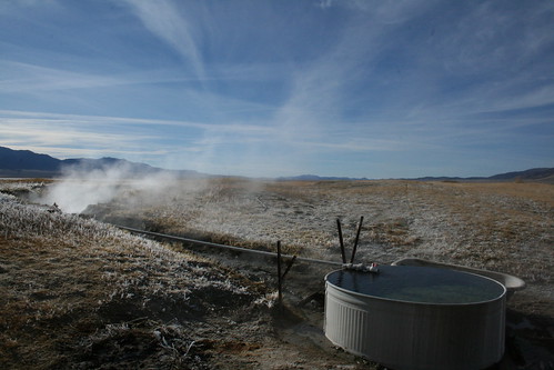
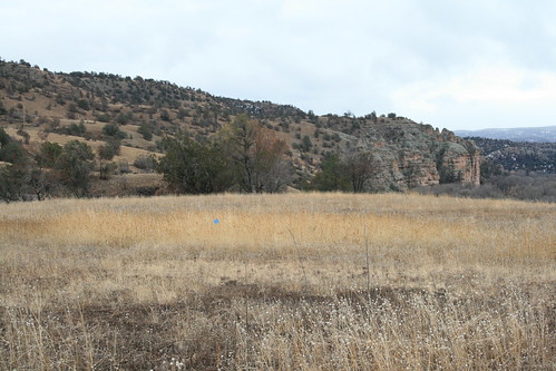
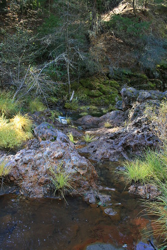
The gravel road we took had no name, except that it went into a large valley called Buffalo Valley, and then continued into Dixie Valley. A bunch of powerlines ran down the east side of the valley, which the road followed for a long time. In the center was a long playa. After almost an hour of driving, we reached the approximate location of where the hot springs were marked on the map. They were called the Buffalo Valley Hot Springs, and as we got closer, the springs became very obvious. We parked the bus as close as we could and followed cattle trails out into the playa where there were numerous mini craters with warm water flowing out. None were very big, but there were a lot of them. They weren't very hot either, and the flow rate was very low, so you couldn't really make use of them for soaking. Oh well, it was neat to find them still in their natural state. After we explored the area a little, we continued driving down the gravel road south. Soon we entered the Dixie Valley region, which was the valley where Nevada's largest geothermal power plant is located. Again, this place was very isolated, but it was also the region where the most hot springs are supposedly located in the state. As we drove down the gravel road, we saw a few hot pools, some not marked on the map. One of the pools was very deep (you couldn't see the bottom) and it was pretty hot. Very tempting to jump in but the fact that you couldn't see the bottom scared us, so we only took pictures. There were some hot springs we passed owned by ranchers, which they made very clear with huge private property signs. At one point, we had to skirt around some ranch land that they didn't want people driving through, and the detour road got really muddy and rough. Somehow the bus got through it, so we continued on. The next big hot spring that was in this valley which the guide book recommended was called Hayden Hot Springs. It took us quite a while to get to it, and by the time we did it was already dark. So we found a flat area next to the springs and camped for the night.

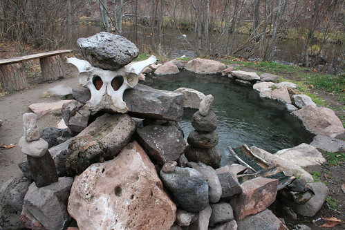
The next morning, we woke up to find a huge water buffalo truck parked next to the springs, but nobody was with the truck. It was just parked there. We also saw a dead cow right next to the spring. The source was pretty obvious and surrounded by a fence. There were supposedly two bathing pools here, but when we found them, they were really nasty and shallow! They were all slimey and the water was just luke warm. It also seemed that when we compared the picture of the source in the guide book to what it currently looked like, it seemed that the current flow rate and temperature were much lower than when the book was last published. Maybe it had to do something with the geothermal power plant off in the distance. Who knows, but Hyder Hot Springs seemed like a bust!

Hyder Hot Springs
The once vigorously flowing Hyder Hot Spring source.


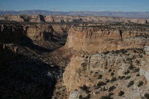
We didn't stay at Hyder long, and instead we picked another gravel road to take over a small mountain pass to the southeast. The road was in very good condition, even though it looked like it was a minor gravel road on the map. It went up and over the mountains, through a canyon like landscape. It passed an abandoned ranch, which was so cool looking, and then popped out just north of Austin. So essentially, we just did a giant loop, up through the Valley of the Moon on a paved road, and then down through the Buffalo and Dixie valleys all of gravel. When we passed through Austin (again) we gassed up. This time I wanted to try a different cafe for coffee. We saw in our pamphlets that the 
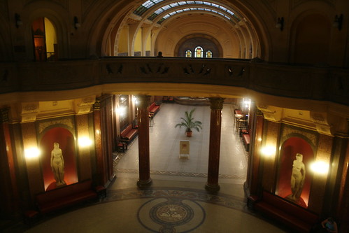
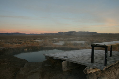
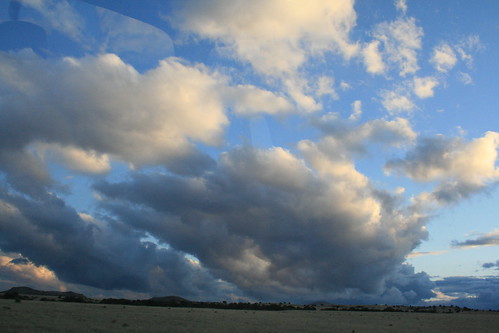
International Cafe was supposedly very old and still had the original bar interior from the old Pony Express days. We seemed to be the only out-of-towners there, which was okay, and it made it interesting to hear the locals talking. The cafe only served drip coffee with creamer, and it was pretty cheap. I was hoping for some espresso, like in the comparatively hole-in-the-wall Toiyabe Cafe up the street. Oh well, now I know. I am a picky coffee person, and having said that, if you want coffee, go to the Toiyabe Cafe. Anyways, after our big loop detour, we started heading east again. We wanted to check out the Big Smokey Valley and the neighboring Monitor Valley. These are right in the heart of central Nevada, and of course they have some really cool looking hot springs, as we saw in the guide book. So we started heading that way. But the weather was getting kind of crappy, with rain headed our way, and snow dumping over the passes! We got as far as Spencer Hot Springs, and decided to wait out the weather there for a while. After Spencer, we had to take a gravel road over a mountain pass to get into Monitor Valley. We didn't want to start driving over the mountains if there was snow coming that way, so we just relaxed at Spencer, where we had a good view of the incoming weather.

Spencer Hot Springs
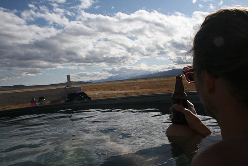
The beautifully terraced pools at Spencer Hot Springs.


Nothing much happened weather wise while we were hanging out at Spencer. It kept raining and snowing to the west, but it never seemed to get across the valley, which was good. After about two hours, the weather actually started clearing out, and we decided to go for it. While we were waiting, we found out that somebody had terraced one of the pools at Spencer, and the run-off from the pool cascaded down the terraces. Within the pools of the terraces, we found a bunch of goldfish! They were just swimming happily, and there was a pretty large and healthy population. How cool!

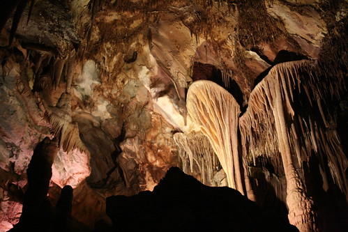
After the weather began to improve, we got back into the bus and started up the gravel road over the mountains. This route was actually recommended as one of the scenic drive in the Big Smokey Valley pamphlet we picked up in Austin, so the road was probably good. Along the way, it went past the Toquima Caves near the summit. Then it dropped back down into Monitor Valley. Once there, we used the guide book to find the next closest hot spring, which was called Pott's Ranch Hot Springs. We drove south down the Monitor Valley, which was amazing! There were more ranches, it seemed, in this valley, because it seemed that water was more plentiful here. The guide book warned that along the road, you would have to drive through an operating ranch. When we got to the ranch, we saw a Mexican guy sitting on the roof of one of the many barns. We asked him if this was the right way and if it was okay to drive through, and he just looked at us and smiled. We realized after a while he didn't speak English, so we just said "Bueno", and kept driving. Eventually we got to the turn off to Pott's Ranch, which in contrast, is totally abandoned.

Pott's Ranch
Living life to the fullest at Pott's Ranch Hot Springs.


There was a huge mound that we had to drive around, and the hot spring was located out of sight of the road, on the other side. When we got there, we discovered a completely brand new tub and lovely deck and seating area. The tub was kept empty, as to keep it clear of algae and other stuff. The hot spring source had an incredible flow rate, so once we set up the proper piping to fill up the tub (8 foot diameter watering trough), it was full in about 15 minutes. And the water temp coming right out of the pipes was perfect, so no temperature adjustment was necessary. The tub here had a great view of the surround mountains and valley.

Pott's Ranch
Our favorite hot spring we've been to so far is Pott's Ranch.


We stayed at Pott's for quite a while because it was so comfortable. The guide book that we had said that the owner did not allow camping, however. So we decided to leave with enough time to still find a campsite. Again we looked at the guide book to see where we should go next. Just south of where we were, it said that we could go see Diana'a Punch Bowl. We read about this place in other books, and all of them said that the Punch Bowl was a pretty awesome place. Supposedly, it was a huge caldron looking thing with steamy hot water inside. I had no idea how big it was going to be, but it was supposed to be really big. We decided that it would be the best place to camp nearby, since there were no camping restrictions. So off we went.

Pott's Ranch
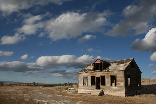
The abandoned farm house at Pott's Ranch.


It was pretty easy to spot Diana's Punch Bowl once we were nearing it. It was a huge whitish travertine mound in the middle of the valley, just east of the gravel road. When we got near, we followed one of the few smaller dirt roads that headed towards the mound. When we finally reached it, there was a fence around the whole thing, but it was only to keep animals out, as it was easily opened. We decided to drive through the fence gate, and then parked the bus just at the base of the huge mound. Romy started walking up the pathway that led to the top. It was huge and it was steep! As you climbed up it, it was impossible to see what was on the top until you crested it. . .

Diana's Punch Bowl
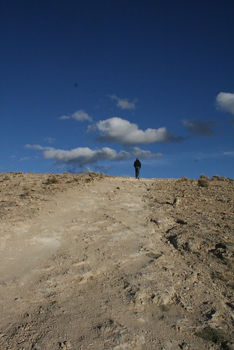
Climbing up the gigantic travertine mound that is Diana's Punch Bowl.


When we got to the top, the ground just dropped out into a HUGE cauldron! Just like something out of Lord of the Rings (without the hot lava), at the bottom was a pool of steaming hot water. It was impossible to tell how deep it was, but judging from how large the mound was, it must of been pretty deep. The edge was very abrupt, so if you weren't paying attention, it would be relatively easy to just walk off and plunge into the burning hot water. We sat on the edge with our feet dangling down. It was surreal.

Diana's Punch Bowl
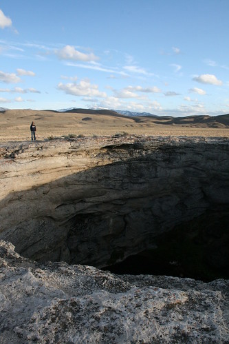
The insanely awesome Diana's Punch Bowl!


It was fun just hanging out and seeing such a unique place in the middle of a beautiful desert landscape. We walked around the cauldron a few times. Supposedly it was formed when the thing suddenly caved in, leaving an almost perfectly circular caldera thing that filled with the hot spring water that presumably caused it to collapse. Next, we checked out the backside of the base of the mound, where there was supposed to be a hot creek running out of the punch bowl. The guide book said you can dig mini pools and bathe in the water coming out of the mound-bottom, but we didn't find any suitable places. That was okay though, because it was starting to get dark, and we were thinking of going a little further south in the valley to camp. Diana's Punch Bowl was our last hot spring of the trip through Nevada, and it certainly was one of the most spectacular springs we've ever seen!

Diana's Punch Bowl
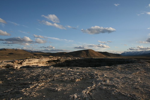
Don't fall into the punch!


Thursday, January 12, 2012

A Long Strange Trip: Nevada Caves and Hot Springs

And now, a long time past when it actually happened, I am writing the final part of the four-part blog post about our winter road trip in the bus. In the last post, we had just finished a long drive along a gravel road out of Utah and into eastern Nevada. The sun was beginning to set just as the gigantic Mt Wheeler had come into view to the west. It made it hard to see anything more than it's silhouette, but it was still really cool looking. The Great Basin Nat'nl Park protects part of the mountain range surrounding Mt Wheeler and its unique micro-climate and habitat. I think it's the second highest peak in Nevada. It really looked big, even in the distance. As we got closer, it became towering, and the sun eventually dipped behind it's peak. Now that the sun was behind it though, we could see more detail of the forest that covered it (there are bristlecone that live on it) it's snow capped peak. It was actually making its own small rotating cloud that reminded me of the imagery of blood from the gash in the sky from the mountain peak scraping it. The bright red sky from the sunset was the reason blood first came to mind, I guess. It was crazy.

Lehman Caves
The famous drapery in Lehman Caves.


On our map, we saw that there was a campground in the park. It wasn't too deep into the park, so that was good. It was getting dark fast, and we wanted to find our camping spot soon! Also, it was getting pretty cold. This was not only because the sun was setting, but also because the road to the campground started taking us up the mountain higher than we thought. Soon we were in an aspen forest with a cold creek running through it. It got suddenly really damp and cooled off even more. This was where the campground was, and where we would be sleeping for the night. It was a good thing we had the bus because camping outside would've been freezing cold! Afterall, we were at elevation in Nevada in winter. And that was also probably why we were the only people camping in the entire park that night.

Lehman Caves
Historic graffiti in the Lehman Caves.


The next morning, we woke up pretty early because we wanted to catch the first cave tour of the day at 9am or so. We were feeling pretty grody, as we'd been traveling for so long already with no shower (not since we left Denver), so we made sure to also have enough time to wash up a little in the visitor center bathrooms before we made human contact that morning! It was nice that the bathrooms were heated, let me tell you, because there's nothing like a freezing toilet seat in the morning! When we were done, we made our way inside where the rangers were and bought cave tour tickets for the first tour of the day. We were kind of surprised we had to buy tickets even though we had a National Parks annual pass, because we didn't have to buy tickets to go into Carlsbad Caverns. Weird, but we bought them anyway because they weren't too expensive, and at that time of season, it is about the only thing you can do in the park. Well, I guess you can go hiking in the bitter cold, but most of the roads were closed due to snow in the park.

Powerlines to Bartine
The power lines to Bartine hot springs.


Nobody else showed up for the first cave tour until 5 minutes after it started. We were all ready and excited to be getting a personal tour of the cave, until a middle aged couple (of who the wife was a huge tubby) were ushered in after the ranger already started telling us the history by flashlight. Bummer, but our group was now still tiny (4 people plus the ranger), so the tour was going to cool anyway! It started out in a man made concrete hallway ramp that led down into the cave. Once in the actual natural cave part, the soft lighting in there brightened it up and lit up all of the cave decorations. There were a lot of cool things everywhere! And a bonus, was that it seemed warmer inside the cave than outside. The ranger told us the history of the cave as we walked through the narrow passages. In some places, you had to duck down and really pay attention to where you were walking, or you would walk right into a stalagmite! What a difference between the more visited Carlsbad Caverns. These in comparison must not see much visitor traffic.

Bartine Hot Spring
Romy washing his greasy hair at Bartine! Ahhh Dirty hippy!


The cave tour was short compared to how long we spent in Carlsbad, I think it was a little over an hour or so, maybe two? We took the longest tour, which was called the Grand Palace Tour. It basically took you into all of the rooms that are possible to easily walk through. When we were all finished, we headed back to the bus to hit the road. The nearest town to the park, Baker, looked totally abandoned, but I'm sure it springs back into life in the summer, when the park gets more visitors. But still, its pretty small, with one cafe and a gas station that we almost didn't notice! I don't remember if we filled up there or not, but next we headed onto Hwy 50, dubbed the Loneliest Highway in America. We had a hot springs guide book with us, and our goal was to try and find as many hot springs as we had time to go see on our way back to California along Hwy 50.

Spencer Hot Spring
One of the tubs at Spencer Hot Springs at dusk.


Our first stop was called Bartine Hot Springs. It actually was pretty close to the highway, just less than a mile north of it. The only point of reference to know you were there was a small mound off in the distance by some powerlines. Also there was a small ranch by the name of Bartine that was right next to it. We turned off the highway, went around the small ranch, and took the powerline access road towards the small mound, where we assumed the hot spring was. The road was super dusty, but as we got towards the hot spring, it started to get flooded! We saw a huge pipe sticking out of the ground, and a concrete tub, so we walked towards it. We could no longer drive due to the soggy ground. However, when we got to the spring, it was kind of a let down. The water was coming out of the ground into a concrete box which had the giant pipe sticking out of it. Then the water was piped into another tub, but it was pretty nasty from cows and algae and dirt. So we didn't soak here, but since we did make the effort to come and check it out, we figured we should at least wash our hair a little. So that was what we did. It was soooo refreshing and nice to wash in hot water.

Spencer Hot Spring
Another nice tub at Spencer at dusk.


After Bartine, we got back on Hwy 50 to go further west. The next hot spring on the way was called Spencer Hot Spring, and it was near the town of Austin, NV. It also was not too far from the highway, but it was far enough that you couldn't really tell by looking that there was an obvious mound or something. Instead, there were some dirt roads that headed towards a black rock thing in the distance. As we got closer, the roads didn't actually go to the black rock formation, but right next to it, where there were now some mounds visible and light whitish soil (often a good indication that there's a hot spring!). We knew we were in the right place once we started seeing the tubs and cleared out areas to park. There were three main tubs. Two of them were made of watering troughs, and one was dug into the ground, lined with large flat rocks. We chose the one that was dug into the ground, because it had a nice large wooden deck somebody built. Plus it was the last one we drove to and decided to park the bus next to it. We got there just as the sun was setting behind the mountains to the west. It was getting really cold outside now, which made us super happy to be camping at the hot springs! Before we went in, we made sure to get the bed and everything set up for the night, so that we could quickly jump back in after the hot spring.

Smith Creek Hot Spring
Clean and clear blue water at Smith Creek Hot Spring.


There was nobody else at Spencer except us. Even if there were other people/campers, the place was so huge that everybody would have their own tub. Spencer was more like a hot spring complex. It was nice to spend the evening there. After getting out of the spring, we stayed warm all night in the bus, thanks to our crazy mega sleeping bags. The next morning we turned on the propane heater to warm up as we packed up the bus to get ready to hit the road again, back on Hwy 50. It was a short drive to Austin, where we filled up on gas and got some coffee at the Toiyabe Cafe. They made some real good cappuccinos in there! And they had some informational/tourist brochures and mini pamphlets about the history of Austin. We took some and read about Austin as we drove further west, towards home.

Smith Creek Hot Spring
A second hotter tub at Smith Creek Hot Spring.


We decided that we still had time to hit up one more hot spring on the way home. The closest one that wasn't too much of a detour was called Smith Creek Ranch, and it was on the Lincoln Highway detour, NV 722. Its a pretty cool road, so we decided to take it. Again, we didn't really have a good idea of where we were going, just a crude map and directions from the guide book, so we were in for another adventure trying to find Smith Creek. We knew it was out towards the edges of the playa, but there were a bunch of dirt roads that went that way. So we picked one and went. It started off pretty good, weaving between the giant sage brushes. Then it started hitting silty patches! The bus almost sunk into the ground, so Romy just pressed harder on the gas so were could make our way through the silt. We had a HUGE cloud of silt behind us. After a while, the road kept getting worse, but once we hit a silty patch, we had to just push through it or else we'd get stuck. Finally, we found a silt-free section where we turned around and went back to try another road (what, did you think we'd give up that easy?). We had better luck with the next road we tried, although it ended up not being the best option either, as we learned when we actually got to the spring. We parked the bus when we were so close that the ground was getting soggy and wet. We discovered that there were two tubs, pretty far apart from each other. Both were really nice. Also, along the span between the two tubs, there were a lot of little mini craters filled with hot water bubbling out. It was really interesting.

Nevada Panorama
Panorama of the bus at Smith Creek.


It took us so long to get to the springs, after the road mishap, that we didn't have much time to stay. So after checking the place out, we headed back to the highway (but on a different road). We would like to go back to this one, as it was really nice. There was a super hot tub, which seemed like the temperature was adjustable by moving the pipe partially out of the tub. There was also a tub closer to body temperature, so you could literally have your pick here. Another interesting thing was that the springs were really close to the original Pony Express Trail! I couldn't of thought of a better way to end our winter break vacation than with some new hot springs in Nevada. We only had a few more hours of driving west on Hwy 50 (well, more like the whole rest of the day) before we were home. What a fun trip!

Friday, January 06, 2012

A Long Strange Trip: Exploring in Moab, Utah

This is part 3 of a 4 part write-up on our winter break trip from California to Chicago and back. However, what I'm not writing about is the time we spent in Chicago over Christmas and up to New Year's. That will be for another post! So what follows is the story of how we made our way back to California in our VW Bus. Along the way, we stopped in Golden to visit Romy's side of the family. There wasn't much snow, even in Colorado, so our plans of skiing along the way back were basically thrown out the window! So instead, we decided to stay in southern Utah for a good part of the ride back to do some hiking and exploring. There were so many places around Moab that we didn't yet see, so we planned on heading over that way and checking stuff out. Plus our friend Will was going to be in town, and we thought it would be fun to hang out with him for a few days. So I guess the story of the trip back to California actually already starts deep in the middle of the Rocky Mountains. After leaving the Denver area, we headed towards Glenwood Springs along I-70, through the very scenic Glenwood Canyon. I read about a place in Glenwood Springs where there was a natural cave, and inside of it a natural hot spring! The place was called a vapor cave because of the steamyness inside, similar to a wet sauna. Being on a tight budget, we decided to go check it out since it was one of the cheapest hot spring things you could do in Glenwood Springs. Only $12 bucks! According to a guide book, the cave was once visited by the Native Americans who took their sick there for healing. It's the only natural vapor cave in North America. I really liked this place (although Romy was not as enthusiastic). It was very dark inside and super steamy! There was water running along the base of the cave walls, and the water was so hot that it heated up the entire cave to a sweltering temperature! We had to go in and out a few times to cool down. If you're ever in the area, go check it out! We didn't get any pictures, as it was so steamy I think the camera would've broke!

The Corona Arch
Jenn and the Corona Arch outside of Moab.


After getting all steamy in the vapor caves for a little bit, we continued our journey west. It was just getting dark as we crossed the Utah border. But the moon was really bright, so we were able to see outside pretty well. We headed towards Moab through Cisco (the weird semi-ghost town). We took the road that goes towards the Colorado River and then stays along side it until you get to Moab. That's the best route in my opinion. The moon was shining down on us and illuminating the towering red canyon walls. It was reflecting off the river water, and the stars were shimmering too! The bus was running well, and we were rolling into Moab enjoying the scenery. It was so cool! Soon we got into Moab, and decided it was time to eat and drink. Last time we were here, we liked the microbrews at the Moab Brewery, so we decided to stop there again in hopes that maybe Will would answer his phone and join us for a beer. But when we got there, the brewery was closed down for annual cleaning! Oh no! Just as we were turning around to get out of the parking lot, a Jeep showed up. And guess who it was!? By some freaky coincidence, the stars aligned and it was Will! He said he saw an orange VW Bus and knew that it could be no one else except us! Wow! So instead of dinner and beer at the brewery, we took some beers we bought back in Colorado over to his friend's place and had dinner and beer there. It was fun!

The Corona Arch
Close-up of the Corona Arch.


That night, after hanging out, we found a camping spot at Ken's Lake, just south of Moab. It was peaceful (since it was mid-week) but pretty chilly since it was also at higher elevation. But we didn't care because we got pretty cozy inside the bus with two sleeping bags each. The next day we decided to go hiking to the Corona Arch, also known as Rainbow Arch. Moab is right outside of Arches National Park, which we've visited before. I think we've seen a majority of the arches and windows inside the park, but there are actually a lot of natural arches outside the park too, and Corona Arch was one of them. It was a short hike from the river to the arch. It actually resembled the corona of the sun (which is what I think its named after). We spent a good part of the morning exploring that area, and then we decided to give Will a call. We made plans the night before to go looking for arrowheads in the washes. So after a quick lunch of whatever food was still left in the fridge of the bus, we met up and headed towards the Klondike Bluffs.

Will and Romy
Will and Romy 'walking the wash' looking for stuff.


We had such a good time just wandering around walking through all of the washes in the Klondike Bluffs region. We were picking through the rocks and pebbles in the sandy ground, feeling them and looking at them. I found some rocks that were clearly chipped or flaked by a human (ie not random). There were others I found that we shaped to be very ergonomic hand tools. Tools for punching holes in leather, cutting, scraping, etc. We would take our finds to Will and show him, since he was kind of the expert of the group. Then he would tell us what he thought they were. Sometimes when I was searching through all of the rocks on the ground, and found one that fit my hand so perfectly, it felt like I was literally taken back to the ancient times when these people used stone tools. I felt connected. Its very indescribable how perfectly these tools fit in your hand, and how instantly you know their purpose! Now I have to admit, at first I thought it was a lot of B.S. and that what I found were just a bunch of randomly broken rocks that resembled tools. However, later on when we went to the visitor center at Valley of Fire State Park in southern Nevada, they had some stone tools on display. They looked EXACTLY like what we were finding in the washes. I could've spent hours walking the washes and just looking. But the sun was going down and it was starting to get really chilly, so we headed back to the cars and went to get some dinner.

View from Gemini Bridges Rd.
Climbing up Gemini Bridges Rd. outside of Moab.


The next morning, we found another place on the map outside of Moab to explore. It was called Gemini Bridges Rd, and it took you deep into the back country around Moab (as deep as you can go on a dirt road). It went right past a set of natural bridges called Gemini Bridges. We were in the Bus, but we decided to go try and see how far we could drive down the road in the Bus. Why not? We figured we could always turn back if the road started getting nasty. So there we went, full of excitement and hope that we could make it. The road started climbing pretty steeply up a windy road that was literally etched into the side of a red rock cliff. The picture above is at about the highest point of the road. That cliff in the picture is what the road somehow got up. I'm still not sure how it all happened, but after we got up, the road flattened out and started following a valley. Then it climbed its way out of the valley into a broad plateau region, which was speckled with eroded sandstone fins and washes. We didn't see many other people, but the few we did see were all in pick-up trucks or jeeps. We were the only people in a VW Bus, but hey, the road was okay for the Bus, and we kept going. After about an hour, we reached Gemini Bridges. A short walking trail took us to the bridges, which we were actually standing on top of. There was no safety rail or anything. It was left completely natural, and you could walk across the top of the bridge, which was pretty wide, but it was still a couple hundred feet drop if you wandered off the edge of it! Below the bridge we saw a trail and also a rough dirt road. We decided to turn the Bus around and try to find that road. Eventually we found something that looked promising according to our map, so we kept driving. Eventually the road dropped into a sandy wash, which we didn't feel the Bus was going to handle very well. So we found a good parking spot, and started walking to see if we could get to the bottom of the Gemini Bridges.

Frozen Spring
A frozen spring in the desert!


Eventually, after a good 45 minute hike, we got to the bottom of Gemini Bridges. I have to admit, it wasn't as spectacular seeing them from the bottom as it was walking across them on the top, but the hike was cool. We then found a small side canyon not to far away and started to explore. As we were hiking deeper and deeper into the side canyon, we thought it might turn into narrows or something. Instead, we found frozen spring water! It was so bizarre! I mean, I realize it was winter and all, but it was still strange to see a creek completely frozen over running down the middle of a dry red rock canyon! Hiking further, we eventually found the source of the creek. It was a slowly trickling cold spring that just came out of the base of one of the cliffs. Very cold! But I bet it would be nice in the middle of summer! I think I prefer cold weather to hot, though. Even so, one of the things that sucks about winter is that it gets dark so early. It wasn't even 3pm and we had to start heading back towards the Bus, otherwise we would risk getting caught by the setting sun. We made it back just in time though. There were some crazy thunderstorms brewing off in the distance as we were driving back to Moab. They all seemed to miss us, but they were dumping rain all over. As long as it didn't rain or snow on us, we were happy! That night, we decided to camp close by the dinosaur footprints along Potash Rd. It was Friday night, so the campground was a little busy. We found a spot away from the party people and got comfy. It was warmer at lower elevation, so we didn't need two sleeping bags, just one was ok.

At Tom Tom's
Trying to stay warm at Tom Tom's.


Our short stay in Moab was unfortunately coming to an end. But no trip to Moab is complete without a drive-by of Tom Tom's VW "museum." So the Saturday morning we were rolling out of Moab, we decided to drive by the place. Every time we've been here, the place seems completely abandoned, yet there are always new Beetles or Buses parked, and sometimes the Buses are re-arranged. So somebody has to be busy, but nobody is there when we've knocked on the door in the past. It was about 8am, we already got our morning coffee (well I did anyway), and so we tried to knock on the door of the garage building that is attached to the huge lot that is just saturated with VWs. Nobody was there. So I just sat in the bus trying to keep warm (it was FREEZING outside) and Romy went to explore the part of the lot which was open to the street. Then, a car pulled up. OMG I was now kind of afraid for Romy, who was probably technically trespassing, although he was just wandering the part of the lot that was not fenced in. I guess Romy wasn't too deep in, because he met the man who pulled up in the car and started talking. After a while, the man went to unlock the garage door (!) and Romy came to the Bus to tell me that the man that just pulled up was in fact Tom Jr!!!! OMG!!! After literally years of stopping by this place every time we've driven past Moab, we finally met the owner of all those VWs. He let us in the lot to see them all. There must of been hundreds of Beetles, Ghias, and Buses of all years just sitting in that lot. He told us he's been slowly selling them to interested parties, and also restoring some himself. Some of the cars were so packed in, I have no idea how he would get them out if somebody wanted it.

At Tom Tom's
The fence at Tom Tom's is almost artful.


Of course we had to ask how much he was selling the stuff for. The prices he quoted were kind of high. But whatever. Its probably because he didn't really want to sell them. He's a collector-type (well, his dad was anyway). And what a collection! I think we stayed in there wandering around and talking to Tom for over an hour. Even though the sun was coming up, it was still really cold, so we walked around very briskly. Tom Jr started up the heat inside of his garage, which was just slightly warmer than outside. After a while, we headed out just as some more people he knew started showing up. What a great way to end a trip to Moab!!

San Rafael Swell
On our way out of Utah, over the San Rafael Swell.


Our next destination was Nevada. We still had a precious few more days before we had to be back, so we decided to spend them in the state that we always intended to go see, but have never come around to exploring. But standing between us and Nevada was the San Rafael Swell, a huge exposed anticline (a piece of the Earth's crust that is bent in a rainbow shape). I think this region is being lobbied to become a national park in the future. One day we would like to go hiking and exploring in the baja before that happens. But we already decided to go spend the last of our days in Nevada, so we drove on through along I-70. The two days of so that we had left wouldn't be anywhere near the time we would need to really see Nevada, though. But it would be enough time to go check out the Great Basin National Park, and some hot springs!

Awesome Nevada Dirt Road
Almost in Nevada! We took a dirt road for a good portion of western Utah.


We drove all the way to Cove Fort, Utah, where I think I-70 ends and butts into I-15. At that point, we decided to get on a tiny gravel road which would eventually take us into the national park, because that was the most direct route. We must of been feeling pretty adventurous, as this was more than 100 miles of dirt road ahead of us, some of it with a good dusting of snow! But what is a road trip in the Bus without a little adventure?! It ended up being one of the most scenic parts of the whole trip, in my opinion. This part of western Utah is the far eastern part of the great basin desert. I really like the great basin desert, and seeing it from a dirt road was even better. We didn't see any other car along the entire 100 mi + stretch before we got to the national park! Bad if we broke down, but the Bus was running just fine and we had plenty of gas and food and water, so we went for it. It was Romy's idea!

Tuesday, December 20, 2011

A Long Strange Trip: Through The Southwest

This is the second part of a 4 part series about our trip from California to Chicago over winter break. In the last part, we were just leaving southern Utah, and heading into northern Arizona. We crossed the border near Lake Powell. Some of the areas that Lake Powell flooded looked kind of eerie and surreal. I remember seeing Monument Valley-like red rock towers coming out of water. And the strangeness of desert dry red rocks next to abundant blue water was weird too. On top of all that, a huge dam and lots of power line towers in the back ground. We were kind of content at keeping on driving, so we quickly drove through the small town of Page. We did pull a few U-turns in front of a AZ cop to get a picture of us and the bus in front of the AZ sign. He was occupied with actual speeders though and likely was amused at the bus from IL taking pictures by state signs. After our photo-happyness, we continued on. We didn't know it at the time, but there is a really cool slot canyon near Page, Arizona. Its on Navajo land and its called Antelope Canyon. Hopefully one day we'll return to Page and go see the slot canyon. As we had no idea, we kept driving. Suddenly it seemed we came up to the edge of a huge mesa. A huge huge mesa we didn't even realize we were on! This drop must have been at least 1000 ft!

Arizona Mesa
A huge Arizona mesa.


The rest of the drive down to Flagstaff was kind of a nonevent-full drive through landscape that was reminiscent of the badlands of South Dakota. It was mainly Indian reservation, and seemed kind of sad and lonely, and very poor, but the scenery was pretty. We rolled into Flagstaff as the sun was setting and had dinner (and a few beers) and slept in a motel that night. OMG, I know, we actually slept at a motel instead of in the bus! But let me explain. Again, it's winter so all of the campgrounds were closed, and there aren't that many operating RV parks. But we did find one, a KOA again. So we pulled into it and hoped that maybe they would allow more than 3 RVs to camp there that night. This time we were lucky, and there were plenty of spots. The owners of the KOA were VW bus owners too, surprisingly. When they saw that we arrived in a bus ourselves, they offered us 10% off the camping fees. Well, we were all about it until they told us how much the fee was, including the 10% discount. It was $39.00! Holy shit, just to park our bus!? We told the lady that we weren't sure if we wanted to stay just yet. We told her we'd go out for a beer first, at the local brewery, and then we might come back. Kind of a strange plan to tell her, but that's what we really were going to do, but we would also stop along the way to check prices at other places (including motels), which might of been a better deal. A few blocks down the main road that went towards the brewery, we spotted a motel with a really cool old fashioned multi-lightbulb sign (I don't know what they are really called). And it also said that there would be a European hostess! The three of us feeling kind of silly, decided we had to try and see how much they charged. Mark went in and told the guy, "I have $43 in my wallet. How much do you charge for 3 people tonight?" or something like that. The European hostess (who was actually a Greek MAN!) told us he would take it. So for only $4 more than a KOA "parking spot", we stayed at a motel and showered and spread out. At some point in the night (about 11pm) while we were still out, the European hostess cut the power to the cool multi-lightbulb sign. This made finding the motel on the way back from the brewery kind of difficult. We thought we could just look for the sign, but apparently he had shut down business for the night! At 11pm? A motel?

New Mexico Sky
Entering New Mexico, where the sky was so high!


The next morning, we continued driving towards New Mexico. But on our way out, we had to make the usual coffee stop. We found one of those tiny huts that made coffee inside, so we pulled over. It was called "Wicked AZ Coffee." Me taking everything so literally mouthed it out loud, "Wicked 'Ayh' 'Zee' Coffee. . . " while at the same time, Mark shouted, "Wicked Ass Coffee!" He had no idea why the coffee shop misspelled the word 'ass' while I had no idea how Mark misread A.Z. as ass (sick mind or something?), and Romy got the pun and had no idea why we were both so confused. And then we looked at each other when we both realized the pun and what state we were in. A double entendre if I might say so myself! There was also an angry disgruntled hippy that came up to the coffee window while we were ordering and started doing stupid stuff, like ordering a fake drink and generally being an ass. Anyways, that morning it was kind of rainy. We drove south out of Flagstaff towards Phoenix but then veered east on hwy 260 (to 87, to 188) which progressed through mountainous terrain, but eroded type mountains, with lots of vegetation growing on them. The closer we got to the New Mexico border, the more desert-like the landscape started getting. Eventually, the storms cleared out and it became sunny for a little while. The road started climbing up a mountain, and got a lot smaller and narrower. Eventually we got so high up in the mountains that there was an actual forest of pine trees for a while. We almost missed the New Mexican border because there wasn't a sign since the road was small. Anyways, what goes up must come down, so there we went, coming down out of the mountains and into what looked like South Dakota (except it was New Mexico). Rolling grass lands and a beautiful open blue sky. I hadn't pictured this in my head when I thought of what New Mexico would look like.

So now we were in New Mexico, the state that we had intended to try and explore while making our way to Chicago. When we got gas, we began to look at the map more closely. On the map, we saw a place called the Gila Cliff Dwellings not too far off (pronounced "Hee-La," not "Gee-La"). That seemed like it might be really cool to see, plus there were some hot springs which our guide book said were located nearby. By the time we got to the main big city which was at the turn off which went into the Gila National Forest, it was totally dark. But in order to get to the campground, we had to keep on driving. The guidebook said that the hot springs were along the Gila River, and Mark and Romy interpreted the directions as if they were part of some Federal campground near the cliff dwellings. I didn't really agree, I thought they were part of a private campground, but since it was two against one, we were looking out for a Federal campground. We eventually found it after about an hour of driving down a single lane mountain road. There were two, actually, but we picked the one that was in line with the guys' interpretation (which ended up being wrong but that's okay because it was a nice campground and free!). As we pulled into the campground along the river, it started raining on us really hard. The land we were on looked like it could be flooded rather easily, so I was kind of nervous. But again, two against one so we stayed put after we found a level spot. We discovered a new leak in the side window on the sliding door. We fixed it by sacrificing a towel, to soak up the rain, draped over the outside of the sliding door. That night we gorged ourselves with a smorgasbord of little dinner items, cheese, pepperoni sausage, stale bread, barley wine, sour patch kids (SPK!), potato salad, and other items. We were the only ones in the entire campground, but there was a pick-up truck that did a drive through the campground twice. The next morning we found out that there were some teenagers missing that day, and it was the rangers looking for them.

Pottery at Gila Cliff Dwellings
Pottery shards at the Gila Cliff Dwellings.


When we woke up the next morning, we headed out in the cold and damp towards the cliff dwellings. It was a National Monument, so similar to a National Park but not as big. When we got there, we discovered the visitor center was being remodeled, so they had a trailer set up where we could go in and talk to the rangers and watch a video. We were the only people there (which seemed like a theme on this trip). The rangers also explained to us that the bridge across the Gila River that led to the cliffs where the dwellings were was washed out. So we couldn't see the cliff dwellings after all! Bummer! Instead, they offered us a personal tour of the TJ Ranch archeological site, which they had never before let the public see. The ranch was the site of the ancient Mogollon people's home, when they eventually moved out of the cliff dwellings to begin raising crops in the meadows. They also made wooden houses which they found evidence of in the meadow of the ranch, and there were a bunch of old pottery shards littered all over the place. The pieces of pottery get brought to the surface somehow (they are only very shallowly buried), and then they got trampled and broken by the grazing cows from when it used to be a ranch.

Gila Cliff Dwellings
This field is where the Mogollon people lived 700 years ago.


The volunteer rangers told us how to spot the evidence of the ancient home foundations. They told us to be observant of the grasses that grew in the field and to notice how more lush certain places in the field were compared to others. The places where the grass was growing very well were the spots where there were Mogollon houses. They grass was essentially fertilized from the organic material that the house was made of. They think that when the people moved on from their area, they burned the houses they built and let them collapse. The burnt charcoal matter is what makes the grass grow much better, plus it is a little obvious because there are slight lumps in the field where the house spots are. The rangers told us that the archeologists don't think the houses were burned in war because there is no evidence of war-like weapons at the site. I don't know if I agree with that because somebody could still come through and raid and burn without actually using weaponry, just fire would be enough to destroy the village, you know? Also, the Mogollon people must of used pottery a lot because there were so many pottery shards everywhere! They were preserved so well that you can see the detail of the painting so well. Why would the people leave behind so many useful and beautiful pots if they were purposely burning down their village and moving on? Wouldn't you think they would take it with them? As always with historic stuff, it's all 'interpretation'.

Gila Hot Springs
The hot springs along the Gila River, near the cliff dwellings.


Well, when we were done with our walk around the archeological site, we asked the rangers if they knew where the hot springs were (that we were looking for last night). They told us where they were (the same place I had a feeling they were, near a private campground and general store), so we headed over there. (Jenn seems a little bitter about the whole hot springs thing, but there was absolutely no way we would have found them the night before.) It was a very short drive from the cliff dwellings, actually. When we got to the general store, we took a left down towards the river. We drove through a farm and finally got to a small parking area. There was a little information sign where they took donations. We walked around to check it out. These hot springs were cool. There were three different pools, all built by hand out of rock and cement, and they were artfully decorated! And just the perfect temperature for a nice dip. Again, we were the only people there, so we had our pick. It was very quiet and peaceful, and the Gila river was running right next to all the pools. I bet if you got really hot, you could just jump into the river to cool off! It was really cold outside though, so sitting outside of the tub was enough to cool you off. What I liked the best about this place was the craftsmanship in how the pools were set up. All the piping was hidden and water cascaded into the pools over rocks or wooden chutes!

Gila Hot Springs
A hot pool at the Gila River hot springs.


I wish we could've stayed at the pools longer, but we needed to move on. We still had an hour drive through the mountains to get back to the main road. We discovered as we were driving back that it had snowed over the pass (whereas it was raining on us last night camping)! We had to take it really slow, and in some parts we were sliding a little, but in general the road was in pretty good driving condition for not being plowed at all! When we finally hit the main road, we decided our next destination should be south. We wanted to stay out of the snowy blizzard in the northern part of the state. So we set our sights on checking out White Sands National Monument, and Carlsbad Caverns National Park. That night on the way to White Sands, we got stopped by the US border patrol. We'd been driving pretty much all afternoon and into the evening so that we could get as close to the White Sands area as possible. We spotted a state park campground nearby, so we started heading there. Apparently we didn't realize how close we were to the Mexican border, until we got stopped by border patrol! They asked us what country we were citizens of, and then looked at us in the face. They must of thought I looked really funny sitting in the back bench seat with my selk bag on, hood and all! Then they started knocking on all of our body panels, I guess checking if we stuffed them with drugs (or people)? Well, they must of realized we were just a bunch of traveling hippies in a hippie bus, and let us pass. After that, we were pretty close to the campground. We pulled into a spot which had an electric hook up. What a luxury! We used that opportunity to crank up the electric heater. That night we also finished off all the sour patch kids (a 2 lb bag Mark bought at WalMart in Cedar City) while watching the skies.

White Sands National Monument
The white sands at White Sands National Monument.


The rainy weather was finally starting to break-up, which was great. That next morning, we packed up the bus as quickly as we could and headed for the White Sands. The region, geologically, is a basin, which is the reason the sand is so white. It isn't actually sand, which is made from silica (basically tiny glass beads). The white sand is gypsum. The basin collects water, but since its a desert, the water evaporates at a very high rate. It leaves behind gypsum crystals (which is the same thing dry wall is made from). The crystals eventually break down into sand-sized pieces, and collect in huge dunes because of the prevailing wind patterns. From far away, the dunes looks like sand dunes, but when you start walking on it, the gypsum has a slightly different quality about it. It hard to explain - its just a little different. I guess its somewhere in between sand and playa dust.

Carlsbad Cavern
Shaking out the rug at our camping spot above the Carlsbad Caverns.


We did a little driving tour of the area, and we took a short hike into the dune fields. The dunes were cool to hike on, but there were *gasp* other people milling about, and every time we parked somewhere where there were no cars, a few minutes later there'd be several other cars. Monkey see monkey do I guess. We got our fill of the dunes then we moved on to our next destination, which was far off in the southeast corner of the state, the Carlsbad Caverns. The park is on the border of Texas, and just across the Texan border is another national park (which unfortunately we didn't have time to see). That whole general area used to be a huge coral reef, once under a shallow sea. The coral reef was uplifted and now forms what are called the Guadalupe Mountain Range. Since the coral reel was made of limestone, caves formed very easily due to the ease at which limestone can be dissolved, just due to slightly naturally acidic water. There are actually over 100 caves under the ground that is protected by the National Park, one of them being the deepest cave system in the US. But visitors are only allowed into 3 of them, and we only had time to see one of them. We didn't make it in time for the last cave 'tour,' so we checked out the visitor center to prepare for our cave tour the next day. The rangers also told us about some free camping spots on BLM land that was adjacent to the NP land. So we headed out to find the BLM land, which wasn't too far at all. We took a dirt road which ended up taking us to the top of the big hill/small mountain which was one of the foot hills of the Guadalupe Mountains. We picked out a nice level camping spot just in time to watch the sunset. We were probably camping above some kind of cave that might of been below us and yet undiscovered. The information at the visit center said that it was important to keep trash and other toxic run-off out of the natural environment, especially the caves. Anything that fell on the ground as liquid would eventually seep its way down into the ground, and into the cave system. We kept commenting how when we went pee, in hundreds of years, it would land on somebody's head in the cave as a cave kiss! And since we were in a VW, someone would get a black cave kiss from the bus!

Carlsbad Cavern
Cave formations in Carlsbad Caverns (The Witch's Finger).


The next morning, we drove back into the park and went into the cave. We entered at 9:30am and walked down through the natural entrance. In summer, this is where the famous Mexican Free-Tailed Bats emerge at dusk to feed. There are hundreds of thousands of them, but we didn't see any because in the winter, they are all hanging out in Mexico! The cave tour is actually a self-guided tour. There are information signs that you can read as you walk along. We rented an audio guide from the visitor center too, to get more information. As we walked deeper and deeper into the cave, the cave decorations started getting better and better. It was kept pretty dim in the cave, with only the major decoration features illuminated. We saw a lot of flowstone and drapery, which is what the cave is famous for. We walked so slowly because we kept looking around. We brought in our own flashlights and sometimes we illuminated things to get a better look at the different features. After an hour or so of walking, we finally got to the main large rooms. It was amazing how suddenly the cave opened up, and it was just filled with so many cave formations. The ceilings were pretty high, and they were all decorated with cave stuff. The rangers told us that this cave was considered to be one of the most decorated caves in the world. It really had so many things to look at.

Carlsbad Cavern
Need to go pee? The caves have bathrooms!


After a few hours, I was getting kind of hungry. My feet were getting tired, but we still wanted to explore every inch that visitors were allowed to see. So we kept walking and walking and walking. The battery on our camera was getting low! Oh no! When we finally saw everything that we could, we walked to the big elevators. The elevators took you up to the visitor center. When we got back out into the above-ground world, it was all sunny and I had to adjust to the light level. We also realized that it was about 3pm and they were about to call the last cave tour! We couldn't believe we spent that much time in the cave, but it was just so cool! No wonder I was getting hungry! We didn't think we would be down in the cave as long as were were, so we quickly bought some souvenirs, and hopped back into the bus. We now had to start our big drive north, towards Chicago. We had only two days to get there!

Tuesday, November 15, 2011

The Baja Goes For a Spin in Mendocino

Romy has been working on making a metal front end for the baja for a long long time now. Its been slow going because of all the things in school this semester, like his qualifying exam, a conference, and other stuff. But he finally got it finished, and we painted it and got the baja ready to get off-roading again!

Mendocino National Forest The baja in the Mendocino National Forest.

We decided to go somewhere close (originally we wanted to go all the way to Death Valley) in case something happened. Tools, our across the street neighbor suggested we go to Mendocino National Forest. We kind of forgot about this place, but it was actually the best place to go, since its just about the closest national forest, and we already knew a little about what to expect. We didn't get out of Oakland until about noon, so it was getting dark just as we pulled out of Upper Lake (on the north end of Clear Lake), where the road enters the National Forest land.

Night was fast approaching, and we tried to climb the first mountain as fast as possible. But dark came upon us and we had to find the closest camping spot we could. Luckily, as if by magic, an off-shoot road appeared and we followed it about a 1/4 mile to a nice opening. We could see all of the thin wispy clouds in the sky glowing bright pink and orange with the sunset as we built our tent.

Mendocino National Forest There is a lot of moss or something hanging off the big oak trees.

The next morning, we woke up pretty early, and packed up. We had in plan to explore as many of the M roads as we had time for that day, before having to head home. We started out on M1, and then took the turn to go on M10. This part of the trip was kind of uneventful (except for some fun stream crossings), as the road was nicely graded. We passed by a bunch of rolling hills, climbing one of them steadily. Dense oak tree forests gave way to large open meadows.


A video of the baja doing its first stream crossing!

We made it all the way to Bear Creek Campground, and decided to look at the map, because we already took the route out of Bear Creek CG before, and knew of another road we hadn't gone on yet. Romy, with his eagle eyes, spotted the road on the map, and then spotted something even more interesting: a hot spring! It was marked on the map with the usual symbol, and there was a road that went right to it. So, we made it our goal for the day to reach the hot springs and check them out!

Mendocino National Forest Stopping the fix something!

The road to the hot springs looked like the "main" road on our map (FR17N16), but it sure was not in very good condition as we started driving along. First of all, to get on the road, you had to cross a wide but shallow stream. Then, you had to navigate your way around sections of the road that were washed out, with ditches at least a foot or more deep! It was like this almost the entire way to the turn-off towards the springs. The road followed the ridge of the mountain we were on.

After about 2 miles on FR17N16, we found the turn off for Deer Valley Rd, which immediately started going down, down, down the other side of the mountain. The road was also washed out, and some parts had very loose dirt/gravel, making it kind of difficult. We basically knew about half-way down the mountain that we were committed to going out of the forest on his route because there was NO TURNING BACK! The road was so steep and loose, all you could do was hope for a nice controlled descent. So we were crossing out fingers. . . .

Crabtree Hot Springs
We saw bubbling waters at Crabtree Hot Springs.

Soon we saw a private property sign, and this bummed us out. We were really hoping that this hot spring wasn't another one of the privately owned springs which forbid public access. Then we saw a really weird collection of junk, and a trailer shack thing, and school bus near the bottom. It looked like somebody was living there (more like squatting or something). WTF!? The set up looked plain old nasty. But shortly after passing that, the land went back to being national forest, so our hopes went back up that the people who "owned" the shacks didn't also own the springs. We hoped anyways.

When we got down to the creek at the bottom of the mountain, we parked the baja. Nobody was there and it was totally silent. We saw on the map that the springs were slightly downstream, so we found a trail and started walking. Only about 5 minutes later did we start to smell sulfur very strongly, and BAM! Bumped right into a no trespassing sign saying the springs were closed. We looked around, but didn't go any further, fearing that one of the people who lived in the shacks would come running at us with a shot gun or something! I normally don't get scared of things like this, but this was giving me kind of a bad vibe!

Crabtree Hot Springs
More bubbling waters at Crabtree Hot Springs.

We turned around and walked back to the baja. We were hoping that the road out of the forest was passable, since we had no other options. But it turned out to be an okay road, without much events. I was just thinking about the hot springs, wondering about them along the whole way back. It was late afternoon by the time we got out of the forest, so we got back on the highway after taking a small detour to see the Indian Valley Reservoir. What a weird place, too! The reservoir must be kind of new, because the tops of old tall trees are sticking out, or the water level must be really low (although it didn't look like low water). Whatever the case, we want to go kayaking on it and paddle up to the freaky trees!!!!!

Indian Valley Reservoir
Indian Valley Reservoir, with freaky trees sticking out.

When we got back home, I Googled "crabtree hot springs" and was sooooooo surprised to see what turned out. Check out this link! It seems as if we had kept walking past the no trespassing sign, we would've got to some big HOT pools! However, the hot springs are kind of shrouded in some drama right now. Apparently the owners (who many think are squatters) have closed off public access to the springs, after first buying the property with the intention of "saving the springs" and having them be open to the public. Reading some info on the hot springs forums online, they seem to only allow people to come in if they bring a bottle of alcohol with them for the owners, or they are friends of the owners, etc. Also, it seems as if the owners are generally unpleasant people, and have basically ruined the soaking experience of many people who used to go there for years before. The most recent thing I read (as of July 2011) said that the woman owner became ill, and has left the property. The boyfriend of the owner has left as well. The springs are now free of their presence, and the shacks we drove by are supposedly unoccupied. The whole thing seems fishy to me. Hopefully the drama will end soon and the next time we return, we can actually soak without worry of crazy people!