Tuesday, December 20, 2011

A Long Strange Trip: Through The Southwest

This is the second part of a 4 part series about our trip from California to Chicago over winter break. In the last part, we were just leaving southern Utah, and heading into northern Arizona. We crossed the border near Lake Powell. Some of the areas that Lake Powell flooded looked kind of eerie and surreal. I remember seeing Monument Valley-like red rock towers coming out of water. And the strangeness of desert dry red rocks next to abundant blue water was weird too. On top of all that, a huge dam and lots of power line towers in the back ground. We were kind of content at keeping on driving, so we quickly drove through the small town of Page. We did pull a few U-turns in front of a AZ cop to get a picture of us and the bus in front of the AZ sign. He was occupied with actual speeders though and likely was amused at the bus from IL taking pictures by state signs. After our photo-happyness, we continued on. We didn't know it at the time, but there is a really cool slot canyon near Page, Arizona. Its on Navajo land and its called Antelope Canyon. Hopefully one day we'll return to Page and go see the slot canyon. As we had no idea, we kept driving. Suddenly it seemed we came up to the edge of a huge mesa. A huge huge mesa we didn't even realize we were on! This drop must have been at least 1000 ft!

Arizona Mesa
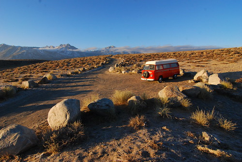
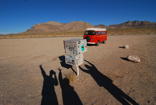
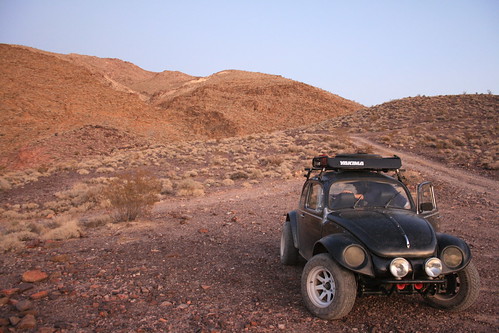
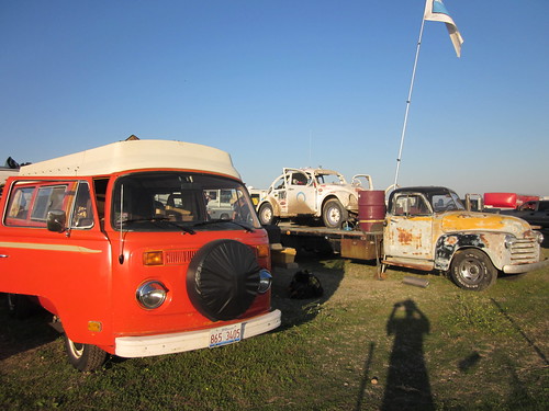
A huge Arizona mesa.


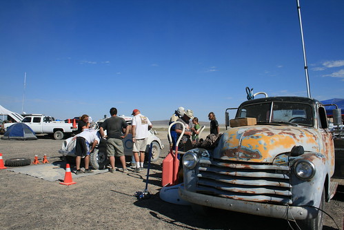
The rest of the drive down to Flagstaff was kind of a nonevent-full drive through landscape that was reminiscent of the badlands of South Dakota. It was mainly Indian reservation, and seemed kind of sad and lonely, and very poor, but the scenery was pretty. We rolled into Flagstaff as the sun was setting and had dinner (and a few beers) and slept in a motel that night. OMG, I know, we actually slept at a motel instead of in the bus! But let me explain. Again, it's winter so all of the campgrounds were closed, and there aren't that many operating RV parks. But we did find one, a KOA again. So we pulled into it and hoped that maybe they would allow more than 3 RVs to camp there that night. This time we were lucky, and there were plenty of spots. The owners of the KOA were VW bus owners too, surprisingly. When they saw that we arrived in a bus ourselves, they offered us 10% off the camping fees. Well, we were all about it until they told us how much the fee was, including the 10% discount. It was $39.00! Holy shit, just to park our bus!? We told the lady that we weren't sure if we wanted to stay just yet. We told her we'd go out for a beer first, at the local brewery, and then we might come back. Kind of a strange plan to tell her, but that's what we really were going to do, but we would also stop along the way to check prices at other places (including motels), which might of been a better deal. A few blocks down the main road that went towards the brewery, we spotted a motel with a really cool old fashioned multi-lightbulb sign (I don't know what they are really called). And it also said that there would be a European hostess! The three of us feeling kind of silly, decided we had to try and see how much they charged. Mark went in and told the guy, "I have $43 in my wallet. How much do you charge for 3 people tonight?" or something like that. The European hostess (who was actually a Greek MAN!) told us he would take it. So for only $4 more than a KOA "parking spot", we stayed at a motel and showered and spread out. At some point in the night (about 11pm) while we were still out, the European hostess cut the power to the cool multi-lightbulb sign. This made finding the motel on the way back from the brewery kind of difficult. We thought we could just look for the sign, but apparently he had shut down business for the night! At 11pm? A motel?

New Mexico Sky
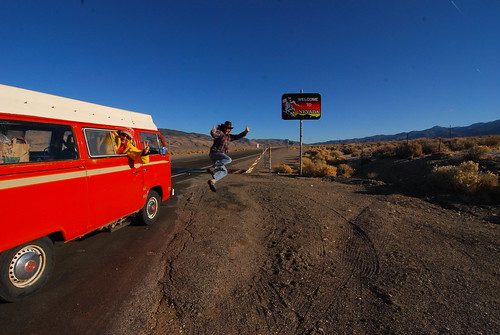
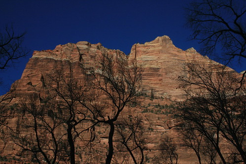
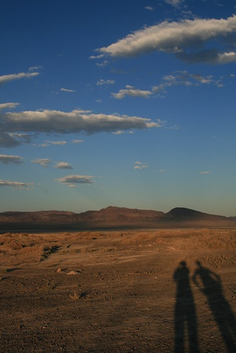
Entering New Mexico, where the sky was so high!


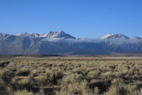
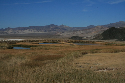
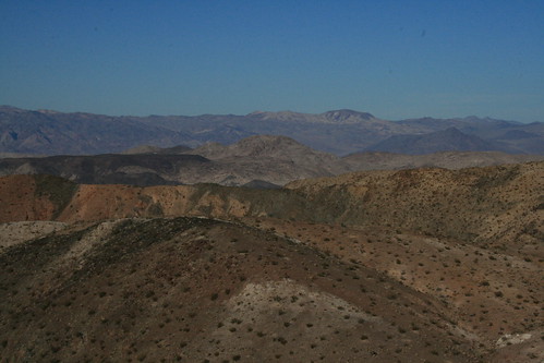
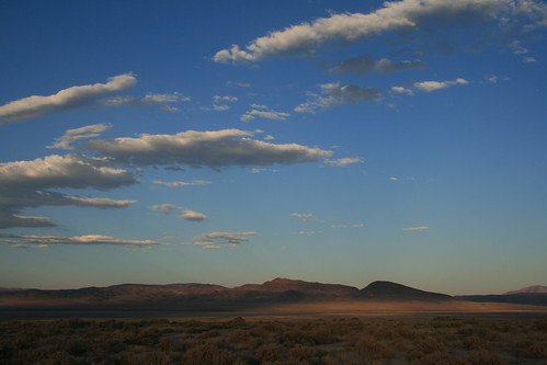
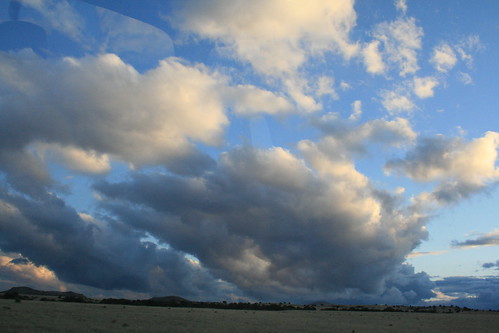
The next morning, we continued driving towards New Mexico. But on our way out, we had to make the usual coffee stop. We found one of those tiny huts that made coffee inside, so we pulled over. It was called "Wicked AZ Coffee." Me taking everything so literally mouthed it out loud, "Wicked 'Ayh' 'Zee' Coffee. . . " while at the same time, Mark shouted, "Wicked Ass Coffee!" He had no idea why the coffee shop misspelled the word 'ass' while I had no idea how Mark misread A.Z. as ass (sick mind or something?), and Romy got the pun and had no idea why we were both so confused. And then we looked at each other when we both realized the pun and what state we were in. A double entendre if I might say so myself! There was also an angry disgruntled hippy that came up to the coffee window while we were ordering and started doing stupid stuff, like ordering a fake drink and generally being an ass. Anyways, that morning it was kind of rainy. We drove south out of Flagstaff towards Phoenix but then veered east on hwy 260 (to 87, to 188) which progressed through mountainous terrain, but eroded type mountains, with lots of vegetation growing on them. The closer we got to the New Mexico border, the more desert-like the landscape started getting. Eventually, the storms cleared out and it became sunny for a little while. The road started climbing up a mountain, and got a lot smaller and narrower. Eventually we got so high up in the mountains that there was an actual forest of pine trees for a while. We almost missed the New Mexican border because there wasn't a sign since the road was small. Anyways, what goes up must come down, so there we went, coming down out of the mountains and into what looked like South Dakota (except it was New Mexico). Rolling grass lands and a beautiful open blue sky. I hadn't pictured this in my head when I thought of what New Mexico would look like.

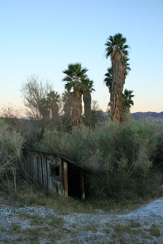
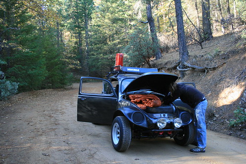
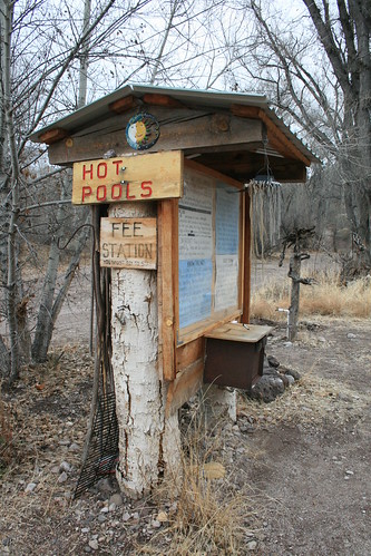
So now we were in New Mexico, the state that we had intended to try and explore while making our way to Chicago. When we got gas, we began to look at the map more closely. On the map, we saw a place called the Gila Cliff Dwellings not too far off (pronounced "Hee-La," not "Gee-La"). That seemed like it might be really cool to see, plus there were some hot springs which our guide book said were located nearby. By the time we got to the main big city which was at the turn off which went into the Gila National Forest, it was totally dark. But in order to get to the campground, we had to keep on driving. The guidebook said that the hot springs were along the Gila River, and Mark and Romy interpreted the directions as if they were part of some Federal campground near the cliff dwellings. I didn't really agree, I thought they were part of a private campground, but since it was two against one, we were looking out for a Federal campground. We eventually found it after about an hour of driving down a single lane mountain road. There were two, actually, but we picked the one that was in line with the guys' interpretation (which ended up being wrong but that's okay because it was a nice campground and free!). As we pulled into the campground along the river, it started raining on us really hard. The land we were on looked like it could be flooded rather easily, so I was kind of nervous. But again, two against one so we stayed put after we found a level spot. We discovered a new leak in the side window on the sliding door. We fixed it by sacrificing a towel, to soak up the rain, draped over the outside of the sliding door. That night we gorged ourselves with a smorgasbord of little dinner items, cheese, pepperoni sausage, stale bread, barley wine, sour patch kids (SPK!), potato salad, and other items. We were the only ones in the entire campground, but there was a pick-up truck that did a drive through the campground twice. The next morning we found out that there were some teenagers missing that day, and it was the rangers looking for them.

Pottery at Gila Cliff Dwellings
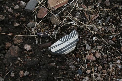
Pottery shards at the Gila Cliff Dwellings.


When we woke up the next morning, we headed out in the cold and damp towards the cliff dwellings. It was a National Monument, so similar to a National Park but not as big. When we got there, we discovered the visitor center was being remodeled, so they had a trailer set up where we could go in and talk to the rangers and watch a video. We were the only people there (which seemed like a theme on this trip). The rangers also explained to us that the bridge across the Gila River that led to the cliffs where the dwellings were was washed out. So we couldn't see the cliff dwellings after all! Bummer! Instead, they offered us a personal tour of the TJ Ranch archeological site, which they had never before let the public see. The ranch was the site of the ancient Mogollon people's home, when they eventually moved out of the cliff dwellings to begin raising crops in the meadows. They also made wooden houses which they found evidence of in the meadow of the ranch, and there were a bunch of old pottery shards littered all over the place. The pieces of pottery get brought to the surface somehow (they are only very shallowly buried), and then they got trampled and broken by the grazing cows from when it used to be a ranch.

Gila Cliff Dwellings
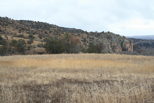
This field is where the Mogollon people lived 700 years ago.


The volunteer rangers told us how to spot the evidence of the ancient home foundations. They told us to be observant of the grasses that grew in the field and to notice how more lush certain places in the field were compared to others. The places where the grass was growing very well were the spots where there were Mogollon houses. They grass was essentially fertilized from the organic material that the house was made of. They think that when the people moved on from their area, they burned the houses they built and let them collapse. The burnt charcoal matter is what makes the grass grow much better, plus it is a little obvious because there are slight lumps in the field where the house spots are. The rangers told us that the archeologists don't think the houses were burned in war because there is no evidence of war-like weapons at the site. I don't know if I agree with that because somebody could still come through and raid and burn without actually using weaponry, just fire would be enough to destroy the village, you know? Also, the Mogollon people must of used pottery a lot because there were so many pottery shards everywhere! They were preserved so well that you can see the detail of the painting so well. Why would the people leave behind so many useful and beautiful pots if they were purposely burning down their village and moving on? Wouldn't you think they would take it with them? As always with historic stuff, it's all 'interpretation'.

Gila Hot Springs
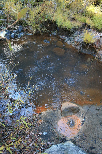
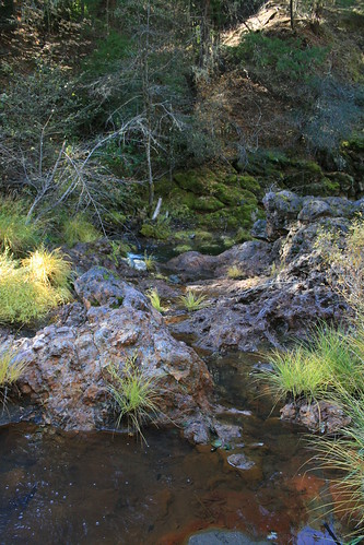
The hot springs along the Gila River, near the cliff dwellings.


Well, when we were done with our walk around the archeological site, we asked the rangers if they knew where the hot springs were (that we were looking for last night). They told us where they were (the same place I had a feeling they were, near a private campground and general store), so we headed over there. (Jenn seems a little bitter about the whole hot springs thing, but there was absolutely no way we would have found them the night before.) It was a very short drive from the cliff dwellings, actually. When we got to the general store, we took a left down towards the river. We drove through a farm and finally got to a small parking area. There was a little information sign where they took donations. We walked around to check it out. These hot springs were cool. There were three different pools, all built by hand out of rock and cement, and they were artfully decorated! And just the perfect temperature for a nice dip. Again, we were the only people there, so we had our pick. It was very quiet and peaceful, and the Gila river was running right next to all the pools. I bet if you got really hot, you could just jump into the river to cool off! It was really cold outside though, so sitting outside of the tub was enough to cool you off. What I liked the best about this place was the craftsmanship in how the pools were set up. All the piping was hidden and water cascaded into the pools over rocks or wooden chutes!

Gila Hot Springs
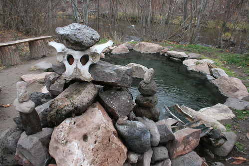
A hot pool at the Gila River hot springs.


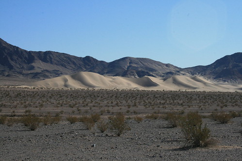
I wish we could've stayed at the pools longer, but we needed to move on. We still had an hour drive through the mountains to get back to the main road. We discovered as we were driving back that it had snowed over the pass (whereas it was raining on us last night camping)! We had to take it really slow, and in some parts we were sliding a little, but in general the road was in pretty good driving condition for not being plowed at all! When we finally hit the main road, we decided our next destination should be south. We wanted to stay out of the snowy blizzard in the northern part of the state. So we set our sights on checking out White Sands National Monument, and Carlsbad Caverns National Park. That night on the way to White Sands, we got stopped by the US border patrol. We'd been driving pretty much all afternoon and into the evening so that we could get as close to the White Sands area as possible. We spotted a state park campground nearby, so we started heading there. Apparently we didn't realize how close we were to the Mexican border, until we got stopped by border patrol! They asked us what country we were citizens of, and then looked at us in the face. They must of thought I looked really funny sitting in the back bench seat with my selk bag on, hood and all! Then they started knocking on all of our body panels, I guess checking if we stuffed them with drugs (or people)? Well, they must of realized we were just a bunch of traveling hippies in a hippie bus, and let us pass. After that, we were pretty close to the campground. We pulled into a spot which had an electric hook up. What a luxury! We used that opportunity to crank up the electric heater. That night we also finished off all the sour patch kids (a 2 lb bag Mark bought at WalMart in Cedar City) while watching the skies.

White Sands National Monument
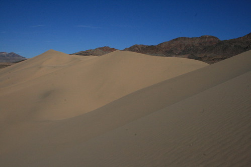
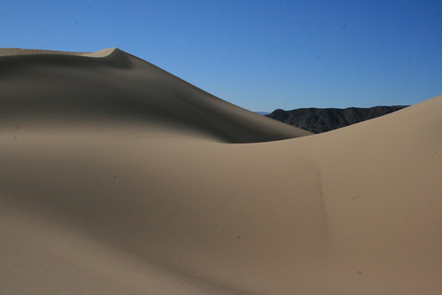
The white sands at White Sands National Monument.


The rainy weather was finally starting to break-up, which was great. That next morning, we packed up the bus as quickly as we could and headed for the White Sands. The region, geologically, is a basin, which is the reason the sand is so white. It isn't actually sand, which is made from silica (basically tiny glass beads). The white sand is gypsum. The basin collects water, but since its a desert, the water evaporates at a very high rate. It leaves behind gypsum crystals (which is the same thing dry wall is made from). The crystals eventually break down into sand-sized pieces, and collect in huge dunes because of the prevailing wind patterns. From far away, the dunes looks like sand dunes, but when you start walking on it, the gypsum has a slightly different quality about it. It hard to explain - its just a little different. I guess its somewhere in between sand and playa dust.

Carlsbad Cavern
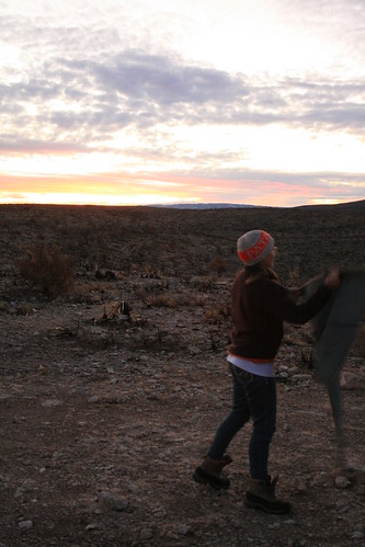
Shaking out the rug at our camping spot above the Carlsbad Caverns.


We did a little driving tour of the area, and we took a short hike into the dune fields. The dunes were cool to hike on, but there were *gasp* other people milling about, and every time we parked somewhere where there were no cars, a few minutes later there'd be several other cars. Monkey see monkey do I guess. We got our fill of the dunes then we moved on to our next destination, which was far off in the southeast corner of the state, the Carlsbad Caverns. The park is on the border of Texas, and just across the Texan border is another national park (which unfortunately we didn't have time to see). That whole general area used to be a huge coral reef, once under a shallow sea. The coral reef was uplifted and now forms what are called the Guadalupe Mountain Range. Since the coral reel was made of limestone, caves formed very easily due to the ease at which limestone can be dissolved, just due to slightly naturally acidic water. There are actually over 100 caves under the ground that is protected by the National Park, one of them being the deepest cave system in the US. But visitors are only allowed into 3 of them, and we only had time to see one of them. We didn't make it in time for the last cave 'tour,' so we checked out the visitor center to prepare for our cave tour the next day. The rangers also told us about some free camping spots on BLM land that was adjacent to the NP land. So we headed out to find the BLM land, which wasn't too far at all. We took a dirt road which ended up taking us to the top of the big hill/small mountain which was one of the foot hills of the Guadalupe Mountains. We picked out a nice level camping spot just in time to watch the sunset. We were probably camping above some kind of cave that might of been below us and yet undiscovered. The information at the visit center said that it was important to keep trash and other toxic run-off out of the natural environment, especially the caves. Anything that fell on the ground as liquid would eventually seep its way down into the ground, and into the cave system. We kept commenting how when we went pee, in hundreds of years, it would land on somebody's head in the cave as a cave kiss! And since we were in a VW, someone would get a black cave kiss from the bus!

Carlsbad Cavern
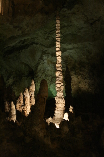
Cave formations in Carlsbad Caverns (The Witch's Finger).


The next morning, we drove back into the park and went into the cave. We entered at 9:30am and walked down through the natural entrance. In summer, this is where the famous Mexican Free-Tailed Bats emerge at dusk to feed. There are hundreds of thousands of them, but we didn't see any because in the winter, they are all hanging out in Mexico! The cave tour is actually a self-guided tour. There are information signs that you can read as you walk along. We rented an audio guide from the visitor center too, to get more information. As we walked deeper and deeper into the cave, the cave decorations started getting better and better. It was kept pretty dim in the cave, with only the major decoration features illuminated. We saw a lot of flowstone and drapery, which is what the cave is famous for. We walked so slowly because we kept looking around. We brought in our own flashlights and sometimes we illuminated things to get a better look at the different features. After an hour or so of walking, we finally got to the main large rooms. It was amazing how suddenly the cave opened up, and it was just filled with so many cave formations. The ceilings were pretty high, and they were all decorated with cave stuff. The rangers told us that this cave was considered to be one of the most decorated caves in the world. It really had so many things to look at.

Carlsbad Cavern
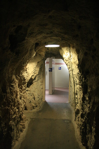
Need to go pee? The caves have bathrooms!


After a few hours, I was getting kind of hungry. My feet were getting tired, but we still wanted to explore every inch that visitors were allowed to see. So we kept walking and walking and walking. The battery on our camera was getting low! Oh no! When we finally saw everything that we could, we walked to the big elevators. The elevators took you up to the visitor center. When we got back out into the above-ground world, it was all sunny and I had to adjust to the light level. We also realized that it was about 3pm and they were about to call the last cave tour! We couldn't believe we spent that much time in the cave, but it was just so cool! No wonder I was getting hungry! We didn't think we would be down in the cave as long as were were, so we quickly bought some souvenirs, and hopped back into the bus. We now had to start our big drive north, towards Chicago. We had only two days to get there!

Saturday, December 17, 2011

A Long Strange Trip: Through Nevada and Utah

For winter break from school, we decided to do a long trip in the bus. We haven't used the bus for any long-term travelling in a while, so this was a perfect opportunity to go far! All the way to Chicago and back! Our friend, Mark, was also joining us for this journey (half of it, actually). He has never been on a road trip in the bus before, so this was going to be an all around exciting trip. Our only real plan was to try and check out New Mexico along the way. Its one of the states we've never been to before (except driving through it along the interstate), and all that we'd heard of it so far was pretty awesome - desert, mountains, caves, hot springs, etc. All good and interesting stuff. As for the rest of the route, we kind of made it up as we drove along. Here are some pictures and stories of our 'long strange trip.' It is written in 4 parts.

Bus at Mammoth
Our first night's camping spot near Mammoth Lakes, CA.


Our adventures started, of course, in California. We left Oakland before noon on December 15th. I think that's about the first time and the last time we thought about what day it was on then entire trip (except when we were nearing Illinois). Trips that are that long, where you forget what day of the week it is are great. It means you're not on a schedule and you can just relax and have fun. It took us all of the rest of the day to get over the Sierras. By the time it was dark, we were thinking of a good place to camp. The first thing that popped into mind was the hot springs near Mammoth Lakes. So we did the regular drive south along Hwy 395 until we saw the little green church. From there, we hoped we would recognize the dirt off shoot road from memory that would lead to the Crab Cooker, our favorite hot spring in the area. We actually found it, amazingly in the dark, and followed the bumpy road to the hot spring. Another amazing thing was that nobody was there! So we hopped out of the bus, realized just how numbingly cold it was outside (probably about 10 degrees F), and decided to send a scout to check out the spring first. I ended up being the scout, so I grabbed a flash light and hiked down. When I got there, I found a huge muddy mess, and the tub was empty. On closer inspection, it turned out that the valve that controlled the hot water source was broken, and leaking hot water (really really hot 130F water) all over the ground, while none of it was making it into the nice tub. What a bummer! I tried to look at how to fix it, but quickly realized that it would mean sticking my hand into the 130F water. Damn, I was kind of upset! I ran back to the bus to inform Romy and Mark that the Crab Cooker was a bust. They almost didn't believe me and actually went to check it out themselves. Instead of enjoying a nice hot soak, we just set up camp in the bus and kept warm in our sleeping bags. The next morning we woke up to ice windows. Except the ice was on the inside! It was also at this point that we'd realized we forgot to bring a snow/ice scraper! Oops! So I dug out the plastic mini dust pan, and started scraping. We got most off that way. The rest melted as we started driving east, towards the morning sun. Good thing we had plenty of paper towels with us too. Next, we were off to cross Nevada.

Entering Nevada
We made it to the Nevada border!


Once east of the Sierra Nevadas, that part of California looks a lot like Nevada, so the border crossing was in perceivable, except of course, for the highway sign. Most of the time, in the west, its rather amazing how the landscape actually seems to change when crossing from state to state. I really like Nevada, so I was excited to be driving through it. There was a thin layer of snow on all of the mountain tops, which made it looks really nice. Nevada actually means "snow capped." Most people don't realize that Nevada is full of mountains, and yes, it gets cold! Its not just a hot dry desert. Soon after we crossed the state line, on Hwy 6, we drove by the highest mountain in Nevada, called Boundary Peak. I think it's called that because its either on or very close to the border between Nevada and California. It is 13,147 feet (4,007 m) high. Just across the border, though, is Montgomery Peak, which is slightly higher. Anyway, there are plenty of high peaks in Nevada, including Wheeler Peak (at 13,065 feet (3,982 m)) on the east side of the state and within Great Basin National Park (yes, Nevada has a National Park too!).

Nevada, Near Boundary Peak
Boundary Peak is the highest mountain in Nevada.


We've never driven along the extraterrestrial highway before, so that was our goal for Nevada. And Mark, being into conspiracy theories, was really excited to try and make a stop along the way, since the road goes very near to Area 51. The conspiracy theory is, that most of the technology that the US military has to make all their advanced airplane designs were actually reverse-engineered from alien space craft. Supposedly, the Roswell (New Mexico) alien UFO crash in 1947 was studied by the US government (and of course also denied that it ever happened to be an alien UFO), and all of the space craft remains, including a few alien life forms, were taken secretly to Area 51 in Nevada. It was then that suddenly after this incident, that the military developed a lot of advanced aircraft, like the stealth bomber, which were only released or unclassified recently. The wikipedia article on the Roswell incident is very detailed if you want to read more.

Extraterrestrial Highway
Near Rachel, NV on the ET Highway.


Rachel is the closest town to Area 51, so a lot of the UFO people go there to search the skies. It may be that the UFOs are actually experimental military aircraft out of the Nellis Air Force Base, but that's interesting nonetheless. There is a small cafe called The A'Le'Inn, where earthlings are welcome. Of course we had to stop (for coffee at least)! Inside, they have actual pictures that people took of the UFOs they saw in the area. I don't know if they were genuine or faked, but they were all so interesting! You will have to go there yourself to see some of these. Pictures of flying saucers, and other strange lights in the sky covered the walls. There were also some locals eating lunch, and sipping on coffee. The town is very very small, and consists of mostly trailers. It was originally named Sandy, but then when the first child was born to the residents of the town, they renamed it after her. Legend has it that she eventually moved to Alaska, but the town is still called Rachel. While the whole alien/UFO/Area 51 theme is still pretty strong, most of the tourist business that Rachel sees now is because of geocaching, actually (but I'll write more about that later)!

The Black Mailbox .
At the famous 'black' mailbox, where aliens communicate?


Further down the road is a pull off where there are two mailboxes. There is also a small forest of Joshua trees surrounding the area. The mailbox there used to be black, but since many people thought it was the mailbox for Area 51 (who would actually think that, really?), it was rifled through a lot. People were looking for top secret stuff that the government would just send through regular US mail. It actually belongs to a local rancher. Finally he got so pissed off that he installed a bullet-proof white set of boxes. I guess people gather there at night to watch the skies. The boxes had a bunch of stickers and even a very creepy plaster mask somebody painted green (like an alien perhaps?).

Entering Utah
We made it to the Utah border just as the sun began to set.


I enjoyed the rest of the ride out of Nevada and into Utah relaxing on the back bench seat in the bus. I was very warm from the sun shining in. But we were climbing up a lot of steep terrain, so it was slow and before we actually hit the Utah border it was already sunset! I put on my selk'bag (the sleeping bag with legs and arms) and got cozy. I watched the pinyon pine trees streak past the window and liked how the setting sun was casting nice colors on the bare rocky mountains. We were headed towards Cedar City, but we wouldn't get there until past night fall. It was getting really snowy, and snow that had blown across the road started to freeze making it very slippery. We didn't want to keep driving anymore in the dark.

Finding a place to camp in the middle of winter is really hard. None of the campgrounds are open, and there are very few RV parks operating. As we pulled into Cedar City, we asked people if they knew of an RV park to camp. There was only a KOA open, so we went to find it, but it was all full! Apparently in winter, the KOA lets ONLY 3 RVs camp each night. It was totally full with a whopping 3 RVS, even though there were plenty of open spaces, but no! So we were turned away. Okay, so with the legitimate camping places a bust, at this point we went to the local 24hr Wal-Mart. But it was completely devoid of RVs, which is unusual. And plus there was a freaky woman security cop cruising the parking lot and she kept making circles around us, making us feel kind of nervous. We wouldn't be able to pop the top here, for fear of blowing our cover, so Mark would have to sleep on the floor. That kind of sucked as an option. So we decided to head up into the mountains and see if we could just pull off the road in a quiet place.

Zion National Park
The red cliffs of Zion National Park in Utah.


We were in luck! As we started driving up the small road that would take us into the National Forest outside of Cedar City, there was a huge pull off with a scrolling light sign saying the road ahead was closed. It was pretty far away from town, and didn't see a lot of traffic, so we just pulled off and camped there. Again, it was a very cold night, but we used the propane heater this time so we stayed nice and toasty. The next morning we had to clear the windows of ice again, but we were getting pretty used to it already. After stopping for some morning coffee, we headed out towards Zion National Park to do a scenic drive through. As we drove to the entrance of the park, I forgot how many little shops and B&Bs there were along the way (apparently I blocked it from my memory last time we were here). So many! It was almost endless! But finally we entered the park boundary and all of that just disappeared. It was only the road and the cliffs. Much better. We stopped at the visitor center and decided to try some quick hikes. First we checked out the weeping wall trail. The giant sandstone cliffs are literally saturated with water, like a sponge. Gravity pulls the water down (which comes from rain at the surface), but eventually the water reaches a layer that is not very easy to flow through. At that point, it's forced to exit the rock, and it makes it appear as the wall is weeping. Water is just dripping out of it, almost mysteriously (well not so mysterious anymore). Lush vegetation such as ferns grow, hanging from the wall. Since it was winter out, a lot of the dripping water froze, so it was very slippery climbing the stairs to get to the part of the cliff that was weeping!

Zion National Park
Taking a hike at the weeping wall in Zion National Park.


As we were driving on the way out of Zion, we saw a bighorn sheep running along the steep sandstone hills/cliffs. It got scared from our loud VW engine, so when it bolted away, it caught our eye. We slowed down to watch it, and then it began to stop running, I guess when it realized we weren't going to do anything to it. It just stared at us and we were able to get some nice pictures! On the Zion National Park website, it says that sightings of these bighorn sheep are actually very rare and that they should be reported! We didn't know that at the time, though. I guess we are reporting it now :-) Another cool thing we saw after we exited the park was a bunch of bald eagles flying over a field. They were all just flying, swooping, and landing in the trees. There had to be about 15 bald eagles, all together! It was crazy!

Zion National Park
We startled a bighorn sheep on our way out of Zion.


We spent the rest of the day driving through southern Utah, but we didn't make too many other stops. One place on the map caught our attention though, and that was the Coral Pink Sand Dunes. None of us ever saw sand dunes that were pink before, so we went to check them out since they weren't very far out of the way. I think they are pink because they accumulate from the weathering red rocks that Utah is so famous for. We were the only ones there, which was cool. It was also very windy, and pink sand was whipping around everywhere. It also made it very cold, so we weren't very inclined to go on a hike through the dunes. I was the only one who braved a quick run out onto the dune field just so I could capture a better picture (which is below).

Coral Pink Sand Dunes
The Coral Pink Sand Dunes on a windy day.


Monday, November 28, 2011

Long Weekend in Death Valley

Baja in Death Valley
The baja at our camping spot near Inyo's Mine on Lee's Camp Rd.

Now that the baja's metal front end work is all done, we decided to take it on a real trip (after the Mendocino test trip). Originally we wanted to take it to Death Valley for it's test trip, but instead, we waited until we had more time (Thanksgiving weekend). Remarkably, we realized that every time we go to Death Valley, we never end up doing as much off-roading as we want to. This is usually because we drive there in the Daewoo. So this time we set a goal to drive on as little pavement as possible! Of course, we needed to get there first, and quickly, so we decided to do the southern route (as opposed to the Tahoe route). As we were driving down I-5, we got into the usual TG traffic. We also noticed the nasty whitish milky smog in the air. It was hard to see the mountains around Bakersfield until you were right in them, literally. As we got closer to Death Valley, the smog started to go away. It took us almost the entire day to get there, so we picked an easy location to camp. We had our site set on a place down Echo Canyon Rd. We were down that road only partially when we rented an SUV 3 years ago on our first visit to Death Valley. As we drove down the same road in the baja, it was almost nostalgic, but of course, way more awesome to be in the baja than an SUV!

The Needle Hole (Hole in the Wall)
The Hole in the Wall on Echo Canyon Rd.

Echo Canyon is a really cool road. At first you drive up a wash. This is really easy going, and a passenger car could do it as long as it didn't bottom out. At the end of the wide wash, there is a small winding entrance to a canyon. There are literally a bunch of S-curves once you enter the canyon, and it starts to get very narrow. Eventually, you get to a place called 'The Hole in the Wall,' which is a cool hole in the canyon wall. If you stand in the right place, you can see all the way into Death Valley Furnace Creek area through the hole! We weren't sure how much farther the road kept going into the canyon, but it sure did keep going. Eventually we saw a sign for Inyo's Mine, which indicated it was at the end of the road. So we kept going, since we still had some daylight left. But once we got there, the road didn't actually end! It kept going over the Funeral Mountains and into Amargosa Valley. We were here to go exploring off-road, so we thought, why not? Lets go over the mountains. . . .

The Waterfall
The infamous dry falls on Lee's Camp Rd.

Well, we literally got 100 feet down the road when we saw an awesome camping spot. Since it was getting dark, we decided to stop. The sun dipped behind the mountains and suddenly it got cold. Really really cold! We built the tent as fast as we could, and then jumped back into the baja (which stays much warmer than a tent, just from body heat). As usual, the wind picked up a little, making it even nicer to be inside the baja. The Funeral Mountains are a bit strange after sunset. They are bare rock, but not like granite. They look almost crumbly and very very dry. They are called the Funeral Mountains, not because of people dying in them or anything, but instead because they have tops which are black in color. The black coloring reminded the first explorers of funeral clothing, so they called those mountains the Funeral Mountains. Who knows if that's true. A lot of things named in Death Valley have to do with death and dying because it was hard to live there (so hot and dry). You could really tell what must have been on those explorers' minds if the first thing they were reminded of when they saw black in the mountains was a funeral! But anyways, as I looked out of the baja window, the setting sun made the mountains glow an intense orangey-red. It looked almost like the rocks themselves that made up the mountains were red hot and luminesceing. At the same time the mountain tops began casting comparatively dark shadows. It was getting spooky!

Willow Spring
The hidden Willow Spring in Gold Valley.

Eventually it got dark, so we turned on the little light so we could read the awesome Back Country Adventures, Southern California guide book to off road mini adventures in a car. We wanted to drive Amargosa Rd the whole way, so we checked the book about what that entailed. The guide book gave it a hard rating, because of one section (like a crux) in the middle called the waterfall. It said the waterfall was passable, but did not recommend doing it if you were alone. Well, we were still eager to go drive down the road a while, even if it meant just to the waterfall and back. And so that's what we did the next morning. We attempted it, but the nature of the waterfall's shape and step-like pass made us afraid we would bottom out and hit the trans or engine really hard. So after having a bit of fun trying to turn the baja around 180 degrees in a slot canyon just barely wide enough for two cars, we headed back towards civilization (Furnace Creek for coffee!!!). There Romy found a guy who was riding the same 80s motorcycle that he had in the basement all apart. You can probably now guess that we stayed at Furnace Creek for a little while longer. One hour later, we headed back into the lonely stretches of the park. The first place we hit was Greenwater Valley Rd. Up back in that valley, we found even more roads that went up into random canyons, and up to cold springs. One spring we found was called Willow Spring. It was so crazy bushy with willows that even the animal trails were being overgrown!

Ibex Springs
Sunset at Ibex Springs, the site of an old talc mine.

Our ultimate goal was to get to Ibex Springs, which is in the southeastern section and only accessible by off-roading. Ibex Springs was close by to an abandoned talc mine, called Ibex.Somebody planted a lot of palm trees at the spring, and also protected them by building a roof over the source pool. We almost missed the turn off, but eventually made our way towards Ibex. The road had warnings that deep sand was ahead. It sure was! Then when the sand was done scaring the hell out of you, the road started to go up and down and up and down in a very sinusoidal way and got pretty rough and washed out. We were roaring about 45 degrees along an alluvial fan. The sinusoidal ups and downs were the natural separation distances between washes. That's kind of interesting. When we were getting close, we no longer had to look at a map to know where to go. We saw huge palm trees, so kept driving towards them. When we got there, the sun was setting. And it was completely abandoned, meaning we were the only ones there. So we explored the springs for a few minutes before it got dark, and then built our tent, and soon went to sleep.

Ibex Springs
The shed that protects the cold springs at Ibex.

When we woke up, the sun was so warm and strong. But getting out of the tent was hard because it was still kind of cold. The next stop in our plan was to see the Ibex Dunes. I think those were the last set of dunes that we hadn't yet seen in the park. These were about as tucked away as the Eureka Dunes or Saline Valley Dunes. From what it looked like on the map, we should've been able to drive right up to them. So that's what we set out to do. I love dunes, and especially going walking on them. Death Valley has some of the biggest and best dunes. Driving to them would take us about an hour, even though they weren't so far away. When we finally saw them, they looked like they were close. But we just kept driving and driving towards them, with the dunes not really getting any bigger. The scale of things in the desert is so huge but you don't really realize. Well, eventually we did get to them, but then the road started curving away. We were still pretty far (about two miles) away, but it was clear to us now that that was about as close as we would be able to get by the road. So we parked the carr off to the side, and started walking.

Ibex Dunes
We took a drive to Ibex Dunes.

We saw a lot of other footprints actually in the sandy washes on our way to the foot of the dunes. I guess we weren't the only ones with that idea. As we looked closer, we could see other people further out in the dunes. But they were still really far away, all the way down the dune that they looked like ants, not like people And at last, after about a half hour walk, we made it to the foot of the dunes. We saw only one trail in the sand. The rest of the huge dunes we could see were completely untouched and fresh. We were gonna be the first tracks since the wind erased the others. The dunes were big and steep, and it was a real challenge to get up them very fast. But we made it to the top, where we had an excellent view. The wind patterns made some of the dune formations look really cool. There were peaks, saddles, and bowls. Straight lines, curves, and ripples.

Ibex Dunes
The prefect sand dunes!

We could've spent all day walking around on those dunes, but we had to keep going on to our next destination, which was Saratoga Springs. The springs were actually not that far away (less than a 1/2 hour drive, I think). There was a small parking area at the trailhead to the springs. The trail was only about 1/2 mile long until the springs. The coolest thing about walking to see those springs was the sudden change in scenery. One minute you were driving next to a dry playa, kicking up loose dirt and dust with each step, and the next minute you hear crickets singing, frogs croaking, dragon flies buzzing, duck quacking, and birds chirping. The reeds and grass grew so high, they were way over your head. There was almost no way to navigate through it without getting wet. The trail ended there at the springs, although if you wanted to go further past the springs, you could keep going on what I think must have been an old mining road.

Ibex Dunes
The Ibex Dunes are not well trodden.

After getting our fill of the springs, we headed back to the car and ate a small lunch. A few more people trickled in and out of the parking lot. I was surprised. When we were done eating, we drove out of there and to our final destination in our plan, which was the Owlhead Mountains. These are in the southern end of the park. I'm not sure why there is a road through them, but I think it has something to do with a communication tower. We started heading down that road, and it was pretty well graded, but also kind of boring. Romy had fun with the baja speeding along. The scenery was cool, but the road had high banks, so you felt weird, like in a channel or something. We stopped after about half an hour when we saw a palm tree. We had hit the Owl Head Springs. It was actually kind of trashed when we got closer. The palm tree was growing out of a weird ditch, there were animal fences all around, and junk or trash remnants strewn all over. What a weird place.

Saratoga Springs
Saratoga Springs was a wildlife haven and unexpected.

When we got our fill of the palm tree and looking at interesting garbage, we headed back to the baja. There was a branching road that started at the springs and went up and back into the mountains. According to the Back Country Adventures guide book, the mine at the end of the road had great views. So we decided to go. It was kind of a rough road, and got very narrow in some parts. It was in general not very interesting, except when three wild burros ran right along side us. Then they got scared, and started running away towards the top of a hill. They stopped all at the same time, and from the top of the hill, just watched us drive past them. We nick named them "The Three Amigos." Soon after the bend in the road where we saw the burros, the road got really narrow, rocky, and dusty. It continued up a steep and washed out incline, which we didn't feel like doing since we were basically at the top. So instead we got out to walk the last few remaining feet to a great view of the surrounding basin and range. It would be a good spot to camp at in the future as it was open and flat with some great views. And I guess that would be the furthest point in our adventure. After that, we drove back down the road, passing our "Three Amigos" who now stared at us driving by again, and kept going until we were almost back at Owl Head Springs. We took a small detour to check out an old abandoned 50s car, but then kept rolling right out of there, and hit the main highway up Death Valley. I think that section (going north on the Henry Wade Rd) was the very best scenery in terms of Death Valley. Entering the Valley from the south was really cool!

View From Black Magic Mine
The view from Black Magic Mine.

That night, we drove far past when it got dark, trying to get as far out of the park as we could get. The next day, our goal was to try and get back home by nighttime. Still, we only made it slightly past Stovepipe Wells to a nice camp site past the airport landing strip. That campsite reminds me that there is a rode that goes up and across the alluvial fan just to the south west. I think it starts with an L. We'll save that for next time I guess!

Tuesday, November 15, 2011

The Baja Goes For a Spin in Mendocino

Romy has been working on making a metal front end for the baja for a long long time now. Its been slow going because of all the things in school this semester, like his qualifying exam, a conference, and other stuff. But he finally got it finished, and we painted it and got the baja ready to get off-roading again!

Mendocino National Forest The baja in the Mendocino National Forest.

We decided to go somewhere close (originally we wanted to go all the way to Death Valley) in case something happened. Tools, our across the street neighbor suggested we go to Mendocino National Forest. We kind of forgot about this place, but it was actually the best place to go, since its just about the closest national forest, and we already knew a little about what to expect. We didn't get out of Oakland until about noon, so it was getting dark just as we pulled out of Upper Lake (on the north end of Clear Lake), where the road enters the National Forest land.

Night was fast approaching, and we tried to climb the first mountain as fast as possible. But dark came upon us and we had to find the closest camping spot we could. Luckily, as if by magic, an off-shoot road appeared and we followed it about a 1/4 mile to a nice opening. We could see all of the thin wispy clouds in the sky glowing bright pink and orange with the sunset as we built our tent.

Mendocino National Forest There is a lot of moss or something hanging off the big oak trees.

The next morning, we woke up pretty early, and packed up. We had in plan to explore as many of the M roads as we had time for that day, before having to head home. We started out on M1, and then took the turn to go on M10. This part of the trip was kind of uneventful (except for some fun stream crossings), as the road was nicely graded. We passed by a bunch of rolling hills, climbing one of them steadily. Dense oak tree forests gave way to large open meadows.


A video of the baja doing its first stream crossing!

We made it all the way to Bear Creek Campground, and decided to look at the map, because we already took the route out of Bear Creek CG before, and knew of another road we hadn't gone on yet. Romy, with his eagle eyes, spotted the road on the map, and then spotted something even more interesting: a hot spring! It was marked on the map with the usual symbol, and there was a road that went right to it. So, we made it our goal for the day to reach the hot springs and check them out!

Mendocino National Forest Stopping the fix something!

The road to the hot springs looked like the "main" road on our map (FR17N16), but it sure was not in very good condition as we started driving along. First of all, to get on the road, you had to cross a wide but shallow stream. Then, you had to navigate your way around sections of the road that were washed out, with ditches at least a foot or more deep! It was like this almost the entire way to the turn-off towards the springs. The road followed the ridge of the mountain we were on.

After about 2 miles on FR17N16, we found the turn off for Deer Valley Rd, which immediately started going down, down, down the other side of the mountain. The road was also washed out, and some parts had very loose dirt/gravel, making it kind of difficult. We basically knew about half-way down the mountain that we were committed to going out of the forest on his route because there was NO TURNING BACK! The road was so steep and loose, all you could do was hope for a nice controlled descent. So we were crossing out fingers. . . .

Crabtree Hot Springs
We saw bubbling waters at Crabtree Hot Springs.

Soon we saw a private property sign, and this bummed us out. We were really hoping that this hot spring wasn't another one of the privately owned springs which forbid public access. Then we saw a really weird collection of junk, and a trailer shack thing, and school bus near the bottom. It looked like somebody was living there (more like squatting or something). WTF!? The set up looked plain old nasty. But shortly after passing that, the land went back to being national forest, so our hopes went back up that the people who "owned" the shacks didn't also own the springs. We hoped anyways.

When we got down to the creek at the bottom of the mountain, we parked the baja. Nobody was there and it was totally silent. We saw on the map that the springs were slightly downstream, so we found a trail and started walking. Only about 5 minutes later did we start to smell sulfur very strongly, and BAM! Bumped right into a no trespassing sign saying the springs were closed. We looked around, but didn't go any further, fearing that one of the people who lived in the shacks would come running at us with a shot gun or something! I normally don't get scared of things like this, but this was giving me kind of a bad vibe!

Crabtree Hot Springs
More bubbling waters at Crabtree Hot Springs.

We turned around and walked back to the baja. We were hoping that the road out of the forest was passable, since we had no other options. But it turned out to be an okay road, without much events. I was just thinking about the hot springs, wondering about them along the whole way back. It was late afternoon by the time we got out of the forest, so we got back on the highway after taking a small detour to see the Indian Valley Reservoir. What a weird place, too! The reservoir must be kind of new, because the tops of old tall trees are sticking out, or the water level must be really low (although it didn't look like low water). Whatever the case, we want to go kayaking on it and paddle up to the freaky trees!!!!!

Indian Valley Reservoir
Indian Valley Reservoir, with freaky trees sticking out.

When we got back home, I Googled "crabtree hot springs" and was sooooooo surprised to see what turned out. Check out this link! It seems as if we had kept walking past the no trespassing sign, we would've got to some big HOT pools! However, the hot springs are kind of shrouded in some drama right now. Apparently the owners (who many think are squatters) have closed off public access to the springs, after first buying the property with the intention of "saving the springs" and having them be open to the public. Reading some info on the hot springs forums online, they seem to only allow people to come in if they bring a bottle of alcohol with them for the owners, or they are friends of the owners, etc. Also, it seems as if the owners are generally unpleasant people, and have basically ruined the soaking experience of many people who used to go there for years before. The most recent thing I read (as of July 2011) said that the woman owner became ill, and has left the property. The boyfriend of the owner has left as well. The springs are now free of their presence, and the shacks we drove by are supposedly unoccupied. The whole thing seems fishy to me. Hopefully the drama will end soon and the next time we return, we can actually soak without worry of crazy people!

Sunday, October 30, 2011

The Dingo Races at Prairie City

This past weekend was the last race of the season for VORRA. The Dingo has been in first place for the entire season, mainly because we've been consistant in showing up to all of the races and we always finish (which is actually a big deal)! We finished the season with first place in Class 11. Yay!

VORRA Prairie City
Romy is ready to get in the car for the first moto of the day as co-driver.

VORRA Prairie City
These are the pits where everybody lives for the weekend. Lots of VWs in our pit!

VORRA Prairie City
Romy is getting strapped in the car before one of the races.

The race this weekend was a double header. Two full days of racing plus three fun races at the end. We came in the bus so that the camping would be more comfy. Since the race was a short track, we were able to sit in bleacher style seats and watch the cars race around the whole track. In the desert races, the tracks are many many miles long and go off in the mountains. You basically never get to see the cars except when they pull into the pits. It was fun to watch all the big trucks. We were the only Class 11 to race this weekend, so when we were "racing" they put us with other classes. Mainly other classes with VW air-cooled engines and funny looking Suzuki things. Romy got to be the driver for two of the 6 motos. He was co-driver for two others. I got to be co-driver for the 4th moto with Bob as the driver, and it was so much fun! It really feels like you're going super fast, but really you're not! Its just because you're going off road, ripping through all the bumps, skidding around in the muddy sections, and going over jumps. Nothing too bad happened to the baja except a weird persistent oil leak from one or sometimes both valve covers. Towards the end of the races, one of the drivers, Dave, overheated the engine by driving the car after the alternator belt popped off. The engine didn't sound very good after that, but it was the last race. Lots of work ahead in getting ready for the next season!

VORRA Prairie City
I look so funny in the racing suit and helmet. I look like a little kid!

VORRA Prairie City
Packing up the Dingo to take it back home (which is the Santa Cruz Mountains, south of the Bay Area).

Lynda brought her hula hoops which she made out of irrigation tubing. She taught me how to hula hoop and it was so much fun and totally addicting. Especially when the super decked out team next to us in the pits started blasting music. They were all drunk watching us hula hoop. We had a mini audience. Lynda gave me a hula hoop to take home. I got Romy addicted to it too! Watch out Burning Man 2012! Saturday night was a lot of fun because Bob brought an old drum out of a washing machine and it became our fire pit. The tiny holes punched in the drum looked so cool as the flames made them glow all crazy. Best fire pit ever. We told a scary story around the campfire, since it was right before Halloween. It was the kind of story where one person adds a sentence, and then passes it on to the next person. The story turned out really funny. One guy kept changing the weather every time it was his turn!


A video of Romy getting strapped in the Dingo for the 5th moto.

Monday, September 05, 2011

The Desert Dingo Races in Fallon

Desert Dingo
The Desert Dingo and Skittles take off, into a cloud of dust.

Over Labor Day Weekend, VORRA held a 24-hour endurance race. It was split over two days, Saturday and Sunday. Each day you had 12 hours (from 8am to 8pm) to get as many laps that you could on the 40-ish mile track. It went winding along the basin and range Nevadan desert, over playas and winding up canyons over the ranges. It was dusty as hell, but surprisingly not that hot!

Desert Dingo
The start of race day #2 on the playa outside of Fallon, NV.

It only got up to 90F, but you know, "Its a dry heat." So it was very manageable as long as you were in the shade. Romy got to the race early on Thursday night to help put the baja through tech inspection. The rest of the team arrived Friday night or Saturday morning. A lot of the people on the team were actually at Burning Man, so there were a few people helping out this race who normally aren't on the team.

Desert Dingo
The Desert Dingo pulls into the pits.

Romy had a lot of fun driving the car during both days of the race. I had my first dust experience (which I had avoided until this weekend), and realized that the dust isn't that bad. Its so fine that you don't even notice it, except when it combines with the grease in your hair and forms a sticky form of natural 'hair product.' It gets all over, and can't be avoided, so you just have to accept it.

Desert Dingo
Another shot of the Dingo in the pits, and Crusty's cool old truck.

Three Class 11 cars started the race, and we were the only to finish! One of the Class 11's broke down on the first lap on the first day due to a busted transmission. They put in a stock transmission another team gave them, and managed 1-3/4ths of a lap before that one broke as well. Then they just started partying. The other class 11 (Skittles) made it through most of the race but were taking it slow. They seemed to stop a few hours before the race ended, but I'm not sure why. We were able to finish 12 laps over the 24 hours! (7 on the first day, 5 on the second) Thats pretty damn good! Actually, it pretty amazing that we FINISHED the race without breaking down like the poor other bajas! This means that the Desert Dingo is still in first place in our class. Yay! First place! But, we did break both shock towers off the front, punch a huge hole in the drivers side fender, and totally screw up the front suspension. Fun!

Next are some pictures I took as the sun was setting at the end of race day #2. The Dingo was on its last lap, but most cars were already done, so the air was quiet, calm, and clear. These next pictures are why I like the desert. Especially at sunset!

Nevada
Nicole and my shadow.


Nevada
Beautiful blue sky and poofy clouds.


Nevada
The sun burst through some clouds to give this shot a glowing effect. I did not photoshop this at all!


Nevada
I saved my favorite for last. Typical basin and range landscape under a sky speckled with nice clouds.