Showing posts with label death valley. Show all posts

Monday, November 28, 2011

Long Weekend in Death Valley

Baja in Death Valley
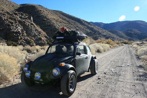
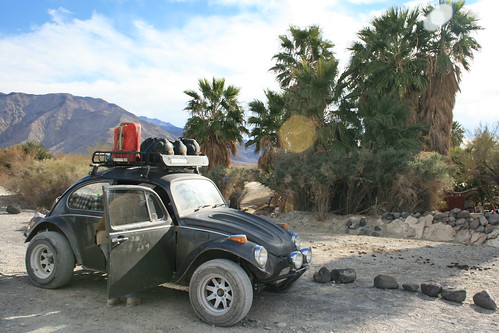
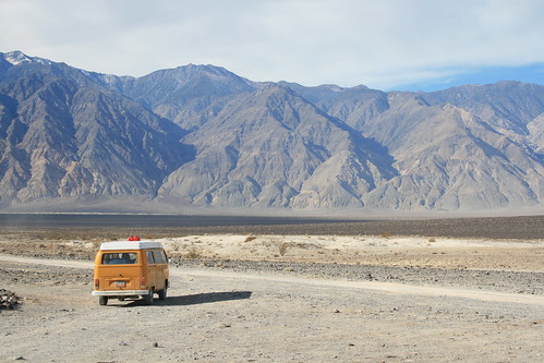
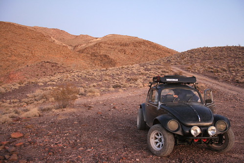
The baja at our camping spot near Inyo's Mine on Lee's Camp Rd.

Now that the baja's metal front end work is all done, we decided to take it on a real trip (after the Mendocino test trip). Originally we wanted to take it to Death Valley for it's test trip, but instead, we waited until we had more time (Thanksgiving weekend). Remarkably, we realized that every time we go to Death Valley, we never end up doing as much off-roading as we want to. This is usually because we drive there in the Daewoo. So this time we set a goal to drive on as little pavement as possible! Of course, we needed to get there first, and quickly, so we decided to do the southern route (as opposed to the Tahoe route). As we were driving down I-5, we got into the usual TG traffic. We also noticed the nasty whitish milky smog in the air. It was hard to see the mountains around Bakersfield until you were right in them, literally. As we got closer to Death Valley, the smog started to go away. It took us almost the entire day to get there, so we picked an easy location to camp. We had our site set on a place down Echo Canyon Rd. We were down that road only partially when we rented an SUV 3 years ago on our first visit to Death Valley. As we drove down the same road in the baja, it was almost nostalgic, but of course, way more awesome to be in the baja than an SUV!
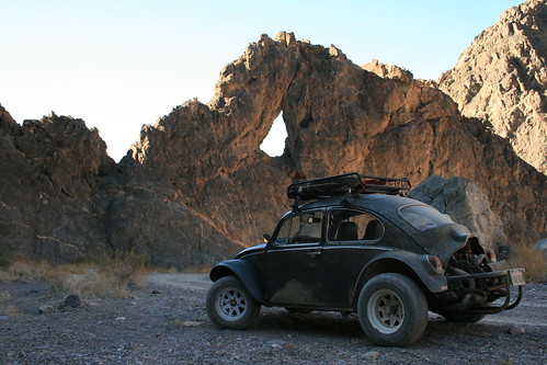
The Needle Hole (Hole in the Wall)
The Hole in the Wall on Echo Canyon Rd.

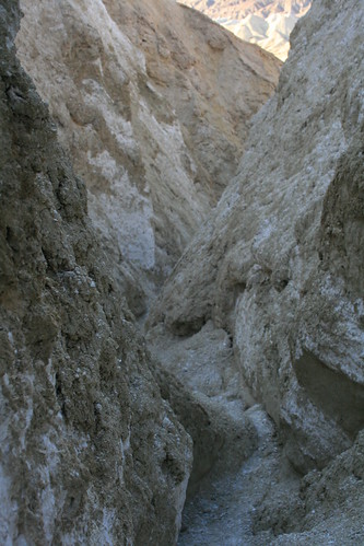
Echo Canyon is a really cool road. At first you drive up a wash. This is really easy going, and a passenger car could do it as long as it didn't bottom out. At the end of the wide wash, there is a small winding entrance to a canyon. There are literally a bunch of S-curves once you enter the canyon, and it starts to get very narrow. Eventually, you get to a place called 'The Hole in the Wall,' which is a cool hole in the canyon wall. If you stand in the right place, you can see all the way into Death Valley Furnace Creek area through the hole! We weren't sure how much farther the road kept going into the canyon, but it sure did keep going. Eventually we saw a sign for Inyo's Mine, which indicated it was at the end of the road. So we kept going, since we still had some daylight left. But once we got there, the road didn't actually end! It kept going over the Funeral Mountains and into Amargosa Valley. We were here to go exploring off-road, so we thought, why not? Lets go over the mountains. . . .

The Waterfall
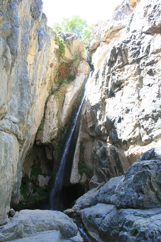
The infamous dry falls on Lee's Camp Rd.

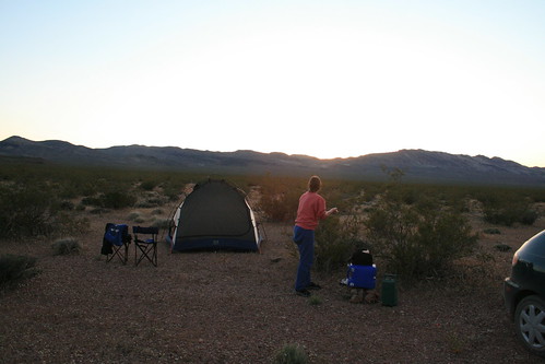
Well, we literally got 100 feet down the road when we saw an awesome camping spot. Since it was getting dark, we decided to stop. The sun dipped behind the mountains and suddenly it got cold. Really really cold! We built the tent as fast as we could, and then jumped back into the baja (which stays much warmer than a tent, just from body heat). As usual, the wind picked up a little, making it even nicer to be inside the baja. The Funeral Mountains are a bit strange after sunset. They are bare rock, but not like granite. They look almost crumbly and very very dry. They are called the Funeral Mountains, not because of people dying in them or anything, but instead because they have tops which are black in color. The black coloring reminded the first explorers of funeral clothing, so they called those mountains the Funeral Mountains. Who knows if that's true. A lot of things named in Death Valley have to do with death and dying because it was hard to live there (so hot and dry). You could really tell what must have been on those explorers' minds if the first thing they were reminded of when they saw black in the mountains was a funeral! But anyways, as I looked out of the baja window, the setting sun made the mountains glow an intense orangey-red. It looked almost like the rocks themselves that made up the mountains were red hot and luminesceing. At the same time the mountain tops began casting comparatively dark shadows. It was getting spooky!
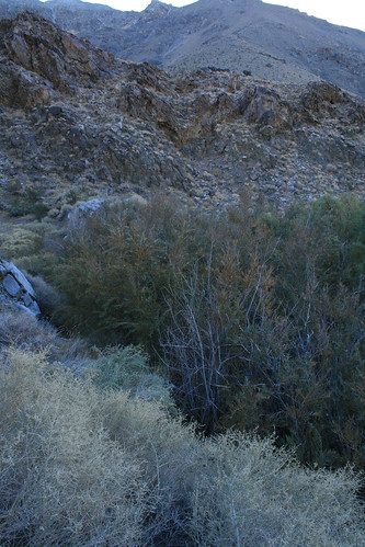
Willow Spring
The hidden Willow Spring in Gold Valley.

Eventually it got dark, so we turned on the little light so we could read the awesome Back Country Adventures, Southern California guide book to off road mini adventures in a car. We wanted to drive Amargosa Rd the whole way, so we checked the book about what that entailed. The guide book gave it a hard rating, because of one section (like a crux) in the middle called the waterfall. It said the waterfall was passable, but did not recommend doing it if you were alone. Well, we were still eager to go drive down the road a while, even if it meant just to the waterfall and back. And so that's what we did the next morning. We attempted it, but the nature of the waterfall's shape and step-like pass made us afraid we would bottom out and hit the trans or engine really hard. So after having a bit of fun trying to turn the baja around 180 degrees in a slot canyon just barely wide enough for two cars, we headed back towards civilization (Furnace Creek for coffee!!!). There Romy found a guy who was riding the same 80s motorcycle that he had in the basement all apart. You can probably now guess that we stayed at Furnace Creek for a little while longer. One hour later, we headed back into the lonely stretches of the park. The first place we hit was Greenwater Valley Rd. Up back in that valley, we found even more roads that went up into random canyons, and up to cold springs. One spring we found was called Willow Spring. It was so crazy bushy with willows that even the animal trails were being overgrown!
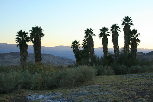
Ibex Springs
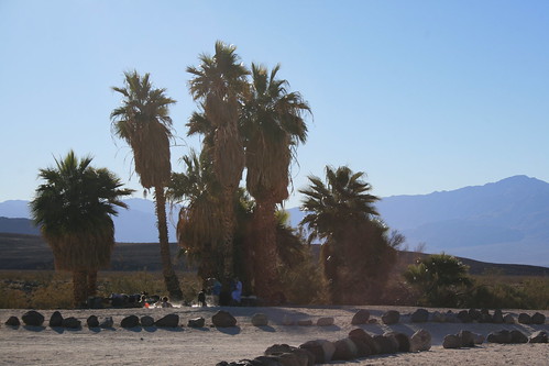
Sunset at Ibex Springs, the site of an old talc mine.

Our ultimate goal was to get to Ibex Springs, which is in the southeastern section and only accessible by off-roading. Ibex Springs was close by to an abandoned talc mine, called Ibex.Somebody planted a lot of palm trees at the spring, and also protected them by building a roof over the source pool. We almost missed the turn off, but eventually made our way towards Ibex. The road had warnings that deep sand was ahead. It sure was! Then when the sand was done scaring the hell out of you, the road started to go up and down and up and down in a very sinusoidal way and got pretty rough and washed out. We were roaring about 45 degrees along an alluvial fan. The sinusoidal ups and downs were the natural separation distances between washes. That's kind of interesting. When we were getting close, we no longer had to look at a map to know where to go. We saw huge palm trees, so kept driving towards them. When we got there, the sun was setting. And it was completely abandoned, meaning we were the only ones there. So we explored the springs for a few minutes before it got dark, and then built our tent, and soon went to sleep.
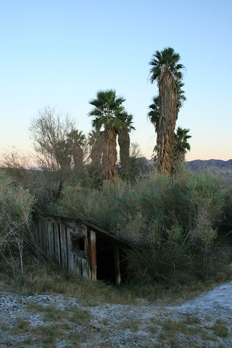
Ibex Springs
The shed that protects the cold springs at Ibex.

When we woke up, the sun was so warm and strong. But getting out of the tent was hard because it was still kind of cold. The next stop in our plan was to see the Ibex Dunes. I think those were the last set of dunes that we hadn't yet seen in the park. These were about as tucked away as the Eureka Dunes or Saline Valley Dunes. From what it looked like on the map, we should've been able to drive right up to them. So that's what we set out to do. I love dunes, and especially going walking on them. Death Valley has some of the biggest and best dunes. Driving to them would take us about an hour, even though they weren't so far away. When we finally saw them, they looked like they were close. But we just kept driving and driving towards them, with the dunes not really getting any bigger. The scale of things in the desert is so huge but you don't really realize. Well, eventually we did get to them, but then the road started curving away. We were still pretty far (about two miles) away, but it was clear to us now that that was about as close as we would be able to get by the road. So we parked the carr off to the side, and started walking.
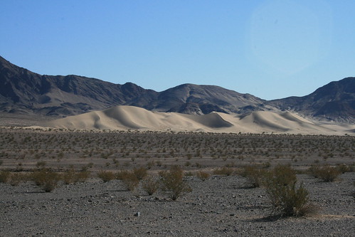
Ibex Dunes
We took a drive to Ibex Dunes.

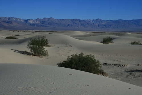
We saw a lot of other footprints actually in the sandy washes on our way to the foot of the dunes. I guess we weren't the only ones with that idea. As we looked closer, we could see other people further out in the dunes. But they were still really far away, all the way down the dune that they looked like ants, not like people And at last, after about a half hour walk, we made it to the foot of the dunes. We saw only one trail in the sand. The rest of the huge dunes we could see were completely untouched and fresh. We were gonna be the first tracks since the wind erased the others. The dunes were big and steep, and it was a real challenge to get up them very fast. But we made it to the top, where we had an excellent view. The wind patterns made some of the dune formations look really cool. There were peaks, saddles, and bowls. Straight lines, curves, and ripples.
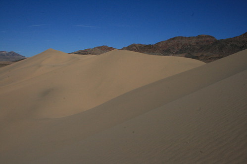
Ibex Dunes
The prefect sand dunes!

We could've spent all day walking around on those dunes, but we had to keep going on to our next destination, which was Saratoga Springs. The springs were actually not that far away (less than a 1/2 hour drive, I think). There was a small parking area at the trailhead to the springs. The trail was only about 1/2 mile long until the springs. The coolest thing about walking to see those springs was the sudden change in scenery. One minute you were driving next to a dry playa, kicking up loose dirt and dust with each step, and the next minute you hear crickets singing, frogs croaking, dragon flies buzzing, duck quacking, and birds chirping. The reeds and grass grew so high, they were way over your head. There was almost no way to navigate through it without getting wet. The trail ended there at the springs, although if you wanted to go further past the springs, you could keep going on what I think must have been an old mining road.
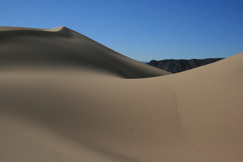
Ibex Dunes
The Ibex Dunes are not well trodden.

After getting our fill of the springs, we headed back to the car and ate a small lunch. A few more people trickled in and out of the parking lot. I was surprised. When we were done eating, we drove out of there and to our final destination in our plan, which was the Owlhead Mountains. These are in the southern end of the park. I'm not sure why there is a road through them, but I think it has something to do with a communication tower. We started heading down that road, and it was pretty well graded, but also kind of boring. Romy had fun with the baja speeding along. The scenery was cool, but the road had high banks, so you felt weird, like in a channel or something. We stopped after about half an hour when we saw a palm tree. We had hit the Owl Head Springs. It was actually kind of trashed when we got closer. The palm tree was growing out of a weird ditch, there were animal fences all around, and junk or trash remnants strewn all over. What a weird place.
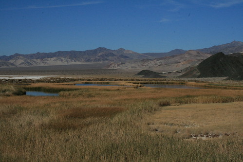
Saratoga Springs
Saratoga Springs was a wildlife haven and unexpected.

When we got our fill of the palm tree and looking at interesting garbage, we headed back to the baja. There was a branching road that started at the springs and went up and back into the mountains. According to the Back Country Adventures guide book, the mine at the end of the road had great views. So we decided to go. It was kind of a rough road, and got very narrow in some parts. It was in general not very interesting, except when three wild burros ran right along side us. Then they got scared, and started running away towards the top of a hill. They stopped all at the same time, and from the top of the hill, just watched us drive past them. We nick named them "The Three Amigos." Soon after the bend in the road where we saw the burros, the road got really narrow, rocky, and dusty. It continued up a steep and washed out incline, which we didn't feel like doing since we were basically at the top. So instead we got out to walk the last few remaining feet to a great view of the surrounding basin and range. It would be a good spot to camp at in the future as it was open and flat with some great views. And I guess that would be the furthest point in our adventure. After that, we drove back down the road, passing our "Three Amigos" who now stared at us driving by again, and kept going until we were almost back at Owl Head Springs. We took a small detour to check out an old abandoned 50s car, but then kept rolling right out of there, and hit the main highway up Death Valley. I think that section (going north on the Henry Wade Rd) was the very best scenery in terms of Death Valley. Entering the Valley from the south was really cool!
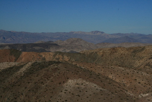
View From Black Magic Mine
The view from Black Magic Mine.

That night, we drove far past when it got dark, trying to get as far out of the park as we could get. The next day, our goal was to try and get back home by nighttime. Still, we only made it slightly past Stovepipe Wells to a nice camp site past the airport landing strip. That campsite reminds me that there is a rode that goes up and across the alluvial fan just to the south west. I think it starts with an L. We'll save that for next time I guess!

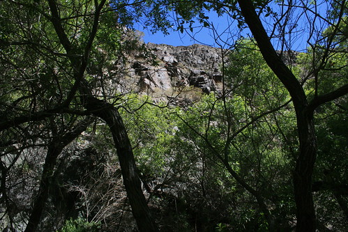
Monday, May 02, 2011

Darwin Falls, a Real Oasis

Before we left Death Valley on this trip, we decided to check out Darwin Falls. The first time we attempted this was when Mark and Emma were visiting, and Mark was giving us directions on how to get the the falls. Instead of parking at the small parking lot, which was at the end of a 2 mile gravel road which followed a wash up towards the narrow canyon where the waterfalls are, we kept driving past it along one of the craziest mining road I've ever been on. It was called Zinc Hill Rd. That first attempt to go see the falls took us to China Springs, where Emma found a lush pool with a bunch of koi fish swimming happily in the middle of the desert next to an abandoned miner's house. This time, we read the directions and parked at the parking lot, which is the trail head to the falls.

Darwin Falls
The surroundings start to get greener as we near the falls.


The trail starts out in the middle of a wash. It was pretty hot already even in the morning, and it seemed a strange place to start a hike into an oasis, since it was bone dry! But less than a quarter mile from where we parked, we started to see some vegetation. First some tall reed grasses, and then leafy bushes, small willows, and finally a forest of cottonwoods. Then we started to hear the quiet trickling of water as it flowed beneath our feet. The farther and farther we went, the greener everything started to become.

Red Dragonfly
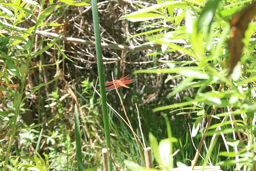
A huge red dragonfly buzzed around us as we hiked towards the first waterfall.


As we entered the canyon, we started to see lots of flowers, many birds, and a lot more insects. We saw gigantic red dragonflys, lizards, and frogs. We were the only ones on the trail. The temperature was a lot cooler too, since everything was moist. As we hiked, we noticed some man made pools, which might still be used for a cool bath, but they were really overgrown and gross looking (even for our low standard).

Darwin Falls #1
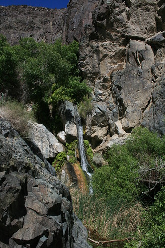
The first of nine waterfalls at Darwin Falls.


The trail involved a lot of water crossing, since almost the entire canyon bottom was filled with flowing or standing water. Mostly, the crossings were made by fallen logs and branches, or small slippery stepping stones. We both had sandals on, so it didn't matter if we stepped through some wet spots. It was nice to have some cool fresh water on my feet anyways.

Darwin Falls
Hiking up and around the first waterfall.


Finally, after about a mile of total hiking so far, we reached the first waterfall. There are nine waterfalls in total. The first one was kind of hidden behind a lot of vegetation, so to see it entirely, we had to wade through some swampy area to get closer. The waterfall cascaded over a tall solid stone wall, and the only way past it to see the others was to go up and around it. Luckily, we had Mark's old guide book with us, which told us how to get past the first fall. When we read the directions, it was kind of vague. All it said was to look for a footpath up the steep canyon wall to the left of the falls, and proceed along the narrow ledges until you see a safe trail back down. When we looked for a footpath up, as described, there were actually many, so we picked one and followed it.

Darwin Falls #3 and #4
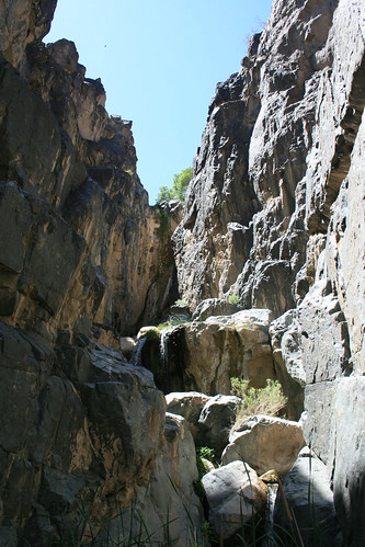
We found the third and fourth waterfalls!


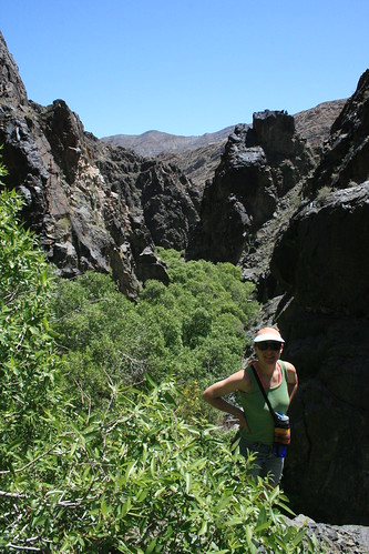
I guess we picked a good enough trail, because it took us up and over the fall, along the canyon walls on ledges that were sometimes less than a foot wide (not the best place to slip!) From up top, we could see the tree tops which filled the bottom of the canyon with a bright green color, in contrast to the dark towering rock walls. We didn't know how far to keep traversing. We saw a few steep drop points that were 'safe' enough to down-climb back to the bottom of the canyon, so again, we just picked one and went for it. When we got to the bottom, under the thick canopy of trees, we found an overgrown trail, and a bright orange ribbon that somebody tied to a branch. I took that as a sign that we found the trail again!

Darwin Falls #4
The fourth waterfall is the highest of the nine falls at 60 feet!


It wasn't very far to the second small waterfall, which was only 2 or 3 feet high. Getting around that was no big deal, and we continued on. Finally we got to the third which was a bit bigger. Behind that one, we could see the bottom of the fourth waterfall, which was roaring! This thing had to be big, but it was hidden from us by steep canyon walls. We were a little confused on how to get to it, and after trying to traverse a few parts of the walls in our clunky sandals, we gave up and looked at the book. It told us that we needed to go find a scree pathway to the right of the two falls. Half-way up the scree, we should see an opening in the canyon wall which would lead us to the top of the third waterfall, and to the base of the fourth.

Darwin Falls #4
The bottom of the 4th waterfall.


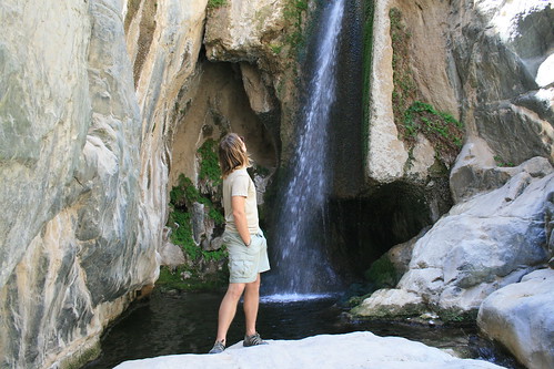
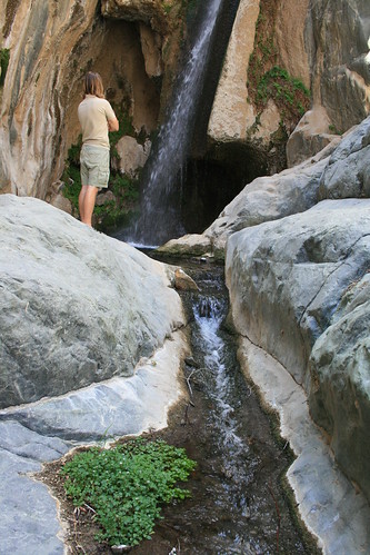
We followed the scree pathway, as the guide book told us to, and there it was - a narrow opening through the wall which opened up to a grotto-like space where the fourth waterfall dropped 60 feet into a clear and deep pool! The pool water then cascaded past where we were standing, into a second more shallow pool filled with grasses. The water here then poured out into the third waterfall, which we were standing beneath just a few minutes ago. It was a little challenging hopping between the pools to get to the bottom of the fourth and tallest waterfall with our wet sandals. Once we got underneath it, the force of the water was so powerful! We tried putting our hands under it, and it smacked our hands down really hard. Good thing we didn't fall in under the churning water, because some of the moss covered rocks were slippery!

Darwin Falls #4
Water cascades from the 4th to the 3rd waterfall.


We decided to stay in the sun-filled grotto between the third and fourth waterfall for a long and relaxing lunch break. It was so amazing to find such an awesome waterfall, and the fact that it was in the middle of a desert made it even more spectacular. We didn't see a single person on our whole hike, which made it even cooler! I have a feeling that 95% of the people hiking the Darwin Falls trail stop at the first waterfall.

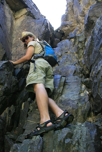
Romy Climbing up to the Falls
Part of the hike back took us along the high canyon walls.


After spending a few hours at Darwin Falls, we made our way back out towards the car, which was baking in the heat! What a different world we just came from.

Saturday, April 30, 2011

Exploring a Mountain Made of Borax

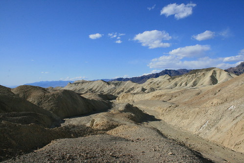
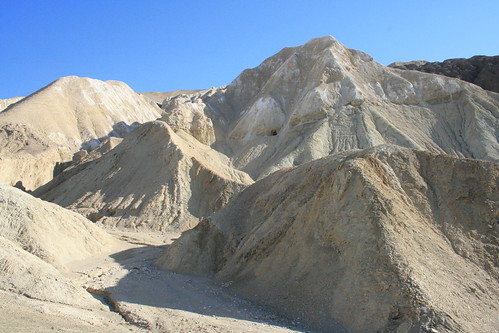
A trip to Death Valley is never without stumbling across references to the Twenty Mule Team and borax mining. This trip (which was sort of a trip where we decided to go explore all the places we missed over the past couple times we've been there) we went to check out what the Twenty Mule Team was all about. There is a short road called Twenty Mule Team Road which is a one-way, single lane road through the northern end of the Black Mountains, and it goes through the Death Valley badlands area. Its an area of quickly eroding, soft mud mountains which were actually once the bottom of a seasonal lake that existed a long, long time ago (before the mountains were uplifted).

Twenty Mule Team Canyon
Starting our hike at the old junction on Twenty Mule Team Rd.


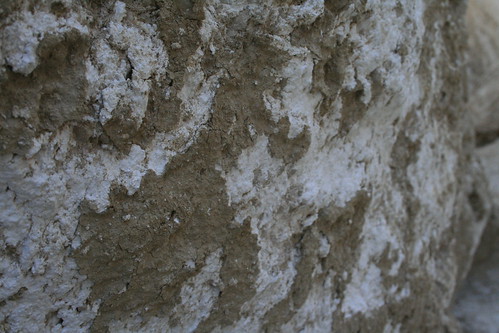
Borax found in nature is an evaporite, meaning it crystallizes after evaporation of the solute it was dissolved in, in this case, after the seasonal lake dried up (multiple times over and over again in the past). Many deposits were created like this on the muddy bottom of the ancient seasonal lake. In modern day, the ancient lake bottom has been pushed up by tectonic processes and forms the soft muddy mountains, some of which have massive borax deposits mixed in the mud. Its really a neat thing to see, because the borax looks like a bunch of bright white streaks, like powdered sugar or something was sprinkled over and within the mountain.

Monte Blanco
The famous Monte Blanco, a mountain made of borax! See all the white streaks?


In the late 1800s, the borax mining industry was booming, especially in the Death Valley area, although it was short-lived. I don't think that Monte Blanco was every mined to its full potential because of the difficulty of the site, but nearby deposits in Death Valley were. The Harmony Borax Works is the most famous of the companies that mined borax there. The way they did it was kind of interesting. As we were hiking, we noticed that a lot of the borax was interspersed with the dried mud deposits, so how were they able to get just the borax out and not all of the mud with it? At first we thought that maybe they just found gigantic or massive deposits of pure borax, but that was not the case (although there were probably larger deposits that we never saw deeper in the mountain).

Borax
A close-up of borax deposits popping out of the muddy mountains.


What the miners did was first dig out a bunch of the borax and mud mix, and together, they then hauled it to a processing facility near present day Furnace Creek. There they dumped it into huge pools or tanks of water where they let the borax dissolve and the dirt settle to the bottom. They did this many times to purify the water, so that only the salts and borax were dissolved in it, and not the unwanted dirt. Then they used the knowledge that borax crystallizes at a certain temperature, so they put a bunch of rods into the tanks and cooled the water down. When the water hit the correct temperature, the rods would act as surfaces which allowed borax crystal to grow on them, and this is the way they were able to extract pure borax from the water. When the Harmony Borax Works was in full swing, it employed 40 men who produced three tons of borax daily! In the heat of the summer, when the water couldn't be cooled to a low enough temperature, they moved the operation to a cooler location, near Tecopa, CA instead of Furnace Creek.

Romy Hiking in Borax
Hiking up into the mud and borax narrows near Monte Blanco.


I'm still not sure what all borax is good for (but you can read about it online if you're interested). I think its mainly for cleaning and buffering certain solutions. I kind of remember hearing that when borax was in its early days of mining, the miners who wanted to make a profit on it had to invent uses for it and then try to market it, because borax wasn't used much before then. While we were hiking up towards Monte Blanco, we kept getting stuck in all kinds of narrows and dead ends. As we got through the tightest narrows, we kept rubbing against the sides of the canyon walls, which crumbled at the slightest touch. In fact, if there was a section of abundant borax deposits, it was like walking through slightly compacted powdered sugar! It was so soft, literally like powder, and we got a good dusting. Our socks (we wore sandals with socks) were completely soaking it up as we hiked, and we joked that when we rinsed them out that evening, they would be super clean from all the borax. But that didn't actually happen because I don't think borax by itself is really good for laundry, its just a laundry "booster" whatever that means.

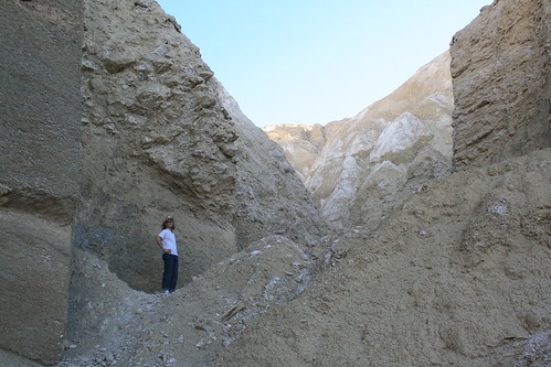
Twenty Mule Team Canyon
We squeezed through these narrows and got covered in mud and borax dust. The mountains just crumbled at the slightest touch.


The way the Twenty Mule Team got famous was due to the crazy trip that the miners devised to haul the final borax product out of Death Valley and to civilization. According to our hiking guide book, the Team never had any mishaps (no broken wagons, no dead mules), even though they were trekking over very rough territory. The team of twenty mules were able to haul 36 1/2 tons of borax and supplies each trip! Here is an excerpt from a great website that gives a much more detailed history of the Twenty Mule Team than I have room for here:

Chosen for their intelligence and ability to lead the others, the first two mules in the train were aptly called the "leaders." The next 10 mules were known as the "swing team," workers that did not need special training beyond responding to commands such as "stop" and "pull." Following the swing team came the "pointers," "sixes" and "eights" — the pairs specially trained to leap over the chain when the mule train turned a corner. These mules were trained to respond to commands by name. Swinging the team around a curve in a mountain pass tested both driver and team: one mistake could spell death for all. As the team started around a sharp curve, the chain tended to be pulled into a straight line between the lead mules and the wagon. To keep the chain going around the curve and not pull the team straight over the edge, some of the mules were ordered to leap the chain and pull at an angle away from the curve. These mules — the pointers, sixes and eights — would step along sideways until the corner had been turned. Swinging a curve successfully was an awesome demonstration of training and teamwork. Finally, the "wheelers" were the last pair in the train. These mules, or sometimes draft horses, were the largest and strongest of the pack animals.

Camping
Our camping spot for the evening.


That evening, after hiking all afternoon around Monte Blanco, we drove up into the Greenwater Valley, which is just east of Badwater Basin. There we found a nicely graded gravel and dirt road called the Greenwater Valley road, and camping off of an offshoot road. It was nice and quiet, and we found a spot between the creosote bushes. That night, we camped with the small birds and lizards, and were surrounded by some late-in-the-season wildflowers, especially the apricot globemallows.

Tuesday, November 30, 2010

The Mecca of All Hot Springs: We Finally Make It!

Saline Valley
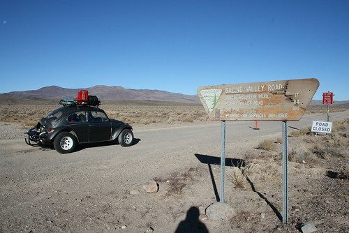
Entering Saline Valley Rd with the baja. Notice the Road Closed sign.


The third time is the charm, as they say. And it definitely was the charm for us, as we can finally say that we've made it into Saline Valley after three attempts! We must have had an unknown good luck charm riding with us that day, because we actually almost didn't make it. But I'm getting ahead of myself telling the story here, so let me back up.

Saline Valley is now a part of Death Valley National Park and is known for being one of the last unspoiled large Death Valley-like valleys left. Its also known for its natural hot springs, which have been taken care of by volunteers and squatters for many many years. Somebody planted huge palm trees at the springs, so they resemble the classic picture of an oasis in the middle of a dry and parched desert. Birds sing, wild burros roam, and a lush grassy lawn under the shade of tall and full palms invite the curious soakers who make it there. Stories of beautiful tiled hot tubs (complete with a hot shower in one area) in the middle of a rarely visited and hard-to-get-to pristine desert valley drew us in. Since I heard of this fabled place over one year ago, we had to go. I mean, WE HAD TO GO. There was no if, there was only when. Only determined souls go there, we heard, and we had plenty of will, so we knew there would be a way.


Saline Valley
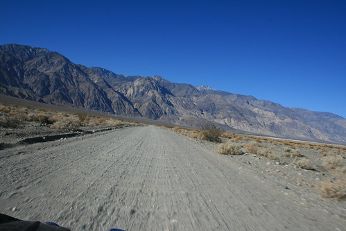
Saline valley Rd as it descends into Saline Valley once over Hunter Mt area.


But what you equally hear about, in addition to the hot springs, are the roads which go into the valley. There are four roads, actually, and you can take your pick. First, the most popular is the south pass of Saline Valley Rd, and then there is also the north pass. Finally there is Steel Pass, and Lippencott Rd. (both of which are worse than the first two). We heard that all were extremely bad and in horrible condition. The park service keeps a 'Road Closed' sign at the intersections of Saline Valley Rd with the paved major highway to keep people out. It is not actually closed for most of the year, but the sign is meant to scare people, or at least make then think twice before continuing. The only time the roads actually close is when they are impassible by snow or if a section gets washed out. Even then, you can still attempt to drive on through. Well anyways, we took all of the rumors seriously, so we decided to take the baja because it had a lot of clearance and take some extra gas too.


Saline Valley
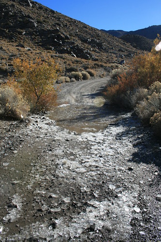
Ice breaks up into tiny chards as we drove through one of a few cold springs which pooled in the road (yes its that cold).


It took us all day driving just to get to Panamint Springs, the closest place that has gas to the intersection where Saline Valley Rd and Hwy 190 (which goes through the national park) meet. Since it was dark when we got there, we decided to gas up, buy some post cards, and get a camping spot for the night. Could you believe that it only cost $7.50/night to camp!? That's so cheap! I guess it was the off-season price. We had no fire or anything to keep us warm, so after we set up our tent (and after our mom realized that scorpions and snakes weren't going to eat her alive) we sat inside the baja to keep warm while we had dinner and drinks. Then we went to sleep.


Saline Valley
Finally in Saline Valley.


I was woken up by the sun the next morning. But it was still very early because it was really cold outside! That didn't matter though because we were really excited to get going on our way down to Saline Valley. We quickly packed up the tents and stuff, and started driving back to the intersection a few miles away. When we got there, we saw the traditional Road Closed sign along with a sign that read 'High Clearance Vehicles Recommended.' Okay, we were prepared for that. What we weren't prepared for was the great condition of the road, exactly opposite of what we thought. We were expecting crazy ruts and large boulders in the road, or washed out sections. We got none of that. It was flat and wide for most of it, except when it dipped into a dry wash near Hunter Mountain. That part was slightly rutted up and rocky, but not bad. We kept commenting how we've been on worse roads in the national park, and they don't have any Road Closed signs. We started to think they must be putting the signs up to keep people at the springs to a minimum.

Well, it took us a bit over an hour of driving until we were deep in the middle of the valley, approaching the salt lake playa and dunes area. Romy had to go pee after all the washboards, so we pulled over. It would have been a routine potty break except that when Romy walked around the back to check the oil and if random parts didn't fall off, we got the shock of our life! A HUGE puddle of oil was under the baja, with a steady trail that lead about 30 ft back on the road and then stopped. The engine was still dripping steadily. Actually, it wasn't dripping, it was pouring! I would estimate we lost almost one quart right there. I feel bad about the spill.


Saline Valley
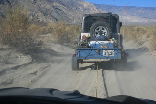
Getting towed in by a Jeep!


Romy decided, after peeking around under the engine, that the rear main seal must have went bad, and that was the source of the oil leak. The good news was that we had two quarts of oil with us, but the bad news was that we didn't have any way to fix the seal, because we didn't have one to replace it. And we were over 50 miles from the nearest paved road, which was still at least 10 or so miles from the nearest town. We weren't sure if we could drive the baja that far without loosing all of the oil in the engine, drip by drip! We only saw one other car since we got into Saline Valley, so we figured our chances of being towed were slim. We started flagging down every car that passed by at that point. About 10 minutes into our wait, the first car came by. We asked them if they had any oil to spare. They didn't. And they said they couldn't tow us. But they gave us some good news. They said that there were hundreds of people (!) at the hot springs and that we were very close to the turn off that went to the springs. If we could get to the turn off, then there would be tons of people driving in or out. So we decided to try and push the baja to the turn off.


Saline Valley
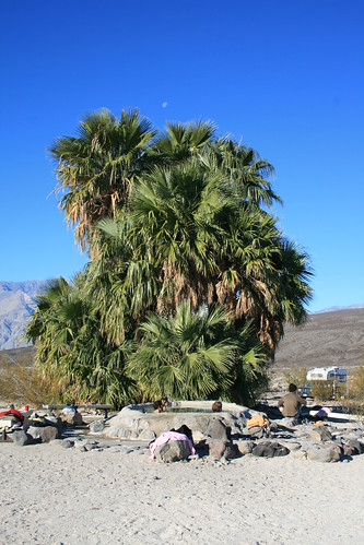
Palm Hot Spring (the slightly cooler pool).


We got some good momentum going, but then the road started going uphill. We couldn't keep pushing it, so we decided to get it far off to the side of the road and keep waiting for more people to pass by. As if on cue, we hear the roar of another car coming down the road. This time it was a Jeep, and it was flying down the road so fast, we didn't think it would stop in time! But the Jeep stopped, and we explained our situation. It was a nice couple and they were headed for the springs. They said that they could tow us into the springs where there was a satellite phone for emergencies, and lots of people who might or might not have spare parts and extra oil. Then the couple offered to tow us back out of Saline Valley on Sunday if we couldn't get it going again before that (it was Thursday, Thanksgiving day). We had nothing to lose at that point. We wanted to go to the springs, we were offered a tow in and out, we had enough food and water for ourselves for the next 4 days - what more could we ask for?! So there we were, hooking up our tow strap to the back of the small trailer that they were pulling behind their Jeep.

We got pulled the last five or so miles from Saline Valley Rd, to the turn off, and then down the sandy and bumpy road to the springs. The whole time, I was kind of thinking if what we were doing was really very sensible. The most reasonable thing to have done, probably, was wait for somebody who was willing to tow us out of there so we could fix the baja. It would of been a bummer. But instead we were getting towed deeper into the middle of nowhere, Saline Valley. But what the heck!? We were thwarted by these springs twice before, and the third time's the charm, damn it! We were going to have our charm even if we had to limp our way in (with the help of a Jeeper of all things)! Soon we could see the silhouette of large palm trees in the distance, and all of the worries were pushed aside with excitement of finally getting to the fabled hot springs of Saline Valley!


Saline Valley
The hot pool at Palm Hot Spring.


What came next was a bit of a shock (this trip was turning out to have a lot of shocks sprinkled here and there). Now, we knew it was Thanksgiving and all, and we also knew that a lot of people go to Saline Valley to have a communal dinner, but the sheer number of people that started coming into view as we got closer, we were not prepared for! Car after car, trucks, tents, and even a yurt! Vans with solar panels, and crazy hippies and naked people abound! I swear it was straight out of Easy Rider, a hippie commune in the desert. When I thought of a large gathering here for Thanksgiving, I was thinking 50 people max. We saw hundreds! Later that weekend, we heard the headcount for dinner was over 200, which meant that there was at least twice as many people camping because not all went to the communal dinner that night.


Saline Valley
Upper Warm Spring, which is fenced to keep the wild burros out.


So here we were for at least the next four days, and I was starting to laugh about what my mom thought of all this. She was shocked too, because she kept making comments about the weirdos and all the naked people. We got out of the baja and thanked the Jeepers for pulling us in. Now we had to find a camp spot. They towed us into one of the last open areas, on top of an old travertine expanse. At that point we unhooked from each other, and started setting up camp. The guy (named Rick) who pulled us in left us with a final comment. He said, "You do know this place is clothing optional, right?" And we said, "Of course." Thats how hot springs usually are. We thought he was referring to the springs, so gave no other thought to the odd, seemingly random comment. And then we looked around. Our nearest camping neighbors were both buck naked, apparently cooking dinner for the communal dinner which they were planning on going naked to. It was almost comedic, because it was only about 60 degrees out. And then my my mom pointed in the direction of the Jeepers who towed us in. "Honey, he's naked!" She laughed. OMG the Jeeper was getting naked too!


Saline Valley
Saline Valley dunes stretch for a couple miles on the west side of the valley.


Apparently, we had not heard of the nudists at Saline Valley. After a few minutes, we all got over the novelty, and accepted that some people just like to be naked, even if its only 60 degrees outside. We just tried not to stare. Besides, there were a lot of other weirdos walking around to pay attention to. Like the guy in the Barney costume with duck feet. Or the pirate man, or the guy in the skirt made out of old ties. . . lets just say that if you looked 'normal', you were actually the weird one. We were surrounded by a lot of 'artist' types - people who use their creativity in unusual ways. It was actually kind of refreshing. We hang out with nerds everyday at school. We are nerds.

While I set up the tents with my mom, Romy immediately started working on the baja, trying to take a closer look to see what exactly was wrong. After an hour or so, he discovered that the oil cooler was extremely loose. And that the rear main seal was intact and that the oil was most likely leaking from the large gap that opened up when the oil cooler wiggled its way loose from all of the bumps in the road for the past 60 miles or so. That was such good news to hear! After all, we would be able to fix it by just tightening the oil cooler back up, and refilling the oil. And with that news, we were pretty happy to head to the hot springs to check them out.


Saline Valley
The baja parked outside of the Lower Warm Springs area.


There were actually three sets of springs. The main area, where the communal dinner was being served, and where there are many small hot tubs complete with a shower, is called Lower Warm Springs. There is even a lawn that is continuously being replanted and watered by the 'campground host.' I have the feeling he's been a squatter there for a long time, and became the host when the national park took the place over. He lives there year round and takes care of all the tubs and springs. It is completely voluntary and he gets no money (or so we heard and read). About 3/4 mile further to the east is another hot spring called Palm Hot Spring. There are two large jacuzzi style tubs build there, both fed by the same source. One is kept around body temperature while the other is about 105 degrees. Thats where we went our first night at the springs. It was packed with people, but not so bad. Everyone was pretty friendly.

Further up the road, heading toward Steel Pass, there is a third and final set of springs called Upper Warm Spring. It is left in its natural state (meaning no tub or anything), although people dug out two muddy bottom pools to soak in. The springs are surrounding by green bushes, and fenced in completely to keep the wild burros out. The wild burros were once tame and owned by the many miners in the valley until they went bust. The miners released their burros and now they are wild, roaming freely in the valley and occasionally invading the campground looking for food that drunk people or stoned people leave out overnight. We went to check it out the next morning after we arrived (the day after Thanksgiving), but already found a bunch of people in there. In fact, it was hard to not find people everywhere. So we decided to wait a little bit and eat our lunch while the people who were already there were in the pool. We had salami and cheese sandwiches with some dried figs and dates. When we finished lunch, we waited some more. And kept waiting and waiting, but apparently these people were just going to keep sitting in the pool until they turned into prunes. Then, another car rolled in, and we saw people converging on the spring by foot. I was kind of getting pissed off at the people who were hogging the springs, so we decided to just leave and go visit the Saline Dunes instead. On our drive out, we passed about 8 more people, all headed to the spring either by foot or by Jeep. How crazy!


Saline Valley
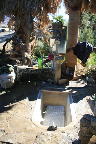
The bath at Lower Warm Springs where you can take a hot or cold shower.


After that point, I was starting to find the whole situation of feeling extremely crowed in the middle of such a huge deserted place a little bit ironic, in a bad way. Of course, we picked one of the most busiest times to come and visit, but its also one of the only times that we have enough time off to make the trip out there worth it. I just did not expect so many people there. Most of the people were very nice and kept to themselves, but others were very annoying. There was definitely a click of people (they called themselves 'camps') that had been coming to the valley every year for many years. I also got the impression that some of them had lived out their better years in the 70s and 80s at the springs, and have regular reunions. These were the people who I didn't like the most, because they had a very strange attitude. They openly commented about themselves and how long they had been coming to the springs, almost with this air about them, like they owned the place or something! One of the alpha females of the group came to the crowded hotter pool at the Palm Hot Spring one night (along with her posse), and saw that it was full. She rudely (but nicely) kicked people out by making all kinds of annoying comments, like, "Isn't it dinner time, guys?", etc, etc, blah blah blah. We had just got there, so there was no way in hell we were moving, but it worked on about 1/3 of the people (maybe because they had experienced her in the past). In some ways I wish we had decided to go to another pool, because being in the pool with those people was weird. They would talk and sing out loud (encouraging others to sing with them), and do a ooohhhmmmmmmm thing. They talked about their weird religion, and how they had to bless things and other strange stuff. Other people at the large pool were talking too (not part of their posse), but as soon as the conversation moved away from the posse, the alpha female said she wanted a moment of silence. WTF? Apparently, it was ok when they talked, but it was too noisy when others not part of their group talked. Somebody shoot me if I ever get that way!


Saline Valley
A bay window bus made it all the way from Utah!


Okay, so I am going to complain some more. What gets me pissed off is that you can tell that these people were once young and hippie types. Except now, after hearing the way that they talked about themselves, they all grew up, made money, and lived in large expensive houses, like the alpha female who kept talking about her home on the top of the Santa Cruz mountains with a pool. It seems like the hippies turned into everything they once hated. Now they are just yuppies. Yuppies who come to Saline Valley once a year to reminisce about the old times, and make themselves feel good about themselves. Whatever.

And now that I got all the bad out, I do have one good thing to say. Even though they were all kind of old (in their 50s, 60s, and even one woman in her 70s), they all looked very young! There must be something they were doing that kept them looking so good. Maybe its their way of thinking and their religion (or stress-free life style?). I don't know. Maybe it was because the sun was going down and I didn't get a real good look at them up close. Maybe they were really all wrinkled, but I just couldn't tell. Maybe it was because they were all skinny?


Saline Valley
Art display in the middle of the desert.


Anyways, there were also plenty of other types of people there too, like the off-roaders kind. I tend to like those people more. They seemed to be there because of the challenge of getting there, and the springs we like a bonus at the end of the tunnel. The second night we camped, we went for an hour dip into one of the larger pools at the Lower Warm Spring. The crowd there seemed more normal. But we did meet one younger person (younger than us) that apparently grew up at the springs. Then we started hearing a lot of comments about children literally being born at the springs. So that's why I have the feeling that there must have been people squatting at the springs before the park took it over. They must have raised kids there and everything. I guess as long as you have shelter and food, you're all set to go, because there is plenty of water (hot and cold)!

One interesting story we heard while we were in the tub, sharing company with more normal people, was one about a bee farmer. This was apparently a pretty recent story because the man is still alive (or maybe just recently passed away). Well, this bee farmer, decided to he wanted to keep his bees in Saline Valley because there is a salt lake with marshy type plants and other vegetation which the bees can make honey from. However, he didn't know that there were already roads that went into the valley made by miners. So instead, he went over the high mountain pass! I think he literally climbed from Big Pine up and over the 11 or 12,000ft mountain range on the west side of Saline Valley. We heard that he built two cabins along the path that he took over the mountains, and that they were along a canyon that has a spring tucked inside that cascades into a waterfall. One person said they hiked to the second cabin, which is still in good shape and can be used as a overnight thing while hiking on the trail. But you need ropes because some of the trail is steep and dangerous, I guess. The other cabin is rotted away, maybe. Well, given all the hints and details from the people we talked to, I think we know which canyon the trail is at. I want to go hiking up it in the spring, hopefully, and try to find the waterfall and old cabin! So the bee farmer kept his bees in the valley for a while, and once he got old and tired, (and figured out about the roads, I presume) he decided to retire on the west side of the valley in Big Pine. He might still be alive. What a crazy story!
Saline Valley Rd
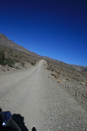
The road we took out of Saline Valley, the north pass.


The last thing I want to write about are the military jets that fly over the valley. The air space over Saline Valley is designated as a low fly zone. So about once a day, the pilots do their low fly by's for training. We heard from other campers that the jets literally fly so low, that you can see the pilot's face from where you are standing. We saw two jets fly by really low our second day and it was actually true! We were able to see their helmets! And they were really loud! It was soooo cool! Better than any air show!
So that's it about Saline Valley. We had a good time and hope to return again, but when there are less people, of course.

Tuesday, April 06, 2010

Death Valley Wildflower Bloom


Death Valley Wildflower Bloom 2010
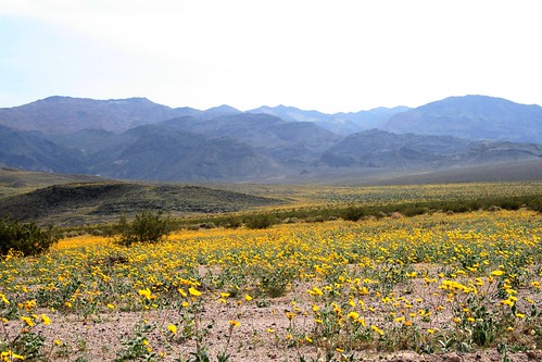
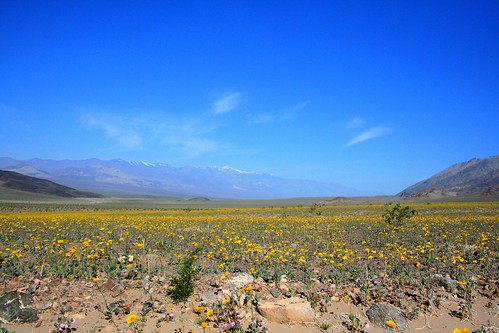
Death Valley is in full bloom!


In the past winter, Death Valley has gotten as much or more rain as it normally does in a whole year. Even so, it isn't what many people would call a lot of rain, just 3 or 4 inches. This year's El Nino like weather helped all of the wildflower seeds sprout, and now they are in full bloom! Most of the flowers are in the southern part of the park, where many of the seeds were deposited from the last big bloom in 2005.

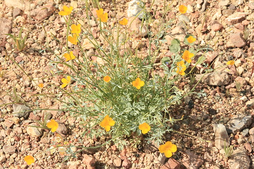
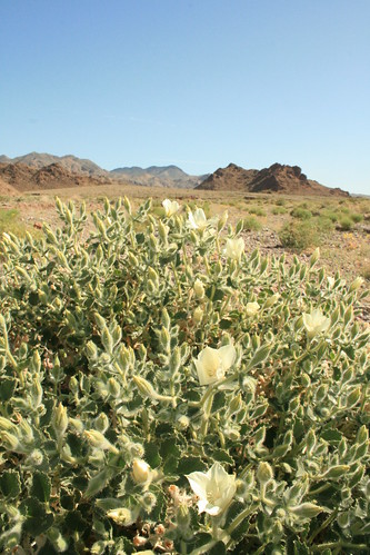
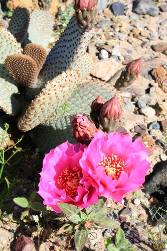
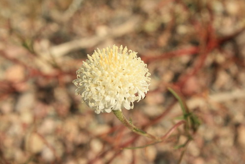
We went to see the wildflower bloom and took a lot of pictures of the individual flowers that we found blooming. As we drove further south, the alluvial fans began to turn bright yellow, covered with the most dominant wildflower, Desert Gold. I am including pictures of the flowers we saw and their common name.


Death Valley Wildflower Bloom 2010
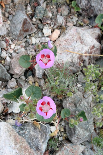
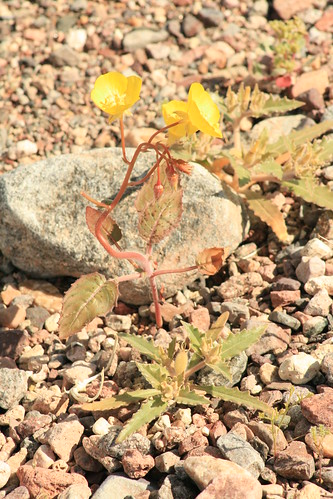
Desert Five-Spot


Death Valley Wildflower Bloom 2010
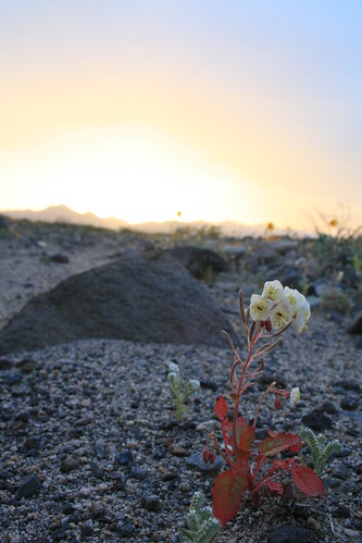
Brown Eyed Evening Primrose


The Brown Eyed Evening Primrose blooms only at night. At dusk, the flower begins to open, and by early morning, when the sun hits it, the petals shrivel up and fall off. The best time to see them in during sunset.


Death Valley Wildflower Bloom 2010
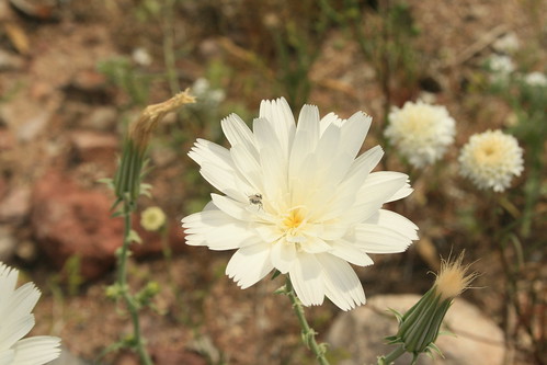
Desert Chicory


Death Valley Wildflower Bloom 2010
Desert Gold Poppy


Death Valley Wildflower Bloom 2010
Arizona Lupine


Death Valley Wildflower Bloom 2010
Golden Evening Primrose


Death Valley Wildflower Bloom 2010
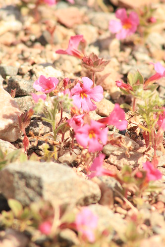
Bigelow Monkeyflower


Death Valley Wildflower Bloom 2010
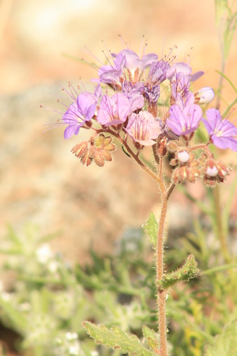
Notch-Leaf Phacelia


Death Valley Wildflower Bloom 2010
Rock Nettle


Death Valley Wildflower Bloom 2010
Beavertail Cactus


Death Valley Wildflower Bloom 2010
Pebble Pincushion


Death Valley Wildflower Bloom 2010
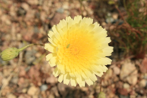
Desert Dandelion


Death Valley Wildflower Bloom 2010
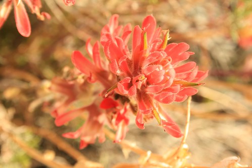
Desert Paintbrush


Death Valley Wildflower Bloom 2010
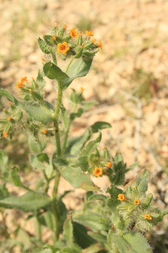
Fiddleneck


Death Valley Wildflower Bloom 2010
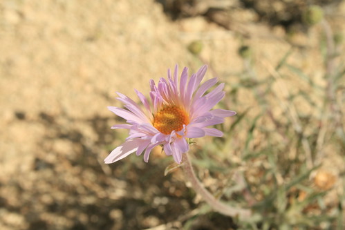
Mojave Aster


Death Valley Wildflower Bloom 2010
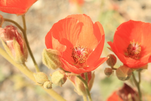
Globemallow


Death Valley Wildflower Bloom 2010
Turtleback


Death Valley Wildflower Bloom 2010
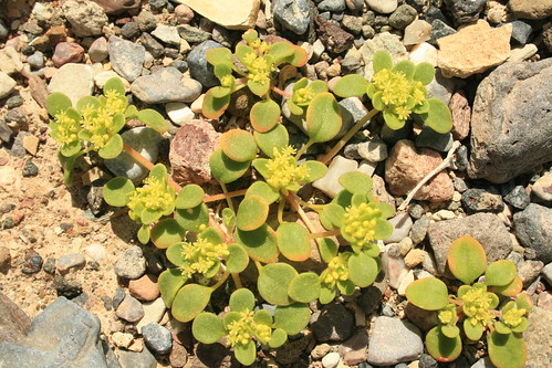
Goldcarpet


Goldcarpet is a rare Death Valley endemic plant. It only grows near the badlands by Furnace Creek. Its extremely tiny and its more like ground cover instead of a flower. I swear I also saw the same plant, except the tiny flowers were white in the southern part of the park growing in a wash. I wonder if its a different plant or not. I didn't take a picture!


Death Valley Wildflower Bloom 2010
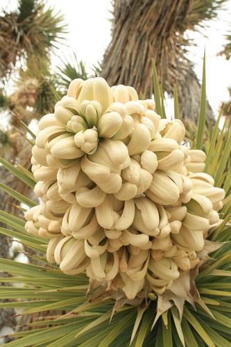
Joshua Tree Bloom


The Joshua Tree bloom really smells gross, like old cheese.


Death Valley Wildflower Bloom 2010
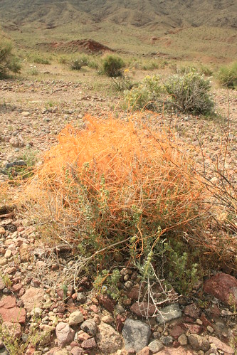
Toothed Dodder


The Toothed Dodder is a parasitic orange vine that grows on top of host plants. I'm not sure if it ends up killing them, but when I touched the vine, it was very moist and plump, so I'm sure it steals a good deal of the host plant's water.


Death Valley Wildflower Bloom 2010
Desert Gold