Saturday, March 31, 2012

Trilobites and Petroglyphs

Over spring break, we went to Nevada to go check out different parts of the state. We had hot springs on our mind and aimed to visit as many natural hot springs as possible, but we also wanted to check out other natural sites. We didn't really have a plan, which is Romy's favorite way of going. We just looked at the map as we drove along to find things that were nearby, or stopped at places as we passed them.


Toquima Caves
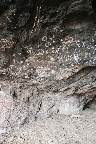
Cave paintings inside the Toquima Cave, in central Nevada.


Nevada is full of archeological sites. One of the first ones we saw during our trip were the cave paintings in Toquima Cave, just west of Monitor Valley in central Nevada. There was a cool mini campground (with about 5 spots and 1 picnic bench) next to the cave area. It was high up in the mountains, about 7,000 or 8,000 feet. We thought the cave would be a lot bigger, but it turned out to be an overhung area in the cliffs where the ancient native people painted things like animals and such. The paint was very vivid and colorful. It was only a short hike from the campground.


Hickison Petroglyphs
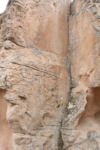
The Hickison Petroglyph site in central Nevada.


Another place we saw, off of Hwy 50 near Austin, was the Hickison Petroglyph site. Here there were carved petroglyphs in the soft stone. There was a little informational trail that went to all of the major petroglyph locations. They looked really old and a bunch of them were pretty abstract. There were even more modern carvings of old visitors from the late 1800s and early 1900s. I didn't know it at the time we were there, but there were a few letterboxes hidden below many of the petroglyph sites. Man, I wish I had know! Next time I will find them and stamp them!!!!


Trilobite Hunting!
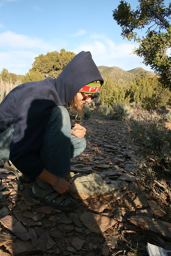
Trilobite hunting in the shale.


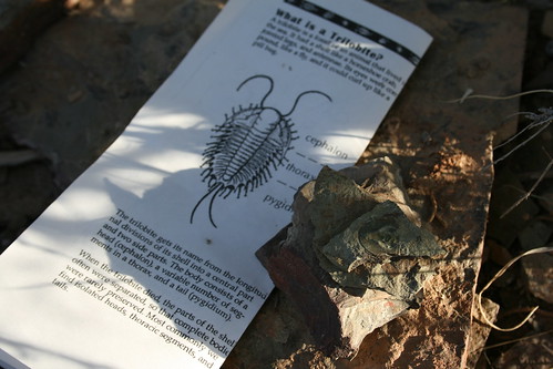
One of the places we saw as we passed by in the far eastern and central part of the state was a trilobite fossil site. It was just off the road that goes into Caliente, NV near the Utah border. We thought that there might be some cool fossils on display, but when we pulled into the parking lot, there was only a map and a few brochures. On the map, it said that you could go fossil hunting, and it showed all of the good locations! We didn't expect that we could actually look for the fossils ourselves, so that was cool! The brochure also gave some info about what/where to look, and gave some hunting techniques. It also said that you could take the fossils that you find with you!


Trilobite Hunting!
We found some decent trilobite fossils!


We set off on the short foot trail to the hunting grounds. We were in a small mountain range, and it was made almost entirely of shale. On the ground in large and small patches were broken up slabs of shale. They looked like stone roof tiles all broken into pieces. These patches were where the trilobites would be found. Trilobites were ancient aquatic organisms with a hard shell, like a rolly-polly, but it was in the water and much bigger. Their hard shells left imprints in the muddy bottoms of the water they lived in and then when the mud turned to rock, the shell imprints became permanent. We were digging for a little over an hour. Well, we weren't really digging, we were more rummaging through the broken shale pieces, and breaking up the larger shale into smaller pieces, to see if we could see a trilobite in the freshly broken shale. To our surprise, we found quite a few fossils! Most were fragments of the head only, and most were pretty small (less than the size of our thumb). But it was really fun trying to see who could find the biggest and the most complete.


Pit Stop
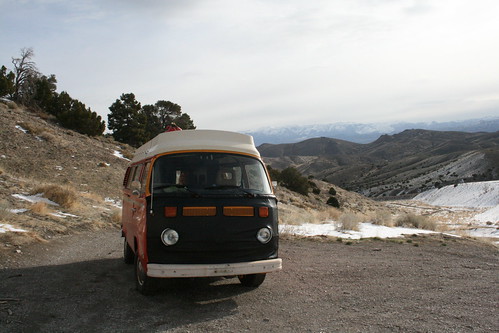
Stopping for a pit stop to relax in the desert sun.


Most of the non- hot spring stuff we did in Nevada was in the southern part of the state. We don't gamble, or anything like that, so Vegas didn't really interest us (except for stopping at one of the local microbreweries). But there were some cool state parks near Vegas, which we stopped at. We wanted to go to both Valley of Fire State Park and Red Rocks, but we only had time for Valley of Fire, since we spent one whole day there. We arrived early in the morning, and drove through Moapa Valley from the north. As is the tradition, I was looking for a place to get a good cappuccino in the morning, but apparently this area was very Mormon. That meant that a coffee shop just didn't exist! The only option was the local McDonald's, which had some shitty drip coffee. Oh well, at least it was something. Anyways, soon enough we were entering the state park and so began our adventure for the day exploring the red rocks of southern Nevada.


Valley of Fire
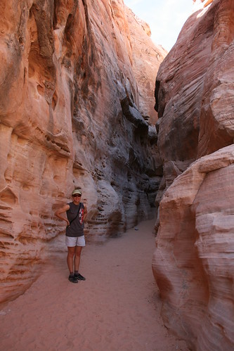
Taking a hike in a slot canyon. It was getting hot!


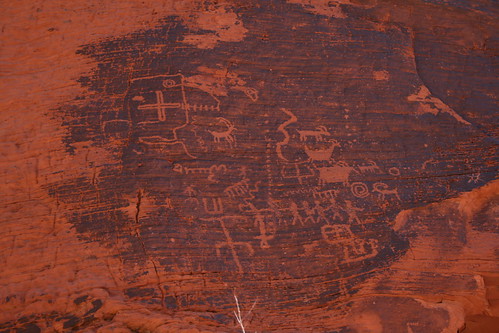
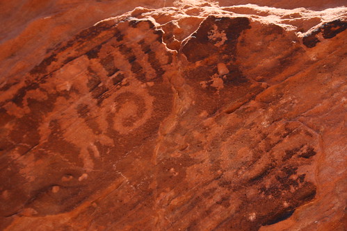
We stopped at the visitor center first, where we learned about the reason for the unique rock formations. It was because of tectonic folding, which exposed a section of red sandstone. It reminded us of being in Utah. The rock was very similar. We decided that we wanted to get out of the bus and hike around a little, so we found a few short hikes that we could do. The first one we went to was a petroglyph trail, which went to some natural water tank in the rocks. People supposedly hiked to this natural holding tank to get water, where it remained for some time after it rained. Along the trail, we saw so many petroglyphs! Some were obvious, but others were high up on the rocks, and you had to climb a little to get a better look. There were some petroglyphs that looked like spirals, and were doodles of the sun or a hand. Others were kind of strange, like animals or hybrids between animals and people figures, and the informational sign gave suggestions on what they meant. The scientists who study them say that the local native people don't know what they mean either.


Valley of Fire
The beautiful rocks in Valley of Fire State Park.


The next place in the park that we went to was called Fire Canyon. It was a part of the park where the red color of the rock was particularly strong and bright. Not many people were on this trail. It was getting really hot! The entire time we were in Nevada for our trip, it was very cold, but now we were kind of shocked with this hot weather! It was so hot, we were stripping down into shorts and t-shirt, and we were still too hot!


Petroglyphs
Petroglyphs in Valley of Fire State Park.


The rest of the day, we continued to do all of the short hikes throughout the park. One of my favorite hikes was the last one we did, where part of it want through a narrow slot canyon. There were also a lot of sandstone color veins through the rock here. All kinds of pinks, yellows, oranges, and purples! They were like somebody swirled some berry sauce in vanilla ice cream. Geologists don't know if the colors were there as the sand got originally deposited, or if the color came from water seeping in the cracks and diffusing. In some places it looks like the color were obviously deposited with the sand, but in others, it looks like fluid carried it in through cracks. Some boundaries are sharp, and others are fuzzy. It's a mystery!


Petroglyphs
Sun and hand spiral design petroglyphs at Valley of Fire State Park.


As we drove out of the park, the bus started acting up. It was getting really hot, and it was losing power. We decided to try and do a valve adjustment, but the engine had to cool down to do that. So we decided to try the beer at a local microbrewery called Tenaya Creek Brewing Company north of Vegas. When we got there, we saw all of the brewing equipment, but the inside of the 'brew pub' was a video poker place with a bar and people were smoking inside. It was nasty! But they did have outdoor seating and so we sat outside in the relatively fresh air. The beer wasn't too expensive, so we tried almost all of the ones they brewed. The place only served drinks, no food, but we later discovered that it was BYOF (bring your own food)! After the people sitting at the next table had a whole pizza delivered to them, we decided to go out to the bus and grab some chips and hummus that we bought earlier and some other snacks to go with our beer. It made the whole experience a lot more enjoyable and much cheaper than if we had to order food off a menu. All in all, the pub began on a weird note, but we liked it a lot in the end. The beer was good, and the outside seating and BYOF was great. Oh, and we managed to do the valves that evening after a few beers, and we were on our way back north, out of Vegas. It was time to start heading back home!
Thursday, March 29, 2012

Nevada Hot Springs

Nevada is a pretty interesting place, and we've only just driven through it most of the time. We wanted to do a trip dedicated just to driving around and exploring Nevada, where the state itself was the main attraction. So we decided that spring break would be the perfect opportunity to go see the desert and all it has to offer, since it would still be cool outside, but late enough in the season where snow on the mountain passes shouldn't be an issue. We wanted to take the bus so we could have the luxury of camping in comfort and still have a lot of mobility.

Earthquake Fault
We camped near the 1954 earthquake fault in central Nevada.


We have a hot spring guide book (two actually) that give information on the natural hot springs in the state of Nevada. Because of it's geology, it has the most hot springs of any other state in the U.S. So far, over winter break (just about 2 months ago), was the first time we've ever ventured out to a hot spring in Nevada, although we've heard a lot about them. For this trip, one of our goals was to find as many as were possible in the short 1-week long break we had. With so many to chose from, where did we begin? Well, the easiest way for us to get over the Sierra Nevada mountains in the bus was to drive over Hwy 50, through South Lake Tahoe. From there, we continued on Hwy 50 out east into Nevada. This took us nearly all day, so we just barely got past Fallon, NV when it was time to camp for the night. We saw a brown sign (BLM) pointing us to a place called "Earthquake Fault." It was so dark we had no idea where we were going, but the sign said it was 6 miles away. So we drove down the road until we found a level spot and camped right there. The next morning, we continued to the fault line. It was actually really huge, but not what you would expect an earthquake fault to look like. There was no gaping crack in the ground. Instead, it was a steep step in the mountainside, and at parts the cliff, or scarp was about 20 feet tall! That's how much the earth shifted during the earthquake, which happened in 1954, and was of magnitude 7.2!

Valley of the Moon
Valley of the Moon Hot Spring was hot hot hot!


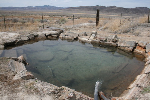
After exploring the fault scarp a bit, we continued east, back on Hwy 50. We passed through Austin to get some yummy cappuccinos at the Toiyabe Cafe, and then headed north up the Valley of the Moon, along NV 305. This was a really nice drive, and about half-way to Battle Mountain (which is on I-80), we stopped at a hot spring called Valley of the Moon. It is privately owned, but the rancher who owns it lets people come on his land and use the hot spring. However, you kind of need to know where it is ahead of time because there is no sign, only a gate which must be closed behind you to keep the cattle in place. We knew we were getting close when we started seeing the tell-tale signs, a big travertine mound and white soil. When we pulled in, nobody was there. The source of the hot spring was about 50-100 feet away from the pool, and it came pouring out of the mound along a giant crack in it. Near the pool, a pipe diverted most of the hot water into the rock bottom pool. The source was super hot, basically unbathable unless it was allowed to cool off. The people before us left the pipe fully flowing into the pool, which made the water unbearable when we got in, so we had to wait. We pulled the pipe out and let the water cool. This took quite a while (almost 2hrs) but we just pulled out our folding chairs and relaxed a while, reading all of the historic pamphlets we got from Austin at the Toiyabe Cafe.

Buffalo Valley Hot Springs
The Buffalo Valley Hot Springs were small, but plentiful.


When we compared the state of the pool area to that of the picture in the guide book, the spring in its current condition was pretty trashed. Previously, somebody had placed a nice wooden bench at the side of the pool, and it looked like there used to be wooden platform mini decks all around the pool. Now what we saw was a partially burned bench, no decks, and two fire pits filled with empty booze bottles. We cleaned up as much as we could, but it is really horrible how people end up trashing such a nice place. Why? Why would you try and burn a picnic bench just to stay warm or make a fire when you have a super hot pool to bathe in? And why wouldn't you just take your trash out with you?

Anyways, after soaking in the pool for a little while after it finally cooled down to the point that it wasn't painful, we hopped back into the bus and continued north to Battle Mountain. At the city we filled up on gas. A few young and bored tweens saw us in our bus, and asked us if we had weed. Hahaha! I kind of felt sorry for them, all bored and growing up in a place like Battle Mountain, where the only thing to do is ride your bike from the McDonald's to the Burger King or whatever. During our little driving break at Battle Mountain, we looked at the map to see the nearest hot springs. There were a few on the map which weren't in the guide book, so we decided to check them out. This time, however, they were very far off the beaten path, a long ways down a gravel road where there were few if no people, and we would be very isolated. But the bus was running well, so we decided to go for it.

Hyder Hot Springs
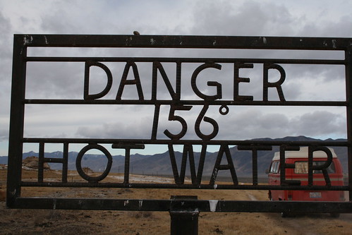
Hyder Hot Springs was so hot, we found a dead cow as we drove right past this sign!


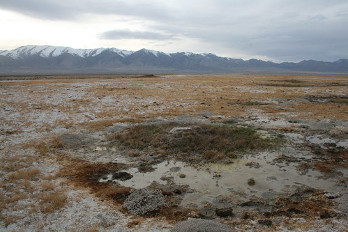
The gravel road we took had no name, except that it went into a large valley called Buffalo Valley, and then continued into Dixie Valley. A bunch of powerlines ran down the east side of the valley, which the road followed for a long time. In the center was a long playa. After almost an hour of driving, we reached the approximate location of where the hot springs were marked on the map. They were called the Buffalo Valley Hot Springs, and as we got closer, the springs became very obvious. We parked the bus as close as we could and followed cattle trails out into the playa where there were numerous mini craters with warm water flowing out. None were very big, but there were a lot of them. They weren't very hot either, and the flow rate was very low, so you couldn't really make use of them for soaking. Oh well, it was neat to find them still in their natural state. After we explored the area a little, we continued driving down the gravel road south. Soon we entered the Dixie Valley region, which was the valley where Nevada's largest geothermal power plant is located. Again, this place was very isolated, but it was also the region where the most hot springs are supposedly located in the state. As we drove down the gravel road, we saw a few hot pools, some not marked on the map. One of the pools was very deep (you couldn't see the bottom) and it was pretty hot. Very tempting to jump in but the fact that you couldn't see the bottom scared us, so we only took pictures. There were some hot springs we passed owned by ranchers, which they made very clear with huge private property signs. At one point, we had to skirt around some ranch land that they didn't want people driving through, and the detour road got really muddy and rough. Somehow the bus got through it, so we continued on. The next big hot spring that was in this valley which the guide book recommended was called Hayden Hot Springs. It took us quite a while to get to it, and by the time we did it was already dark. So we found a flat area next to the springs and camped for the night.

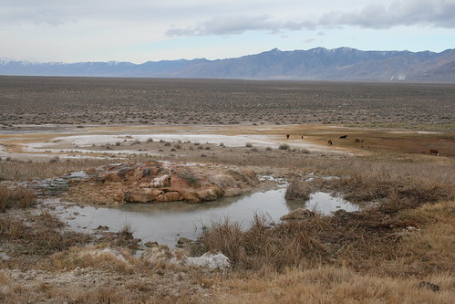
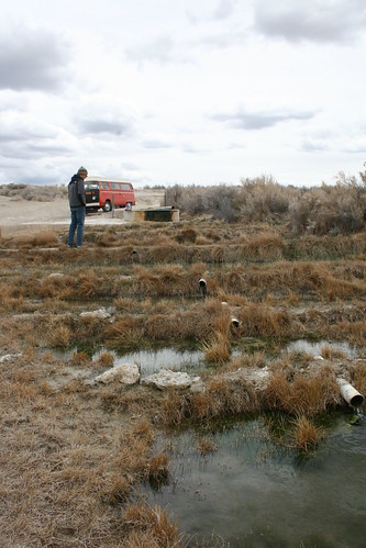
The next morning, we woke up to find a huge water buffalo truck parked next to the springs, but nobody was with the truck. It was just parked there. We also saw a dead cow right next to the spring. The source was pretty obvious and surrounded by a fence. There were supposedly two bathing pools here, but when we found them, they were really nasty and shallow! They were all slimey and the water was just luke warm. It also seemed that when we compared the picture of the source in the guide book to what it currently looked like, it seemed that the current flow rate and temperature were much lower than when the book was last published. Maybe it had to do something with the geothermal power plant off in the distance. Who knows, but Hyder Hot Springs seemed like a bust!

Hyder Hot Springs
The once vigorously flowing Hyder Hot Spring source.


We didn't stay at Hyder long, and instead we picked another gravel road to take over a small mountain pass to the southeast. The road was in very good condition, even though it looked like it was a minor gravel road on the map. It went up and over the mountains, through a canyon like landscape. It passed an abandoned ranch, which was so cool looking, and then popped out just north of Austin. So essentially, we just did a giant loop, up through the Valley of the Moon on a paved road, and then down through the Buffalo and Dixie valleys all of gravel. When we passed through Austin (again) we gassed up. This time I wanted to try a different cafe for coffee. We saw in our pamphlets that the International Cafe was supposedly very old and still had the original bar interior from the old Pony Express days. We seemed to be the only out-of-towners there, which was okay, and it made it interesting to hear the locals talking. The cafe only served drip coffee with creamer, and it was pretty cheap. I was hoping for some espresso, like in the comparatively hole-in-the-wall Toiyabe Cafe up the street. Oh well, now I know. I am a picky coffee person, and having said that, if you want coffee, go to the Toiyabe Cafe. Anyways, after our big loop detour, we started heading east again. We wanted to check out the Big Smokey Valley and the neighboring Monitor Valley. These are right in the heart of central Nevada, and of course they have some really cool looking hot springs, as we saw in the guide book. So we started heading that way. But the weather was getting kind of crappy, with rain headed our way, and snow dumping over the passes! We got as far as Spencer Hot Springs, and decided to wait out the weather there for a while. After Spencer, we had to take a gravel road over a mountain pass to get into Monitor Valley. We didn't want to start driving over the mountains if there was snow coming that way, so we just relaxed at Spencer, where we had a good view of the incoming weather.

Spencer Hot Springs
The beautifully terraced pools at Spencer Hot Springs.


Nothing much happened weather wise while we were hanging out at Spencer. It kept raining and snowing to the west, but it never seemed to get across the valley, which was good. After about two hours, the weather actually started clearing out, and we decided to go for it. While we were waiting, we found out that somebody had terraced one of the pools at Spencer, and the run-off from the pool cascaded down the terraces. Within the pools of the terraces, we found a bunch of goldfish! They were just swimming happily, and there was a pretty large and healthy population. How cool!

After the weather began to improve, we got back into the bus and started up the gravel road over the mountains. This route was actually recommended as one of the scenic drive in the Big Smokey Valley pamphlet we picked up in Austin, so the road was probably good. Along the way, it went past the Toquima Caves near the summit. Then it dropped back down into Monitor Valley. Once there, we used the guide book to find the next closest hot spring, which was called Pott's Ranch Hot Springs. We drove south down the Monitor Valley, which was amazing! There were more ranches, it seemed, in this valley, because it seemed that water was more plentiful here. The guide book warned that along the road, you would have to drive through an operating ranch. When we got to the ranch, we saw a Mexican guy sitting on the roof of one of the many barns. We asked him if this was the right way and if it was okay to drive through, and he just looked at us and smiled. We realized after a while he didn't speak English, so we just said "Bueno", and kept driving. Eventually we got to the turn off to Pott's Ranch, which in contrast, is totally abandoned.

Pott's Ranch
Living life to the fullest at Pott's Ranch Hot Springs.


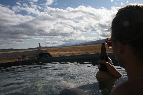
There was a huge mound that we had to drive around, and the hot spring was located out of sight of the road, on the other side. When we got there, we discovered a completely brand new tub and lovely deck and seating area. The tub was kept empty, as to keep it clear of algae and other stuff. The hot spring source had an incredible flow rate, so once we set up the proper piping to fill up the tub (8 foot diameter watering trough), it was full in about 15 minutes. And the water temp coming right out of the pipes was perfect, so no temperature adjustment was necessary. The tub here had a great view of the surround mountains and valley.

Pott's Ranch
Our favorite hot spring we've been to so far is Pott's Ranch.


We stayed at Pott's for quite a while because it was so comfortable. The guide book that we had said that the owner did not allow camping, however. So we decided to leave with enough time to still find a campsite. Again we looked at the guide book to see where we should go next. Just south of where we were, it said that we could go see Diana'a Punch Bowl. We read about this place in other books, and all of them said that the Punch Bowl was a pretty awesome place. Supposedly, it was a huge caldron looking thing with steamy hot water inside. I had no idea how big it was going to be, but it was supposed to be really big. We decided that it would be the best place to camp nearby, since there were no camping restrictions. So off we went.

Pott's Ranch
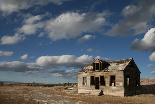
The abandoned farm house at Pott's Ranch.


It was pretty easy to spot Diana's Punch Bowl once we were nearing it. It was a huge whitish travertine mound in the middle of the valley, just east of the gravel road. When we got near, we followed one of the few smaller dirt roads that headed towards the mound. When we finally reached it, there was a fence around the whole thing, but it was only to keep animals out, as it was easily opened. We decided to drive through the fence gate, and then parked the bus just at the base of the huge mound. Romy started walking up the pathway that led to the top. It was huge and it was steep! As you climbed up it, it was impossible to see what was on the top until you crested it. . .

Diana's Punch Bowl
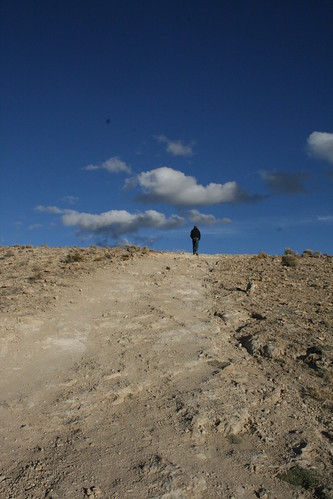
Climbing up the gigantic travertine mound that is Diana's Punch Bowl.


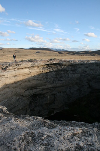
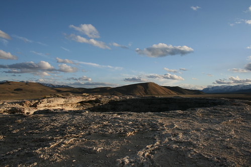
When we got to the top, the ground just dropped out into a HUGE cauldron! Just like something out of Lord of the Rings (without the hot lava), at the bottom was a pool of steaming hot water. It was impossible to tell how deep it was, but judging from how large the mound was, it must of been pretty deep. The edge was very abrupt, so if you weren't paying attention, it would be relatively easy to just walk off and plunge into the burning hot water. We sat on the edge with our feet dangling down. It was surreal.

Diana's Punch Bowl
The insanely awesome Diana's Punch Bowl!


It was fun just hanging out and seeing such a unique place in the middle of a beautiful desert landscape. We walked around the cauldron a few times. Supposedly it was formed when the thing suddenly caved in, leaving an almost perfectly circular caldera thing that filled with the hot spring water that presumably caused it to collapse. Next, we checked out the backside of the base of the mound, where there was supposed to be a hot creek running out of the punch bowl. The guide book said you can dig mini pools and bathe in the water coming out of the mound-bottom, but we didn't find any suitable places. That was okay though, because it was starting to get dark, and we were thinking of going a little further south in the valley to camp. Diana's Punch Bowl was our last hot spring of the trip through Nevada, and it certainly was one of the most spectacular springs we've ever seen!

Diana's Punch Bowl
Don't fall into the punch!


Sunday, March 11, 2012

Painting The Bus - Lemonhead

After we got back from our long winter break road trip in the bus, we discovered a few leaks in the windows after it rained on us a few times. The worst leak (which has been bad for some time now) is around the bottom of the front window. The rust that is forming under the window seal is defeating the purpose of the window seal! So every time it rains we got a big puddle of water on the rubber mat in the front. Another leak we discovered was around the sliding window on the sliding door. As we were camping in New Mexico, it down poured over night. Water started dripping in at the top of the sliding door window, into the pilot seat where I was sitting, eating dinner. The only way to fix it at the time was to put a towel over the outside of the window so water could stream down through the towel, past the window. It worked, but now it was time to fix it!!!

Romy 2.11.2012
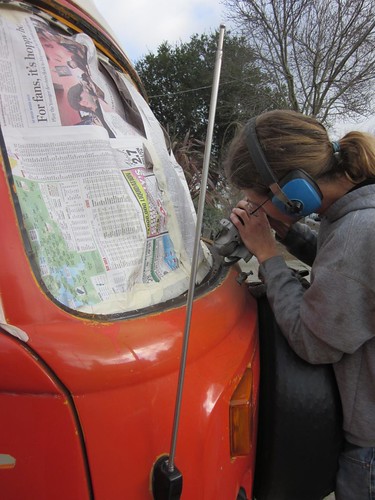
Grinding the rust around the window seal.


We started out by removing the front window and getting all of the seal off of the metal. This wasn't as easy as it would seem, since the seal was melted/glued on in some places. Then came the grinding to get rid of the rust that formed all around and under where the window seal was.

Jenn 2.18.2012
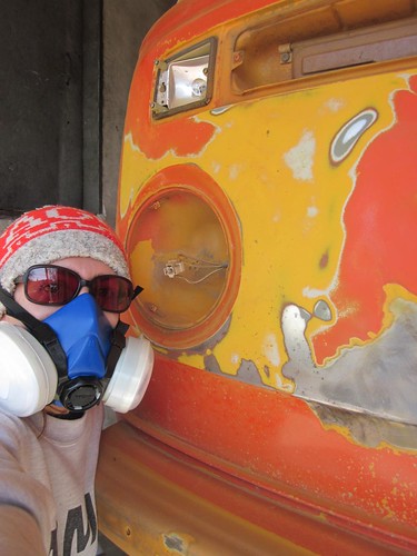
Stripping off all of the paint.


There were a lot of dings from rocks hitting the front of the bus from the road. Some dings were shallow, but others were deep and the exposed metal started to rust. So in addition to grinding around the window seal, we decided to take off all of the paint on the front. This is when we discovered that there was actually a lot of bondo behind where the spare tire mounted. The spare tire mount was bending the thin sheet metal which makes up the front of the bus, so we took it off and sealed the holes where it mounted.

Painting the Bus
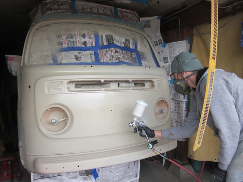
A layer of primer goes on first.


Taking off all the paint and redoing the bondo in some places took us a month! We only worked on the weekends, so it took a long time and really dragged out. We also fixed dents and dings in the front that had been there since before we bought the bus over 5 years ago. I think one of the previous owners bumped into something with the spare tire and it indented the whole front. Also, before we bought it, a huge rock was thrown out from under a lawn mower and then got flung into the front of the bus, leaving a huge gash. We fixed that too.

Painting the Bus
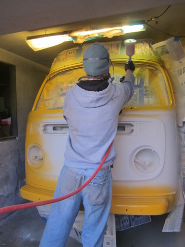
The first coat of the new color is being painted.


We chose to repaint the bus to the original burnt yellow color, called Chrome Yellow. We found information on what color the bus was originally painted in the M-code on the tag that is under the dashboard on the driver's side. So the front doesn't match the rest of the bus, but little by little, we will fix every body panel and repaint it to match.


A video of the color going on.


Romy was a lot better at painting than I was, so he applied all of the paint with a paint gun. We got the paint from a place called San Leandro Color, a paint shop in the Bay Area. It was kind of expensive, but it was really good primer and paint. We put a few coats of primer on and then sanded it down before putting on the actual coats of color. We found that wet sanding was the best and helped get the primer really smooth!

Painting the Bus
The paint is all done!


Once the color got on, it started looking really good and very shiny! All that hard work in prepping was all worth it! Seriously, about 80% of all the work in repainting isn't actually in the painting part. It's all the work you do before hand! The paint really smelled, so we worked with masks on our face the whole time (and during sanding too). The paint smell leaked upstairs into our apartment for a few days, so we had to have all of the windows open for ventilation!

Lemonhead
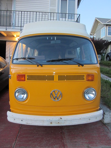
The finished front! It's now called Lemonhead.


When we were finally done painting, we were sooooo happy! It then took us a relatively short time to put all of the trim and lights and other stuff back on. We got a new window seal and then put the old window back in (it was still good). Then we washed everything one more time and now it's finished! We gave the bus a new name. Because of the yellow front and the yellow pop-top canvas, we call it Lemonhead! We also bought a bra for the bus, and when we drive it now, we put the bra on to protect the new paint. We should've had one the entire time, really. We also replaced the sliding door window seal, and now that window doesn't leak anymore. Yay! After all that work, we are taking a break for a while!