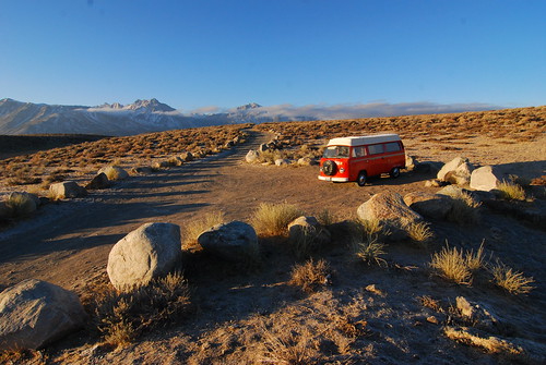
Our first night's camping spot near Mammoth Lakes, CA.
Our adventures started, of course, in California. We left Oakland before noon on December 15th. I think that's about the first time and the last time we thought about what day it was on then entire trip (except when we were nearing Illinois). Trips that are that long, where you forget what day of the week it is are great. It means you're not on a schedule and you can just relax and have fun. It took us all of the rest of the day to get over the Sierras. By the time it was dark, we were thinking of a good place to camp. The first thing that popped into mind was the hot springs near Mammoth Lakes. So we did the regular drive south along Hwy 395 until we saw the little green church. From there, we hoped we would recognize the dirt off shoot road from memory that would lead to the Crab Cooker, our favorite hot spring in the area. We actually found it, amazingly in the dark, and followed the bumpy road to the hot spring. Another amazing thing was that nobody was there! So we hopped out of the bus, realized just how numbingly cold it was outside (probably about 10 degrees F), and decided to send a scout to check out the spring first. I ended up being the scout, so I grabbed a flash light and hiked down. When I got there, I found a huge muddy mess, and the tub was empty. On closer inspection, it turned out that the valve that controlled the hot water source was broken, and leaking hot water (really really hot 130F water) all over the ground, while none of it was making it into the nice tub. What a bummer! I tried to look at how to fix it, but quickly realized that it would mean sticking my hand into the 130F water. Damn, I was kind of upset! I ran back to the bus to inform Romy and Mark that the Crab Cooker was a bust. They almost didn't believe me and actually went to check it out themselves. Instead of enjoying a nice hot soak, we just set up camp in the bus and kept warm in our sleeping bags. The next morning we woke up to ice windows. Except the ice was on the inside! It was also at this point that we'd realized we forgot to bring a snow/ice scraper! Oops! So I dug out the plastic mini dust pan, and started scraping. We got most off that way. The rest melted as we started driving east, towards the morning sun. Good thing we had plenty of paper towels with us too. Next, we were off to cross Nevada.
We made it to the Nevada border!
Once east of the Sierra Nevadas, that part of California looks a lot like Nevada, so the border crossing was in perceivable, except of course, for the highway sign. Most of the time, in the west, its rather amazing how the landscape actually seems to change when crossing from state to state. I really like Nevada, so I was excited to be driving through it. There was a thin layer of snow on all of the mountain tops, which made it looks really nice. Nevada actually means "snow capped." Most people don't realize that Nevada is full of mountains, and yes, it gets cold! Its not just a hot dry desert. Soon after we crossed the state line, on Hwy 6, we drove by the highest mountain in Nevada, called Boundary Peak. I think it's called that because its either on or very close to the border between Nevada and California. It is 13,147 feet (4,007 m) high. Just across the border, though, is Montgomery Peak, which is slightly higher. Anyway, there are plenty of high peaks in Nevada, including Wheeler Peak (at 13,065 feet (3,982 m)) on the east side of the state and within Great Basin National Park (yes, Nevada has a National Park too!).
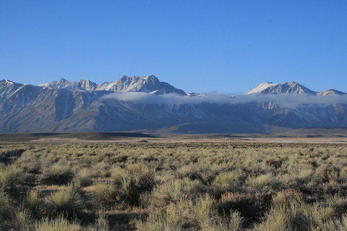
Boundary Peak is the highest mountain in Nevada.
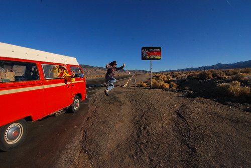
We've never driven along the extraterrestrial highway before, so that was our goal for Nevada. And Mark, being into conspiracy theories, was really excited to try and make a stop along the way, since the road goes very near to Area 51. The conspiracy theory is, that most of the technology that the US military has to make all their advanced airplane designs were actually reverse-engineered from alien space craft. Supposedly, the Roswell (New Mexico) alien UFO crash in 1947 was studied by the US government (and of course also denied that it ever happened to be an alien UFO), and all of the space craft remains, including a few alien life forms, were taken secretly to Area 51 in Nevada. It was then that suddenly after this incident, that the military developed a lot of advanced aircraft, like the stealth bomber, which were only released or unclassified recently. The wikipedia article on the Roswell incident is very detailed if you want to read more.
Near Rachel, NV on the ET Highway.
Rachel is the closest town to Area 51, so a lot of the UFO people go there to search the skies. It may be that the UFOs are actually experimental military aircraft out of the Nellis Air Force Base, but that's interesting nonetheless. There is a small cafe called The A'Le'Inn, where earthlings are welcome. Of course we had to stop (for coffee at least)! Inside, they have actual pictures that people took of the UFOs they saw in the area. I don't know if they were genuine or faked, but they were all so interesting! You will have to go there yourself to see some of these. Pictures of flying saucers, and other strange lights in the sky covered the walls. There were also some locals eating lunch, and sipping on coffee. The town is very very small, and consists of mostly trailers. It was originally named Sandy, but then when the first child was born to the residents of the town, they renamed it after her. Legend has it that she eventually moved to Alaska, but the town is still called Rachel. While the whole alien/UFO/Area 51 theme is still pretty strong, most of the tourist business that Rachel sees now is because of geocaching, actually (but I'll write more about that later)!
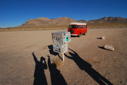 .
.At the famous 'black' mailbox, where aliens communicate?
Further down the road is a pull off where there are two mailboxes. There is also a small forest of Joshua trees surrounding the area. The mailbox there used to be black, but since many people thought it was the mailbox for Area 51 (who would actually think that, really?), it was rifled through a lot. People were looking for top secret stuff that the government would just send through regular US mail. It actually belongs to a local rancher. Finally he got so pissed off that he installed a bullet-proof white set of boxes. I guess people gather there at night to watch the skies. The boxes had a bunch of stickers and even a very creepy plaster mask somebody painted green (like an alien perhaps?).

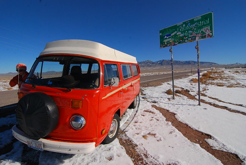
We made it to the Utah border just as the sun began to set.
I enjoyed the rest of the ride out of Nevada and into Utah relaxing on the back bench seat in the bus. I was very warm from the sun shining in. But we were climbing up a lot of steep terrain, so it was slow and before we actually hit the Utah border it was already sunset! I put on my selk'bag (the sleeping bag with legs and arms) and got cozy. I watched the pinyon pine trees streak past the window and liked how the setting sun was casting nice colors on the bare rocky mountains. We were headed towards Cedar City, but we wouldn't get there until past night fall. It was getting really snowy, and snow that had blown across the road started to freeze making it very slippery. We didn't want to keep driving anymore in the dark.
Finding a place to camp in the middle of winter is really hard. None of the campgrounds are open, and there are very few RV parks operating. As we pulled into Cedar City, we asked people if they knew of an RV park to camp. There was only a KOA open, so we went to find it, but it was all full! Apparently in winter, the KOA lets ONLY 3 RVs camp each night. It was totally full with a whopping 3 RVS, even though there were plenty of open spaces, but no! So we were turned away. Okay, so with the legitimate camping places a bust, at this point we went to the local 24hr Wal-Mart. But it was completely devoid of RVs, which is unusual. And plus there was a freaky woman security cop cruising the parking lot and she kept making circles around us, making us feel kind of nervous. We wouldn't be able to pop the top here, for fear of blowing our cover, so Mark would have to sleep on the floor. That kind of sucked as an option. So we decided to head up into the mountains and see if we could just pull off the road in a quiet place.
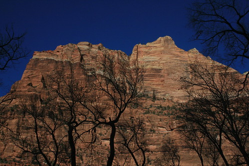
The red cliffs of Zion National Park in Utah.
We were in luck! As we started driving up the small road that would take us into the National Forest outside of Cedar City, there was a huge pull off with a scrolling light sign saying the road ahead was closed. It was pretty far away from town, and didn't see a lot of traffic, so we just pulled off and camped there. Again, it was a very cold night, but we used the propane heater this time so we stayed nice and toasty. The next morning we had to clear the windows of ice again, but we were getting pretty used to it already. After stopping for some morning coffee, we headed out towards Zion National Park to do a scenic drive through. As we drove to the entrance of the park, I forgot how many little shops and B&Bs there were along the way (apparently I blocked it from my memory last time we were here). So many! It was almost endless! But finally we entered the park boundary and all of that just disappeared. It was only the road and the cliffs. Much better. We stopped at the visitor center and decided to try some quick hikes. First we checked out the weeping wall trail. The giant sandstone cliffs are literally saturated with water, like a sponge. Gravity pulls the water down (which comes from rain at the surface), but eventually the water reaches a layer that is not very easy to flow through. At that point, it's forced to exit the rock, and it makes it appear as the wall is weeping. Water is just dripping out of it, almost mysteriously (well not so mysterious anymore). Lush vegetation such as ferns grow, hanging from the wall. Since it was winter out, a lot of the dripping water froze, so it was very slippery climbing the stairs to get to the part of the cliff that was weeping!
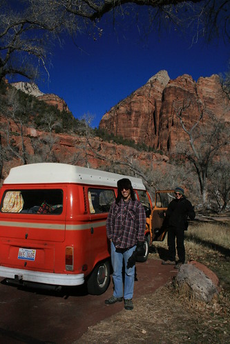
Taking a hike at the weeping wall in Zion National Park.
As we were driving on the way out of Zion, we saw a bighorn sheep running along the steep sandstone hills/cliffs. It got scared from our loud VW engine, so when it bolted away, it caught our eye. We slowed down to watch it, and then it began to stop running, I guess when it realized we weren't going to do anything to it. It just stared at us and we were able to get some nice pictures! On the Zion National Park website, it says that sightings of these bighorn sheep are actually very rare and that they should be reported! We didn't know that at the time, though. I guess we are reporting it now :-) Another cool thing we saw after we exited the park was a bunch of bald eagles flying over a field. They were all just flying, swooping, and landing in the trees. There had to be about 15 bald eagles, all together! It was crazy!
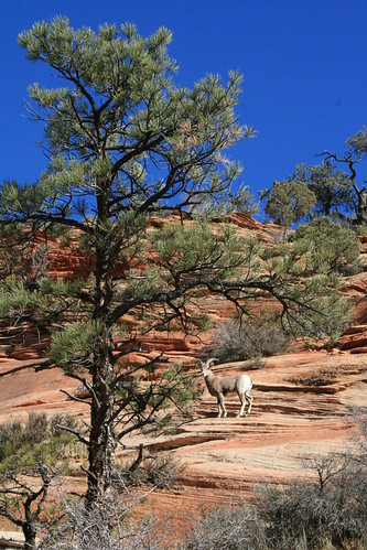
We startled a bighorn sheep on our way out of Zion.
We spent the rest of the day driving through southern Utah, but we didn't make too many other stops. One place on the map caught our attention though, and that was the Coral Pink Sand Dunes. None of us ever saw sand dunes that were pink before, so we went to check them out since they weren't very far out of the way. I think they are pink because they accumulate from the weathering red rocks that Utah is so famous for. We were the only ones there, which was cool. It was also very windy, and pink sand was whipping around everywhere. It also made it very cold, so we weren't very inclined to go on a hike through the dunes. I was the only one who braved a quick run out onto the dune field just so I could capture a better picture (which is below).

The Coral Pink Sand Dunes on a windy day.

0 comments:
Post a Comment