Sunday, August 14, 2011

Mendocino/Trinity Adventures

This weekend we headed north to join up with all the people on the EPS grad student camping trip. It was originally supposed to be in the eastern Sierra near Mammoth Lakes, but at the last minute, the group campground was closed down due to budget cuts, and the students in charge changed the location to the Trinity Alps region on the Trinity Lake in northern Cali near by Mt Shasta. It was a place that we never really have been to (only Shasta) so we were excited to go. We joined up with the group a day later because we couldn't leave as early as everybody else did (Thursday morning at 8am) due to a lab meeting Romy had to be at. After Romy came back from the lab meeting, we packed up the bus and hit the road, about 4pm. But of course, we decided to take the scenic route, which ended up taking us a whole 24 hours before we reached Trinity Lake. On the way, we had a great adventure through the Mendocino National Forest.

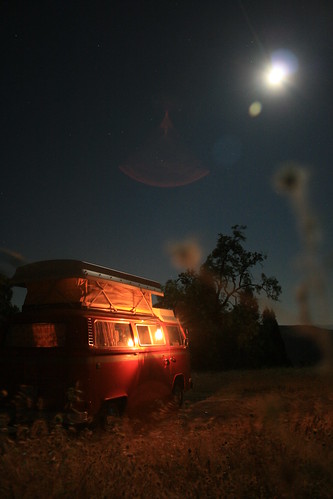
Moon and Lantern Light
The bus under moonlight and the old Deitz lantern, up high in the Mendocino National Forest.

We never went exploring in the Mendocine NF, so it was all new for us. Our journey started with a drive up Hwy 101 until we got up almost to Ukiah, CA. The mountains started to get taller and taller as we drove north, and being that we were looking for a place to camp, I checked out the map to see if there would be any good spots nearby. The only forest land I saw was north of Clear Lake, which was east of the highway, so we stopped on the side of the road near Hopland to see what the best way to cross the mountains into the Mendocineo NF was. As we pulled off the road, we saw what looked like another VW Riviera stopped on the opposite side of the road. So of course we had to say hi! They were a nice and friendly family from Orange County (in southern California) doing a trip along the coast. Their bus was actually a Westfalia, but they replaced the pop top with a Riviera style one instead. Thats because Riviera pop tops are the best, and those with a Westy don't know what they're missing ;-)! Once we introduced ourselves (halfway through the conversation) they recognized our name because they actually had read my blog online. I was kind of surprised - I had no idea people were actually reading the random adventures I write about occasionally, and I'm glad that some people are enjoying it! They gave us some good camping tips, and also explained how to replace our pop top with new canvas from BusDepot.com, which inspired us to make plans to order a new pop top because ours has some tears and the zippers are kind of stuck. Now that we predominantly camp in the Sierras or the desert where bugs don't exist, it hasn't been too much of a problem, but it would be nice to have a good functioning pop-top. Anyways, random meetings of VW people are always fun.
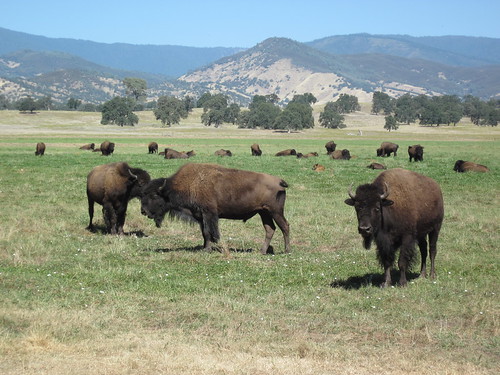
Buffalo
NorCal farmed buffalo between the Coast Range and the Central Valley.

It happened that right out of Hopland was a two lane paved road that went over the Mayacamas Mountains and to Lakeport. Then it was a short drive north of the lake to Upper Lake (very original name again) and into the Mendocino NF. The road (road M1) into the forest first followed a small river, and then started climbing up into the endless rolling mountains of Mendocino county. By this time the sun was getting low on the horizon, so we pulled off the road as soon as we were almost at the top and there was a convenient flat area where it looked like people camped before. The moon was almost full and overhead all night. It was quiet and warm overnight. We used the Deitz lantern as our source of light and ate dinner by lantern-light, pasta with pesto out of tupperware and a 'classy' box wine poured into a plastic wine cup. Dinner in the bus always tastes better.


A video of the bus crossing the water.

The next morning, our goal was to meet up at Trinity Lake to go camping with the EPS people. Since we were on the scenic route agenda, we decided to find a road that went through the Mendocino NF, while also trying to be as direct as possible towards the Shasta area. We found three possible roads. One was close to 100 miles of dirt forest roads which eventually met up with Hwy 36. Another two others were a compromise of about half that distance, give or take about 15 or 20 miles and an unknown elevation gain. We decided to go with the shorter two routes, which were roads M10 and M3. M3 branched off from M10, but both eventually got to Hwy 5 near Redding. So after breakfast, we started on our way. The road turned dirt soon after the junction of M1 and M10, and we saw a lot of dirt bike trails. We even saw some early morning dirt bikers riding along through the forest. The trees were a mix of pine and chaparel type shrubs like manzanita with the red bark. The soil was kind of reddish beige. The dirt road was very well graded and for a while we were able to drive pretty fast. But then the switchbacks started as the road took us deeper and deeper into Mendocino county and we had to slow down. About 25 miles or so down the road, we came up to a small river. There was no bridge. We had to drive through it! So I got out and waded across the river to see how deep it was. It was only a little past my ankles for most of the way, so we decided to drive through it to get across. I took a video of the bus's first river crossing (the one on Pacheco road doesn't count!).
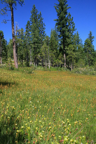
Field of Pitcher Plants
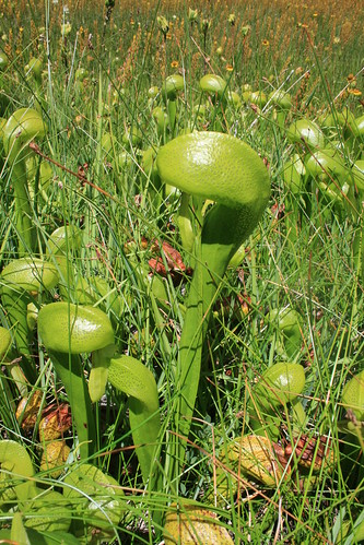
A field full of pitcher plants in the Trinity National Forest.

Soon after, M3 split off from M10. We decided to keep going on M10. Almost immediately after the split, the road quality degraded. There were ruts and deep holes, with rough gravel patches. Then it went up really high along the top of a ridge, called Long Ridge, with death drops on both sides! I didn't get a picture, cuz I was clutching my chair so tightly. Romy noticed I was kind of 'stiff'. It was one of the first times I was actually scared on a forest road! It went on like that for about 5 miles, and then back down. All the while we were kicking up a lot of dust because the roads were very dry. Soon we were over the mountain range and dropping back down towards the central valley. We had the option of getting onto Highway 5, but of course we were on the scenic route so that really wasn't an option. Instead, we stayed on the outskirts of the mountains and drove north, parallel to the highway along farm and ranch roads. Most of them were also dirt, but all were very well graded. We passed by a buffalo farm. It seemed like we were in Yellowstone! I wonder if they are the buffalo that Trader Joes makes buffalo jerky with. They all looked like very happy California buffalo.
Pitcher Plant
A close up of the pitcher plants we saw while hiking.

Before we knew it, we popped out of the ranches and into Red Bluff by Hwy 5. We didn't see any road that we could take as an alternative, so we got onto Hwy 5 at that point and drove north to Redding, where we exited to get on Hwy 299 West. At this point, we followed the directions I printed out to get to Trinity Lake. Right out of Redding, the road climbed up back into more mountains, and we even had some great views of Mt Shasta along the way! The theme of this trip was definately driving through mountains. This isn't really so hard to do in California, since the only flat part of the state is the central valley, and we did our best to avoid it. We got to the group campsite at Trinity Lake just about 4pm, 24 hours after we had left the day before. Nobody was there, since they all went out hiking for the day, so we picked a camping spot and took a swim in the lake. It was soooooo warm! Almost like swimming in a heated pool. Eventually everybody came back from their hike, so it was dinner time, along with copious drinking around the campfire under a full moon.
Swimming and Log Rolling
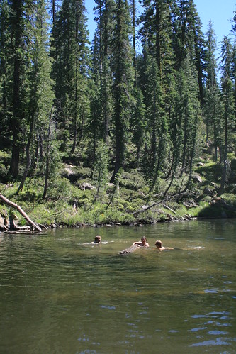
Swimming in one of the many mountain lakes in the Trinity National Forest, trying to roll a log.

The second day camping at Trinity Lake, we took a group hike to Lake Elanor, and also to another lake a few miles beyond, which was high up in the mountains. Along the way, we saw a whole meadow of cool looking pitcher plants! The hike to the second lake had over 1000 feet or so of elevation gain, so by the time we got there we were all hot. The lake looked so clear and inviting so of course we had to go for a swim. The water was suprisingly warm for its elevation, but it was also pretty shallow, about 10 feet deep. It didn't have a lot of vegetation, so that was good. Everyone had fun swimming, especially when we tried to have a log rolling contest in the water! After having lunch there, we headed back down (which was much easier hiking) and met with the rest of the group who stayed back at the first lake. When we all got back to the camp site, we were all hungry and ready for a cold beer. So the second night followed just like the first, with dinner around the campfire and more drinking. Sunday was the last day, when we all sadly had to go home!

Sunday, July 10, 2011

Its Snow Plant Time

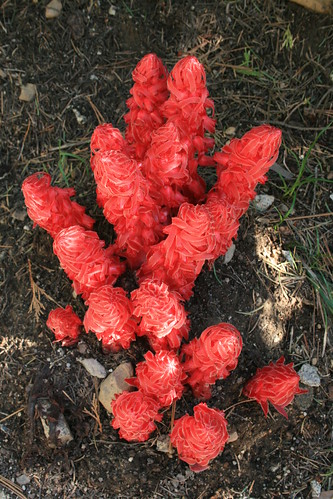
Its that time again for snow plants. Here they come! I saw these in the Eldorado National Forest. I wrote more info about them in a past post, here.

Snow Plant
A bunch of bright red snow plants pop out of the ground.

Saturday, July 09, 2011

Euro-Summer: Part 1: Norway & Lofoten

I came to Norway again this year, this time for the 6th annual Trondheim Carbon Capture and Storage (or Sequestration, depending on who you ask) Conference. At least, that was the official reason for coming back to Norway. But that official reason means I can have a more important unofficial reason – see some of Norway with my friend Mark (specifically, Lofoten), then go back with him to Switzerland and see some of Switzerland!

Mark took a good chunk of vacation time for this trip and drove his company car (a newish Audi A4 Quattro wagon) up from Switzerland.  He blitzed it and drove straight through, sleeping on the ferry across the Skagen Channel then drove straight up to Trondheim. Meanwhile, I wrapped up my school/work related things and got ready to leave the apartment hotel. The people who ran the apartment hotel were nice enough to let me stay in it beyond the checkout time, just asking I not mess it up after they had cleaned and prepared it for the next guests. Well, Mark arrived, and after geeking out to see each other, there was a mutual agreement he should bathe. After a blitzkreig of driving for 16hrs or so, he was, um, not so fresh and the prospect of driving northwards already smelling was not an appealing one.

I packed up the car while he un-funked. He had arrived around 5pm and we had no place to stay in Trondheim overnight.  The way I saw it, we either started driving north to Lofoten right away, or somehow campout near Trondheim. But, before our imminent northward voyage, we decided that he needed a break from being in the car, and I needed to shift gears out of school mode. School mode generally leaves me grumpy and annoyed, so to get out of my funk, we toured Trondheim a bit.


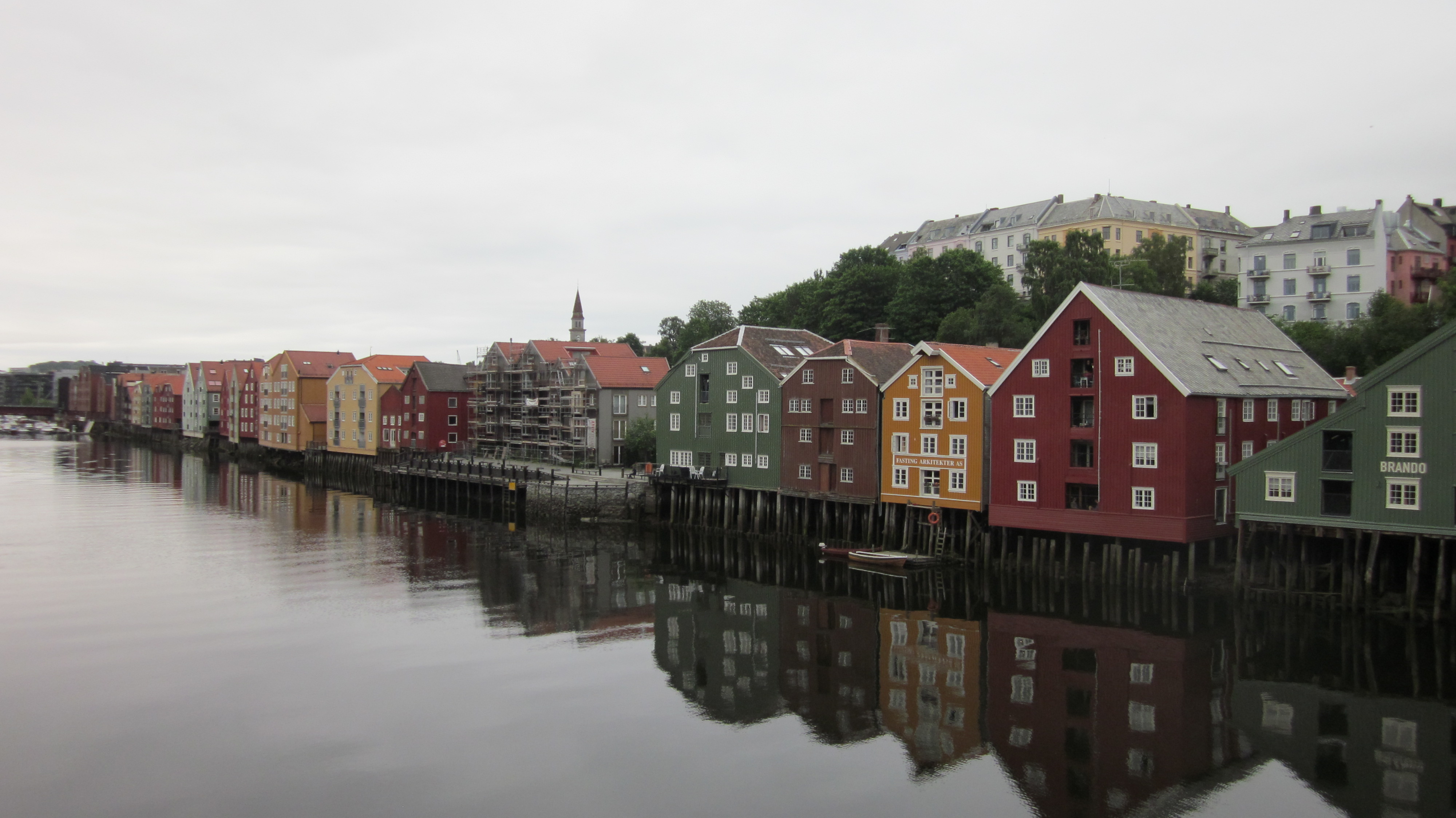
Some buildings on the river in Trondheim. You can see how high the water gets when the tide comes in.


Trondheim is a neat little city; the 3rd largest in Norway (which isn't really that big). It was founded over a thousand years ago by the Vikings, and used as an outpost, capital, and seat of the Archdioceses of Nidaros. The latter is responsible for the Nidaros Cathedral, which can be seen from everywhere in Trondheim and is quite impressive. However, in its current form, the Cathedral is not very old. The original burned, was struck by lightning, burned some more, and generally fell apart by the mid-1800s. Apparently this didn't suit the residents of Trondheim, so around 1869, they started rebuilding it. But these things apparently take time, (I'd also imagine the winters here don't help) and it wasn't finished until 2001. So although it's impressive, I wouldn't call it old. It's more like a new thing that was made to look vintage, extremely vintage.

But enough of that and back to the trip. We toured around Trondheim on foot for a few hours, seeing most of what's interesting (and laughing at the Fag School, and how Johan's banken at the Spare bank) and decided it was time to move on. But first, I thought we should stop by some friends from school and check if my climbing equipment had arrived in the mail yet. It was about 10pm when we showed up and knocked on the door, but luckily a party was going on and all was well. We had some drinks and chatted a while, but ultimately decided we needed to get moving (as sleeping there during a party wouldn't work) so said some goodbyes and voyaged onwards, to the north. So we left, at midnight, because it's Norway and light all the time!

The drive up is a bit of a blur in my head. There were some suicidal birds that shot in front of the car (and got hit), lots of driving, some snoozing (possibly by both occupants of the car), and a bit of snacking. It's a road trip after all!

The coastal road going north.


We took the coastal road going north when we could, and drove the long way up to the 'armpit' area of the archipelago Lofoten, took a ferry across, then drove eventually drove into Svolvær. By this time it was really late and we figured we might as well keep going to the first spot we wanted to see - the area around Henninsvær. We found some small pulloff, and setup camp for the night/morning. Unfortunately, although there was little traffic when we pulled in, we soon learned that although Lofoten seemingly is a sleepy area, there sure can be a lot of traffic.

So anywho-ha, we awoke and rolled into Henninsvær proper, a small fishing / outdoorsy village (depending on the season) to get some coffee and check out the climbing cafe. We had actually checked it out the night before (since there's daylight all the time) but if we wanted to climb, we needed some gear. Mine had not arrived in the main due to customs (although I had shoes), and Mark didn't have any, figuring he'd just buy what was needed. A whole paycheck later, Mark had gear, and we were off to explore outside of the small village.


A view towards the mainland from near Henninsvær.


The whole area of Lofoten is actually decently similar to the rest of Norway, it's just that instead of it being a fjord, it's a bunch of mountainous islands (an archipelago) and because it's so far north (and possibly also due to wind), there are very few trees on these islands at higher elevations. Since we were newly arrived and were surrounded by these magnificent mountains, we decided to do a quick climb up one of the mountains near Henninsvær. We had gotten pretty high when I started realizing my worn old shoes didn't have much grip. Mark had no problems, so we split (since he wanted to keep climbing) and I stayed lower and just enjoyed the view. I watched him climb up to near the top and started to think I'd be driving back south alone (and he'd be dead or in a hospital). He disappeared for a while, but reappeared after about 30 minutes and picked his way down. In typical Mark fashion, he acted like it was not a big deal, but revealed later his climb was pretty sketchy. I'm glad I abstained.

And about now things get blurry in my memory. You see, when it's sunny 24/7, you have no concept of time. You don't sleep much, because your body is always telling you to be awake. So instead of trying to provide some sort of linear story of what happened and when, I'll let pictures tell the story. The archipelago is pretty long, and we wanted to see all that we could, plus backpack and climb. So here are some pics from places we visited, in vaguely the order we visited them.


Flakstad: Amazingly epic beach, and not unusual either!


Reine in the south of Lofoten. It's a small and pretty fishing village that's a bit touristy now.


A gravel road near the start of the hiking trail to Kvalvika. This is pretty typical landscape in Norway.


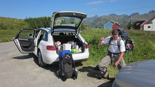
Mark checking pooping motions before our overnighter on Kvalvika. We brought all sorts of climbing things but just ended up bouldering. And no bouldering pads were needed because the grass around the boulders was so soft!


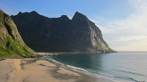
Kvalvika looking north. The bouldering was just to the left of this area. There was a bit of outcropping to cross between this southern beach and the northern beach, but it was easy to do at low tide. So the climbing gear we brought was extra weight for 'sport'. Dolphins :-)


Kvalvika looking south. We jumped in the water after our hike and pitch the tent right above the beach. The water was a bit chilly, but all in all, very nice and refreshing!


Climbing above Kvalvika to get a better view around. This picture was taken at about 1am. The tundra is so nice and comfy to walk on, it feel like you're walking across memory foam or a soft bed, but for miles instead of just a few feet!


A view of Lofoten from the mainland on our drive back south. It was an awesome experience, but was now followed by a many many hour drive back to Switzerland!

Thursday, June 23, 2011

From Ollantaytambo to the Pumamarka Inka Ruins

Trail to Pumamarca
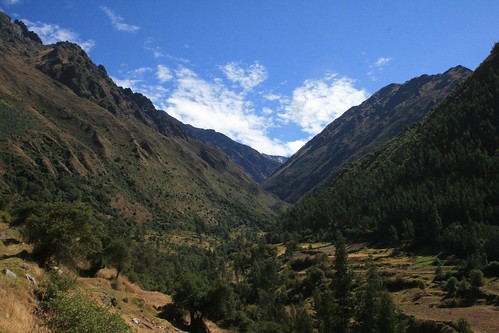
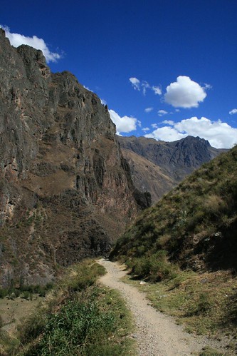
The view of the Patacancha valley on the way to the ruins.


While we were in the small ancient Inka town of Ollantaytambo, Peru, we had about half the day to spare on our last day there before we caught our train to Machu Picchu. The people at the hostal we were staying at (Hostal Iskay) told us about a hike we could do to the Pumamarca ruins. They said it should take us about 5 hours round-trip. I was totally up to it (and my mom was kind of unsure), but we went anyways. If anybody reading this is planning on doing the same hike, my story might be useful (I couldn't find anything on the internet when I looked before leaving to Peru).

Trail to Pumamarca
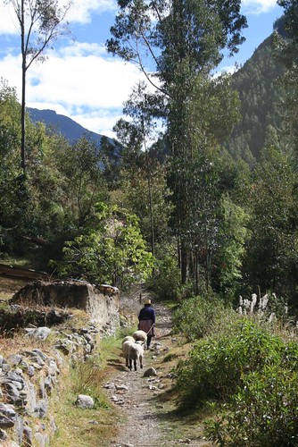
A Peruvian woman leads her sheep around.


The guy working at the front desk (his name was Jose) was kind enough to draw us a really rough map on how to get there. Basically, the map told us to take the dirt road out of town that followed the Patacancha River, north. There would be three bridges that we would need to cross along this dirt road. Eventually, after the third bridge, the road would take us to a very small town called Pallata. It would be in this town that we would see a sign for the Pumamarca ruins. Then for the way back, he recommended we take a hiking trail which would take us over "the 700 steps." It seemed very straight forward while he was drawing it for us on the back of our receipt. For some time estimates, he told us no longer than 2 hours to Pallata, 1/2 hour up to the ruins from Pallata, and then 1.5 hours on the trail from the ruins back to Ollantaytambo. It sounded perfect to us.

Trail to Pumamarca
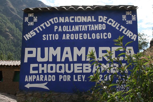
The sign pointing hikers to the ruins was bigger than I expected!


The actual hike we took was more of an adventure than it looked on the hand drawn map! We followed the road north out of town, at a brisk walking pace, starting our hike at 7:40am (I recorded the time that we reached major milestones on the map Jose drew). Soon we walked over the first bridge at only 7:45am. Right after this bridge, the road split into two (but then rejoins again later). You can choose which fork to walk down, and we chose the right fork which follows the river, as this was a pedestrian-only path, and the cars had to take the left fork. I considered the hike to really start here, because the scenery started to get more beautiful as we got farther from the town of Ollantaytambo. Near the river, it was a lush oasis of trees and other plants. We saw school children running past us, late for school I guess, and they all smiled and waved to us. The mountains got taller and taller. At 8:07am we reached the place where the two forks rejoin, and by 8:30am we reached the second bridge.

Pumamarca
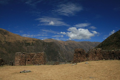
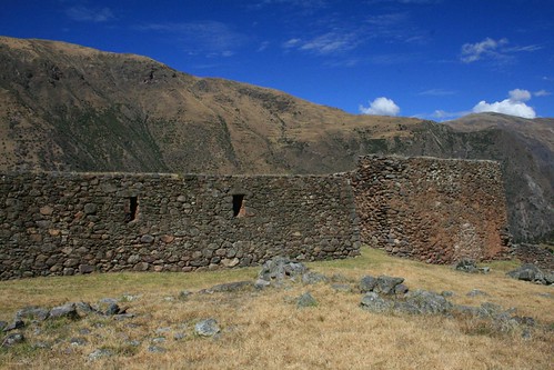
The Pumamarca ruins and a beautiful blue sky.


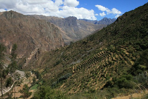
We paused here at the second bridge, and saw a man riding a really furry horse pass us by. As he passed us, he asked where we were going (I guess not many gringos walk this way), "Pumamarca?" And we nodded. He didn't show any sign of concern as he rode away, so we assumed we were on the right track. According to our map, we would soon be able to see the 700 steps that Jose drew. From far away they looked like lines on the side of the mountain. When we got closer, you could start to see the terracing, but it was badly overgrown. There were sooooo many terraces! I didn't count, but I don't doubt that there were actually 700! Although it was beautiful mountain scenery, this part of the hike seemed to drag a lot. I don't know why. At 9:09am we reached the third bridge. Jose instructed us to keep going after the third bridge, even though all the cars that drive up to the ruins turn here at the third bridge. So we kept walking towards Pallata. We got there at 9:43am, almost exactly 2 hours after we set off from Ollantaytambo. At the town, we saw a big blue sign marking where we should turn off of the road to go to the ruins. It pointed us down a foot path that took us past a few houses to a creek. When we got to the creek, we were confronted with another fork in the trail which Jose didn't tell us about! There were two bridges over the creek, which lead to two different trails. An old lady leading her sheep around took the left bridge, so we asked her if she was going towards Pumamarca. She just swung her arms up towards the top of the mountain, and kept walking, which was her version of a signalling to us, I guess, of where Pumamarca was. But by this point, we already knew where it was since it is possible to see from the road we were walking on. We just decided to follow her over the left bridge. There was a trail going very steep up the mountain towards Pumamarca which disappeared and reappeared. Then it totally disappeared when it junctioned with dirt road half way up to the ruins.

Pumamarca
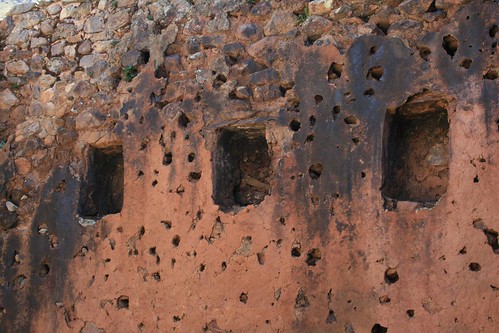
Detail of the ruined walls at Pumamarca.


We knew where the ruins were, so we just kept taking every opportunity to go up, be it footpath or road. Eventually we got to the ruins, but I think we must of taken a wrong turn somewhere, but maybe not, because it seemed very indirect! It took us over an hour to reach the ruins from Pollata! My mom was dragging behind me, and after a while I got really far ahead of her. When I reached the entrance of the ruins (a small wooden gate) the place was totally deserted. I was the only one there! So I opened the wooden gate and started walking around the ruins. They were so high in the mountains! Everywhere you looked, it felt like you were on top of the world! As I walked in and out of the rooms, I tried to imagine what they were used for. I had no information about these ruins, other than they were really old (8th century AD supposedly, and inhabited continuously until the Spanish conquest). I started to walk back towards the entrance to see if my mom made it yet or not. As I did, a man popped out behind a wall holding a machete. No joke! It was a big machete! I got so scared for a second, but then he smiled and said hello. After the initial scare, I noticed he was wearing a INC uniform (like a national park ranger kind of). OMG, the machete was for cutting overgrown grass and weeds, not for murdering people while they were alone in the ruins!

Pumamarca
The color of the rock in the walls matches the surrounding mountains.


I tried to talk to him, even though I don't speak Spanish at all, and tell him that my mom was coming behind me and that I just wanted to walk around and look and take pictures. He said okay, and that he would let my mom know I was here when she showed up. I am surprised that I was able to convey that message to him successfully, although it took me about 5 minutes of gesturing and stuff! These were the most beautiful ruins we had seen so far on the trip. And they were worth hiking to, in my opinion. I don't think my mom thought they were worth it, since she had a really hard time hiking up, at high elevation (over 2,000m). But she eventually made it, and after we saw the ruins, we asked the man with the machete how to get back to Ollantaytambo via the camino, or trail. He pointed us in a direction, but the trail was not very obvious. We figured we'd start walking that way and maybe we would see it as we got closer. As we started hiking back down from the ruins, a nice man named Henry that lived right next to the ruins asked us if we knew were we were going as we passed him by. I said we were trying to find the trail back to Ollantaytambo, and he said he would show us how to get to it. I am so glad he showed us because it was not obvious at all!!!! He took us past bushes, through a farm with a few big cows, and in general along many meandering footpaths that just looked like animal paths, to be honest.

Trail to Pumamarca
The 700 agricultural terraces on the trail back to Ollantaytambo.


After about 20 minutes of that, the trail got more beaten in, and began to follow an ancient (i'm assuming ancient) aquaduct type thing. He left us at that point, since he felt the trail was obvious enough now that we wouldn't get lost. Thank you Henry!!!! The line on our map that Jose back at the hostal drew began to make me laugh now. At that point I also remembered that Jose said the trail would also take us past some waterfalls, and we would walk on top of the 700 steps. Sure enough, a few minutes after we left Henry, we saw a waterfall! And then we began walking along one of the 700 terraces. You could start to tell that the trail becoming a footpath over one of the highest terrace walls, because you could start to make out the stone walls beneath all of the overgrown vegetation. How awesome! This part of the journey also had the best views, since we were high up on the mountainside. We could see the Patacancha River below us, and the road we walked on earlier that morning. I felt like it might have been better to just get on this trail right out of Ollantaytambo when we were hiking to see the ruins, instead of taking the road next to the river. It certainly would've been more direct, but then again, we wouldn't of had the opportunity to see the 700 steps from below. At least this way we did a big loop, avoiding seeing the same thing twice. It took us about 2 hours to get back to Ollantaytambo on this trail. The place where this trail meets with the road coming north out of Ollantaytambo is behind a house, just past where the two forks in the road rejoin (the pedestrian-only fork and the car traffic fork, between the first and second bridge). We got back to Hostal Iskay around 2pm, giving us a little over an hour to spare before we had to head over to the train station. I read on the internet, before we left to Peru, that this hike was easy to moderate, but I think it's at least moderate, because of the elevation and the steepness near the ruins. But it was well worth it and one of the most memorable of all the ruins we saw in Peru! Oh yeah, and unlike Machu Picchu and a lot of other ruins, it was free to enter!

Trail to Pumamarca
The trail back to Ollantaytambo.

Saturday, June 04, 2011

A Muddy Rodeo

This weekend was the annual Russian River Rodeo located in Duncans Mills, CA, on the banks of the Russian River just inland of where it meets the ocean. We found out about it via a website I discovered that lists all of the rodeos going on all over the country. Its called rodeoz.com. It was an intensely rainy week before the rodeo, but the website said it was going on rain or shine, so we got our rain gear on and headed over there along Hwy 1.

Russian River Rodeo 2011
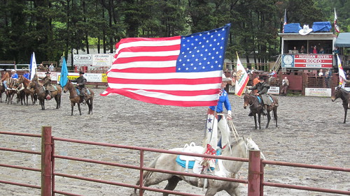
The American flag gets paraded around a few times by a cowgirl.


We got there about half-hour early, and as it was still raining on and off, we headed over to have a drink at the tavern right across the street before the rodeo started. They had Pliny the Elder (brewed by the Russian River Brewing Co) on tap, so we ordered a pitcher and shared it with Nicole and Marcel, who came along for the rodeo. We had just enough time to enjoy our beer, when we saw all of the cowboys rounding themselves up on the muddy rodeo grounds.


A video of a bull-rider at the rodeo.


We hurried to get a spot in the bleachers, which were only half full because I guess a bunch of people were deterred by the rainy weather. I took a few videos of the bucking horse and bull riding events. We got to sit really close. It was a lot of fun! I hope I get to go the the Bridgeport Rodeo next month. I'm becoming somewhat of a rodeo-addict!


A video of a bucking bronco rider at the rodeo.

Wednesday, June 01, 2011

First Desert Race: The Desert Dingo

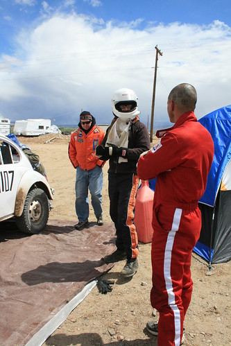
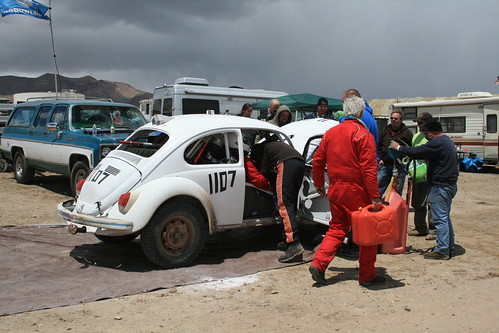
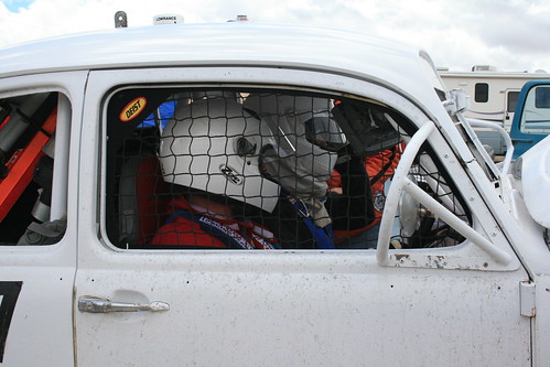
Romy joined a Class 11 team that does off-road racing. The car is called The Desert Dingo (check out www.desertdingo.com). Here are some pictures from the Yerington, NV, VORRA race this past weekend.


VORRA Yerington NV
The Desert Dingo and other Class 11's line up at the starting line.


VORRA Yerington NV
Romy getting ready to drive.


VORRA Yerington NV
Pit stop time.


VORRA Yerington NV
Romy and Jim, ready to drive off on the last lap!


VORRA Yerington NV
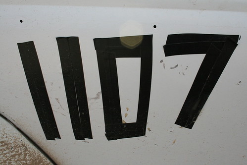
For now, electrical tape number.


VORRA Yerington NV
The Desert Dingo finished the race.


The Desert Dingo is currently in first place with 100 total points in the Class 11.
Next race: USA 500 July 15-17 near Reno-Sparks, NV.