Sunday, November 30, 2008

Our Thanksgiving Holiday: A Photo Journal

This thanksgiving, we decided to pack the Daewoo and get out of the Bay Area. We didn't know exactly where we were going, but we knew we wanted to see the desert. It was the perfect time to go see the desert because the temperatures were cool and there were less people. We took so many pictures that I decided to make a photo journal and share our thanksgiving adventure!

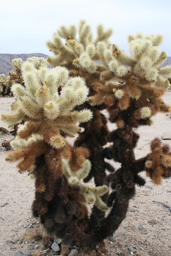
Cholla Garden
The first place we drove to was Joshua Tree National Park. We didn't go rock climbing here because we were only driving through. It was raining in the desert here. Joshua Tree and most of Southern California is in the Mojave Desert, one of the four great deserts of North America. The Mojave Desert covers most of Southern California. The Great Basin Desert covers most of Nevada. The Sonoran Desert covers South-Western Arizona and parts of Baja California. Finally, the Chihuahuan Desert starts in New Mexico and Texas and extends south into Mexico.
Cholla Garden
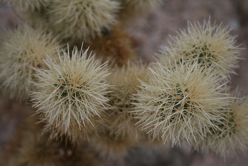
This is a Cholla Cactus. It grows mostly in the Mojave Desert. The needles are very special because if you touch them, they have the ability to embed deep into your skin and break off, leaving the tiny needle buried somewhere in your skin! This is the reason they are sometimes called the 'Jumping Cholla.'
Cholla Garden
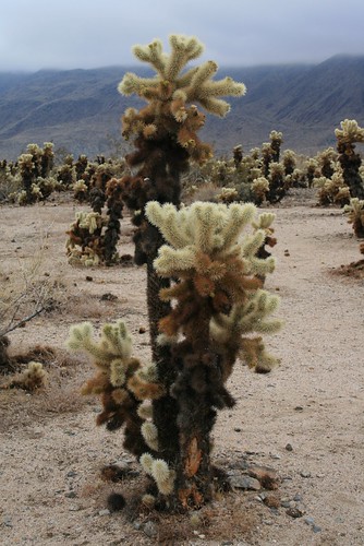
The Cholla Cacti grew dense in 'gardens' at Joshua Tree National Park. They grew at the transition zone, where the Mojave Desert transforms into the Sonoran Desert. Joshua Tree NP of course also had Joshua Trees, but we didn't take a picture of one for some reason!
Desert Coyote
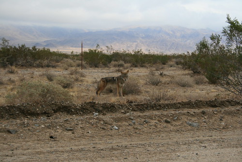
As we were exiting Joshua Tree NP, we saw a coyote along the side of the road. It paused and let us take a picture. It didn't seem afraid of us.
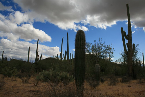
Saguaro NP
Next, we entered the Sonoran Desert, as we drove into Southern Arizona. Our goal was to go visit Saguaro National Park, where we took a short hike. The weather was great, except it was actually raining and thunderstorming! A very rare event, but it happened while we were there!
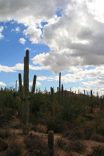
Saguaro NP
Saguaro cacti are very tall (probably 10 feet or more) and they grow very slowly. It could take up to 75 years for the Saguaro to start growing an arm. The arms are formed when the cactus flowers. In the picture above, you can see many adult Saguaros and one baby in the middle-bottom of the picture.
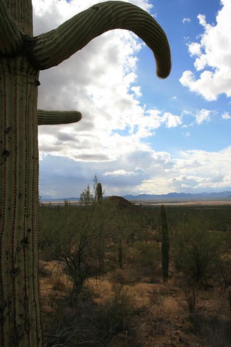
Disco Saguaro
This Saguaro is disco dancing. Sometimes the arms don't grow upwards, but sideways. Then they really start to look like people! There are strong winds in the desert. There was one research group which concluded that the Saguaro grows ribbed trunks/arms because it makes it stronger against the wind, preventing it from toppling over in the wind.
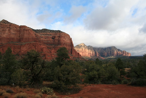
Red Rocks
After visiting Southern Arizona, we headed north towards Phoenix and Flagstaff. On the way we drove through Sedona, Arizona. There were a lot of red rock cliffs in the area.
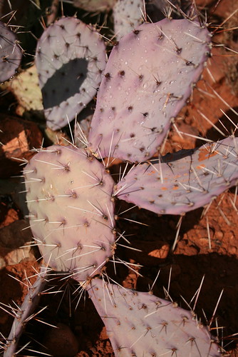
Purple Cactus
While we were hiking around Sedona, Arizona, we found a purple cactus. It was so unusual looking, I had to take a picture! It was even still wet from a short rainshower earlier that morning.
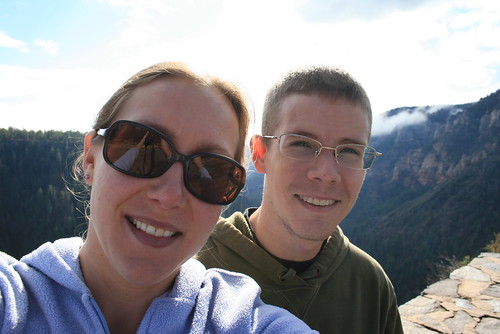
Jenn & Romy
This picture was taken on the way to Flagstaff. We were at about 6,400 ft in elevation. We never knew Arizona had mountains! Haha! The peak in Flagstaff had snow and was around 12,500 ft.
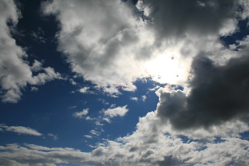
Arizona Sky
The sky in Arizona was so crazy! We saw everything from 'little fluffy clouds' to giant thunderheads.
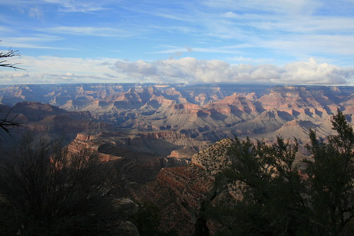
Grand Canyon
As a last minute detour, we decided to visit the Grand Canyon. No visit to Arizona is complete without peering over its edge! It was really cold! The elevation was about 7,500 ft at the south rim. There was some snow. And suprisingly there were a million other people who also wanted to visit the canyon!
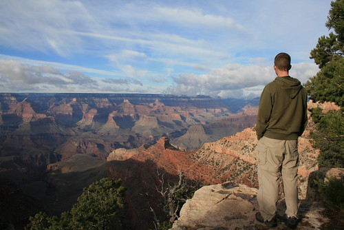
Romy Looking into the Grand Canyon
Romy looking over the canyon egde into the abyss. It was hard to actually see the Colorado River from the south rim. The Grand Canyon was carved over the past 6 million years. It is actually really really deep - almost 6,000 ft to the canyon floor in some places. Thats over one MILE!!!!
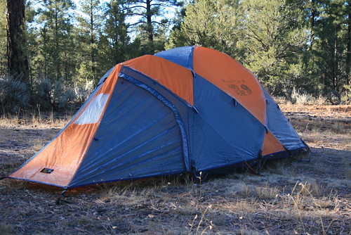
Camping
Even though it was really cold, we decided to camp anyways in the National Forest land near the south rim. When we woke up, the tent was frosted over. It was about 25 degrees over night. But we were warm inside the tent and our sleeping bags!
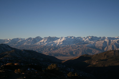
Sierra Nevadas
We decided to drive along the east side of the Sierra Nevada mountains on our way back home. From Arizona, we drove to Las Vegas, and then into California. We camped in the Inyo National Forest near the bristle cone pine forest in the White Mounatains. We camped at about 6,000 ft. When the sun came up, we hurried up and packed up the tent and drove up to a lookout in the White Mountains at about 9,500 ft. We saw the sun rise and light up the Sierra Nevadas. They were sprinkled with snow.
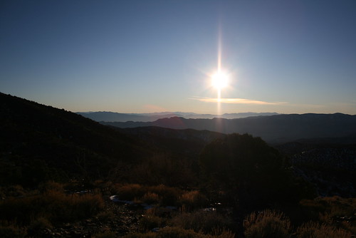
White Mountains
Looking east, into Nevada, you can see the rest of the White Mountains and almost into Death Valley.
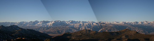
Sierra Panorama
I created this panoramic picture from three pictures that I took of the Sierra Nevadas next to each other. I am standing on top of the White Mountains, looking west over the Owens River Valley and towards the Sierra Nevadas. Mount Whitney is not in the picture. It is a little south. These peaks range from ~10,000 ft to ~14,500 ft.

Sunday, November 23, 2008

Rock Climbing at Pinnacles NM

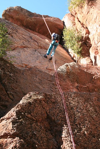
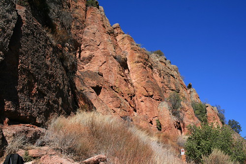
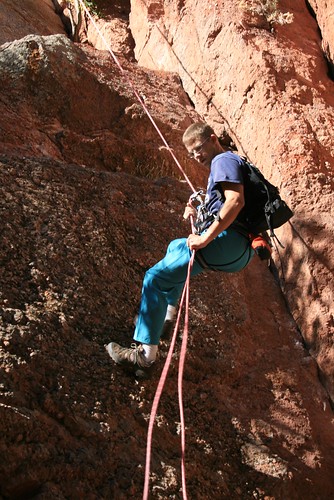
This weekend we finally got out to go climbing outdoors! We went to Pinnacles National Monument, which is about 2 hours south of the Bay Area. It is a park which lies along the San Andreas fault, and its used to be an old volcano which was eroded away into weird rock formations and pinnacles. There are trails through the park, and two "caves" which formed when deep small canyons got buried in huge boulders. You can hike through the canyon "caves" which are mostly dark, since they are covered in rock debris. There's only a little bit of room to walk through, if you have a flashlight. We didn't bring one, because we went rock climbing. Next time we will visit the caves.

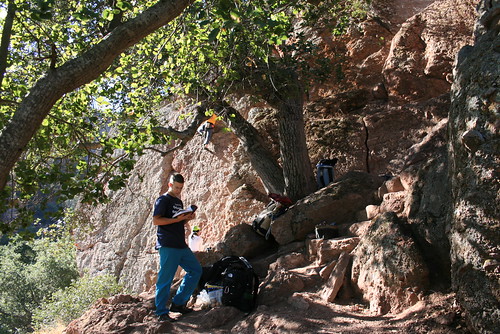
The rock is strange. It is a conglomerate of tiny pebbles, all cemented together like concrete. It has a reddish hue, like molten lava. The rock is scary to climb on because it is loose sometimes, but it was interesting and fun. Here are some pictures:

Romy Rapelling

Romy Rapelling

Romy Rapelling

Romy

Pinnacles National Monument

Sunday, November 09, 2008

Birthday Snowshoes!

Today is my birthday, and it was nice, sunny, and about 70 degrees out! We went jogging at Joaquin Miller Park on the trails. I took along my GPS so that we could visualize the path we ran and also record the distance that we ran. We did a total of 2.43 miles. It was our first time jogging since we moved to California! Can you believe that!? When we got back to the car, I plotted the surface elevation of our jogging trail. We jogged the Sequoia Byway Trail, which was between 1,200ft-1,550ft in elevation!
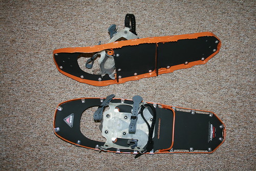
Also, we were searching craigslist.com for snowshoes to get ready for our Thanksgiving holiday, and we found a pair of MSR Lightening Men's snowshoes for half the price! Some guy who works at REI bought them and never used them, and sold them to us for the 'at cost' price. Yay! Here's a picture:

Romy's Snowshoes

They are orange and super light, made of aluminum. The crampons are part of the frame, and there is an extend-able heel bar so that you can rest your heels when climbing uphill. So even though it was my birthday, these snowshoes are for Romy. Now I have to find some for myself!!

Monday, November 03, 2008

Foggy Day

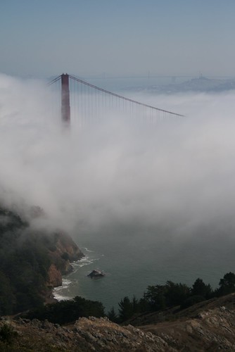
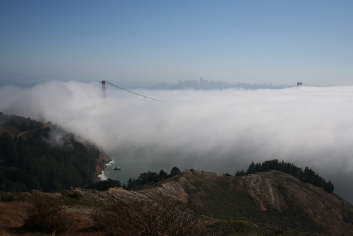
We've been really busy with school for a long time! A few weekends ago, we went to go see the Golden Gate bridge in the fog! The narrow channel that the Golden Gate Bridge spans is the opening to the ocean. Whenever there is heavy fog from the ocean, it all squeezes between the mountains through this passageway, and a stream of fog shoots inland over the bay right towards Berkeley. The bridge is almost completely engulfed by the stream of fog except for the very top! Ocean ships need to use their fog horns, so there was a lot of "tooting" of fog horns a few times each minute. They are really loud! Sometimes at night, you can hear them all the way in Oakland! Here are some pictures:


Golden Gate in the Fog

Golden Gate in the Fog

Saturday, September 27, 2008

Through The Ages


Thursday, September 04, 2008

Labor Day Travels around NorCal

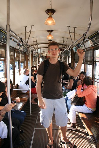
This labor day weekend, my mom flew to San Fran to visit us! We decided to make the most out of our last long weekend before school really started. On Thursday, we went to down town San Fran and rode on the historic trolley cars. We had dinner at Fisherman's Wharf.

San Fran Historical Trolley F
Romy on the F-line trolley in San Francisco

We headed out on Friday in the bus from Oakland across the Bay Bridge. . . except we almost didn't make it over the bridge!!!! There was bumper to bumper traffic (since we left during rush hour) and all of a sudden, as we were approaching the middle of the bridge between San Fran and Treasure Island, we heard a huge and scary 'klump bump thump' from the transmission area. WTF!? So Romy stopped the bus in the middle of the highway traffic on top of the bridge! To make this worse, we were on an incline (since we were on the section of the bridge that lets boats go under it) and the e-brake was malfunctioning. So I had to put one foot on the brake, while Romy went under the bus. I kept my foot pressed down hard on the brake pedal, otherwise the bus would roll over Romy! So he got under the bus, all tucked under so that nobody would run him over on the highway. This was scary in itself, not to mention what he discovered under there. . .. . the driver's side half-shaft just fell off somehow on the transmission side! Thats the shaft that connects the transmission to the rear wheels. Its a mystery how it fell off. He also discovered that one of the ball bearings from the CV joint rolled out, but luckily it didn't roll far! It was still under the bus! So he shoved it back in, and then re connected the shaft to the transmission (part-way). It was messy, with all the grease getting all over, but we were able to drive away after about 15 minutes or so. It was a long 15 minutes. But we had a great view!!!!

We exited right away as soon as we crossed the bay. We parked somewhere in down town San Fran, and Romy continued to reconnect the shaft properly. The threads got screwed up because of what happened, so luckily we had a tap of the correct size in the tool box, so Romy re-tapped the treads and screwed the shaft in securely. There were no problems after that.

The fog was rolling in. It was actually pouring in between the slot between the mountains at the Gold Gate Bridge. Approaching the bridge, you couldn't even see it! When we got on the bridge, all you could see was 5 feet ahead of the bus. In fact, you couldn't tell you were on a bridge at all. The tall towers and suspension wires were within the thick stream of fog. It was like driving through a cloud.

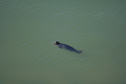
Once in the north bay, we got on Hwy 1 towards the ocean. It was getting dark now, and remained foggy the entire way to the Sonoma coast, where we camped at Sonoma Coast State Beach in the Noreaga Dunes campground. We got site #18 for the night. The fog was creating a mist in the air that hit your skin and made you shiver! It was so cold! But inside of the bus it was warm, and when we woke up, the fog slowly retreated to the ocean. We had coffee and breakfast in Jenner, a small town a little ways up Hwy 1 from the campground. The coast was lined with cliffs, and large rocks jutted out of the water near the coastline. At Jenner, there was a river which fed into the ocean, creating a calm pool area. There were seals swimming and playing in the water!

Seals Swimming near Jenner
A seal swimming near Jenner on the Sonoma Coast

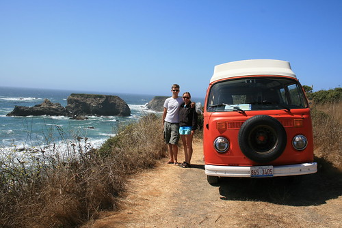
We then continued driving north, along the cliffs and mountainous rocky coast. We stopped along the way at some beaches and scenic places. We had lunch on a cliff-top where we pulled off of Hwy1. The sun was warm, with a cool breeze off the water. We cooked ramen noodle soup. It was spicy flavored (really spicy).

NorCal Coast
Jenn and Romy and the bus on the Pacific Coast

Our goal was to reach the Avenue of the Giants. This is the area where Hwy1 joins Hwy101 in the Coastal Mountain range. This area has a lot of coastal redwoods. Avenue of the Giants is actually the old Hwy101, before they expanded it. It is a 32-mile stretch that runs along side the new Hwy101, but it weaves through old growth redwood groves, and literally lets you drive right past the giant redwoods. There are nice campgrounds all along this route, and we stopped at the Giant Redwoods RV Park in Myer's Flat. We made it to the campground around 6 or 7 pm, just with enough time to shower and make dinner (chilli and hot dogs) before it got too dark out. We didn't have wood to make a fire, so we just had some beer instead.

Drive-Thru Sequoia
Camping in Myer's Flat at the Avenue of the Giants

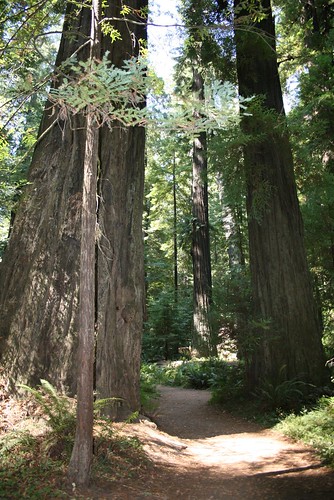
The next morning, we woke up and drove to the northern end of the Avenue, and made our way south. Along the route, we stopped at some tourist attractions, like a redwood burl which was hollowed out to make a 20 ft high small room (it was once used as a gift shop). There were 3 drive-through sequoia trees, and even a "one-log cabin!" We didn't see the one-log cabin, but I assume its a hollowed out redwood or sequoia log that somebody made into a cabin. We also went to Humbolt Redwoods State Park and walked on a trail around the Founder Tree. We walked past trees over 300 ft high. The trunk diameters on some trees were over 12ft wide! Their circumferences were over 30ft around! It was a little breezy, and the tops of the trees were swaying slowly back and forth. It was softly snowing pine needles and other 'leaf litter.' Mostly is was quiet except for some creaking and birds. And it was like standing in a room with cathedral ceilings, except you were in a forest whose canopy was about 160 ft above your head. Below 160ft, there were just tall 'slender' trunks of the redwoods.

Humbolt Redwoods State Park
Humbolt Redwoods State Park trail at the Founder Tree

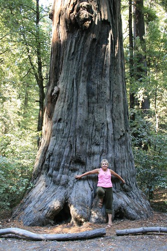
Sequoias
My mom in front of a huge sequoia tree near Legget, CA

That afternoon, we headed back south, back home. The ride back was a little boring, because we took Hwy101 the whole way, instead of the coast. But it was quicker. Once we got to the Golden Gate Bridge, it was all clear, so we stopped for a few pictures before crossing it. We happened to cross it on the last day before they hiked up the toll to $6! On Monday, it was really hot out, so we headed south towards Santa Cruz on Hwy 1. We went to the beach. It was windy, but we found a pocket of calm behind a dune. We all got partially burned, but the next day we were tanned. That evening, we grilled dinner in our backyard. Yummy yummy burgers!

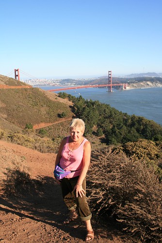
Golden Gate
My mom in front of the Golden Gate Bridge