Wednesday, February 25, 2009

Bathroom Painting Finished

As promised, I am posting the final pictures of our bathroom repainting project. We chose glossy bright white as the color for the bathroom paint. We also bought some wooden blinds to replace the white ones that were in here before. Also, we got a wooden toilet seat, which looks a lot better than the white painted metal old one. When you sat down on it in the morning, it was really cold and the white paint on it was peeling. Every time I cleaned the toilet, it would peel a little more. The wooden one is much better.


The bathroom after its final coat of paint.


The bathroom after its final coat of paint in the daytime sunlight.


We actually finished painting on Monday night, and yesterday we found a sink vanity on craigslist which we really liked. It was from some rich house in Tiburon, which was perched on the top of a hill, with a driveway so steep it was almost 45 degrees! After checking what IKEA had to offer, and pricing it out, we decided that the used vanity on craigslist was higher quality and cheaper. So we called Linda, the woman who was selling the vanity, and drove over the bay to get the sink. We just finished installing it tonight.

The bathroom is almost complete, with a new-to-us vanity sink.

The vanity is real Maple wood (unlike IKEA) and has an acrylic sink (which is okay). It was light in weight because of the sink material, and it fit perfectly into our small bathroom. I think the wood tones of the bathroom match the golden shower doors. Originally, I hated the golden doors, because I would've preferred silver ones, but we had to work with what we had. With a little face lift, the bathroom looks much better. But it is not done yet. We still need to install light fixtures (notice the hanging bulbs in the pictures) and a small shelf above the toilet area. Thats about it!

Monday, February 23, 2009

Bathroom Painting Project

We decided to paint the bathroom about two weeks ago, and have been working on it here and there ever since. We usually get a chance in the evenings for 2 or 3 hours at a time. The bathroom had cracks and peeling paint in some areas, so we decided to do something about it finally. Our landlord will hopefully reduce our rent this month to reimburse us for the painting supplies. We didn't ask our landlord to have the bathroom painted for us because last time he hired somebody to re-paint the ceiling in there, some Mexican came (who was as high as a kite) and replastered, but didn't sand the plaster down smooth, so it was all bumpy. Then when he painted over it, the white paint he used was bright white, while the rest of the bathroom was off white! How dumb! So here we are, having a painting project which should be finished tonight.

We started by sanding down all of the paint to prep the surface. The cracks and peeling paint was scraped down, and then we spackled the holes and uneven surfaces. The spackle had to dry overnight, and once it was set we sanded it down smooth to match the rest of the wall. We don't have any pictures of this part, but we do have pictures of what the bathroom looked like once we finished sanding and spackling.

We also decided to remove the bathroom sink because it was tiny. Everytime we washed our hands, brushed our teeth, or washed our faces, we got water all over the sink and it ended up dripping down the side of the vanity (which was cheap fiberboard) and was in general poorly designed. And the faucet was so tiny, the water ran down next to the back wall of the sink, so you had to stick your hands back all the way to get them wet. Sometimes my hands would hit the back wall. Who designed that so stupidly? Is there really a point to that kind of thing, or was it a mistake? We are looking for a bigger and better sink on craigslist or at IKEA.

So here are a few pictures of the project so far:

The bathroom wall after spackling and sanding. The bathroom sink was removed and there is a plastic drop cloth on the floor.

View of the toilet all covered in newspaper to protect it from stray paint drops.

The bathroom after two coats of primer. Its starting to look much better!


To be continued. . . . .

Monday, February 16, 2009

Mt Shasta

Mt Shasta
A winter wonderland on Mt Shasta.

This past weekend, we took a drive to Mt Shasta to go snowshoeing and cross country skiing. We heard there was a huge storm coming from the Pacific Ocean and was going to hit California with force. In the central and south part of the coast, there was a lot of rain. It rained for three days already, and its still raining here in Oakland as I write. All that rain on the coast meant that there would be a ton of snow up in the northern volcanic mountains (like Mt Shasta) and the Sierra Nevadas. And since we had a three day weekend, we decided to pack up the car and go north to visit Mt Shasta.

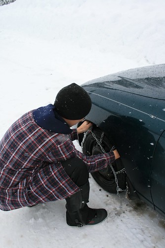
When we started driving Saturday morning, the rain/snow storm already hit us on the coast. As we drove north on I-5, the valley slowly began to rise into mountains, and the rain turned to snow. The highway was not plowed yet, so we drove slow until we got to Mt Shasta City, about 180 miles north of Sacramento. The snow was already deep once we got there. We found a small motel which we stayed at our first night. Once we unpacked our stuff, we drove around town. The streets were pretty packed with snow, so we put the chains on the Daewoo for the very first time! The chains made it MUCH easier to drive through all of the snow.
Mt Shasta
Romy puts chains on the Daewoo.


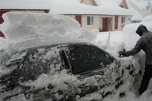
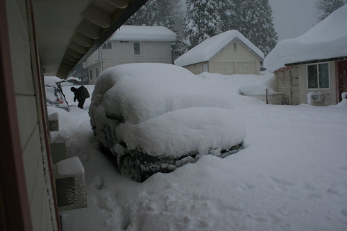
The next morning, we expected the snow to be pretty deep, but when we drew back the curtains in our room to look outside, we were shocked! Over a foot and a half fell while we slept, and it was still snowing! We were seriously wondering how we were going to drive out of the motel and onto Mt Shasta. We started shoveling around the Daewoo, and then the motel owners called a big Cat plow to remove all of the snow in the parking lot. This took about 1/2 hour, so we packed and ate breakfast.
Mt Shasta
Romy trying to clear off snow from the Daewoo at our motel.
Mt Shasta
The car next to us was buried in snow.


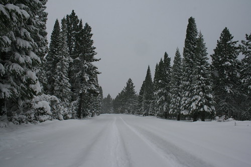
When it was all clear to exit the motel, we drove up the forest service road from town which goes all the way to the summit of Mt Shasta. Its about 14 miles long, but in winter it is closed at about 7,000ft. We only drove up to about 4,300ft which was the elevation of the end of town. The forest service road was completely covered with freshly fallen powder, deeper than the Daewoo could clear, so we parked at a school, and started snowshoeing from there.
Mt Shasta
The forest service road which we snowshoed along.


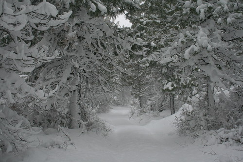
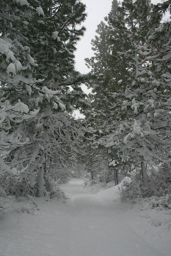
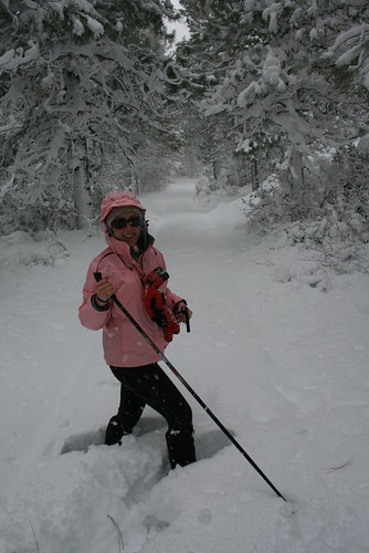
All of the trees were covered with powder and they looked like they were frosted with whipped cream. The skies were overcast and sometimes we hit white outs of snow. The temperature hovered around freezing, so it wasn't too cold. We were actually getting really warm snowshoeing through the deep snow. There were all kinds of off-shoot forest roads that split from the main one. These were completely wild looking because of the snow. The only way you could tell they were there was a line of trees cleared out that showed the way. The first one of these roads we went down had extremely deep snow. We sunk down to our waists sometimes, which made it hard to go forwards, but we switched places breaking trail and took lots of rests.
Mt Shasta
An off-shoot forest road we snowshoed along.
Mt Shasta
We sunk deep into the snow while snowshoeing sometimes!


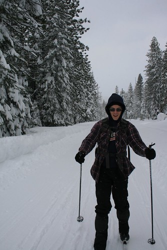
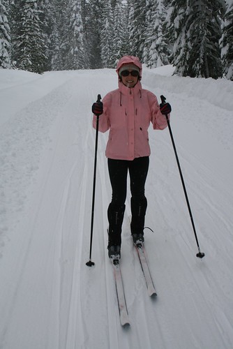
All day it snowed, and again overnight. When we woke up on Monday morning, it was still snowing! Not as much snow fell as the night before, but still almost a foot. The roads in town were plowed, so we decided to go cross country skiing near the Mt Shasta Ski Park at the Nordic Center. The Nordic Center is on forest service land (I think) but it is managed and groomed in the winter by a non-profit group. They run by skiers' donations. When we got there, the trails were beautifully groomed with a thin layer of fresh snow on top. There weren't too many people there, so we had almost the whole place to ourselves!
Mt Shasta
Romy skiing at the Mt Shasta Nordic Center.
Mt Shasta
Jenn skiing at the Mt Shasta Nordic Center.


Just like a down-hill ski resort, this place rated their trails green, blue, and black. We tried them all! The black were the most fun, because they had the steepest hills which got pretty twisty and turny on cross country skis. The green routes were mostly flat, and wove through the snow covered pine trees. The base of snow was at least 4 feet deep, because we tried poking our skis into the snow to see how far down they would go. They went all the way to the binding, and still didn't hit bottom!
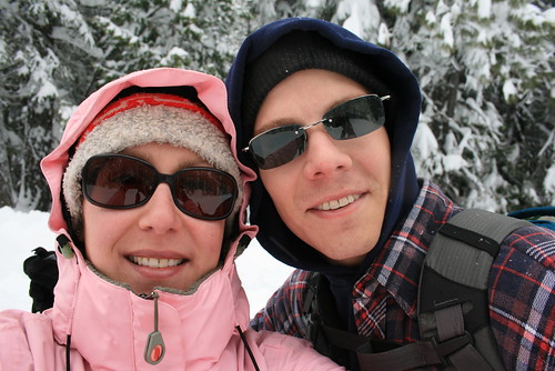
Mt Shasta
Jenn and Romy


After a few hours of skiing, we had to start heading back home. We will be back!
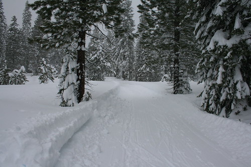
Mt Shasta
The groomed trails at the Mt Shasta Nordic Center.

Monday, February 02, 2009

Racetrack Playa and Badwater Basin


Death Valley
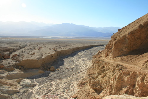
Basin and Range landscape in Death Valley National Park.

Death Valley is literally being pulled apart, as is much of the Great Basin Desert. I'm no expert in geology, but the Great Basin has one of the most interesting stories in geologic time. At one time, long long ago, the area where the Great Basin now sits was lifted up. In Nevada, Utah, and parts of eastern California, tall mountains began to rise out of the earth 250-70 million years ago. Yet due to the ever shifting volcanic activity underneath the earth's crust, about 30 million years ago, the area which is now called the Great Basin Desert, began to be pulled apart. Mountain ranges which once stood next to each other began to slide away from each other due to the crust being extended. Huge deep and flat valleys formed while the mountains actually continued to get higher. The crust got thinner and thinner. In fact, it is still getting thinner as you read this. And the valleys are getting deeper and deeper as well.

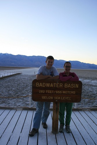
This type of landscape is typical of the Basin and Range Province, an area which includes Death Valley National Park. In Death Valley, we had to chance to see one of the tallest mountains, Telescope Peak (11,043 feet), rise from the lowest valley in the western hemisphere, Badwater Basin (-282 ft). This great difference in elevation is due to the crust being stretched out. Badwater Basin is actually getting lower and lower. The debris that is washed from the surrounding mountains into the basin can't keep up with how fast the basin is dropping. The next big earth quake may drop Badwater Basin a few more feet below sea level!

Badwater Basin in Death Valley
Jenn and Romy at Badwater Basin.

Badwater Basin in Death Valley
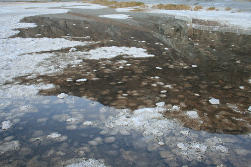
Salt saturated spring water in Badwater Basin.

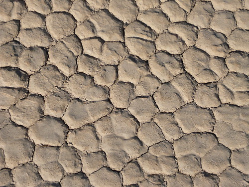
Playas also form in the basin area between mountain ranges. Playas are large flat areas where water flows and pools temporarily. As the water washes down the surrounding high lands, it brings with it dissolved minerals like salt. As the water pools and evaporates in the playa, salt is deposited in these flat plains. Racetrack playa is one of the most famous of these land formations because of the rocks which seem to leave mysterious tracks in the muddy playas.

Dried Mud on Racetrack Playa
The dried surface of a playa in Death Valley National Park.

Racetrack in Death Valley
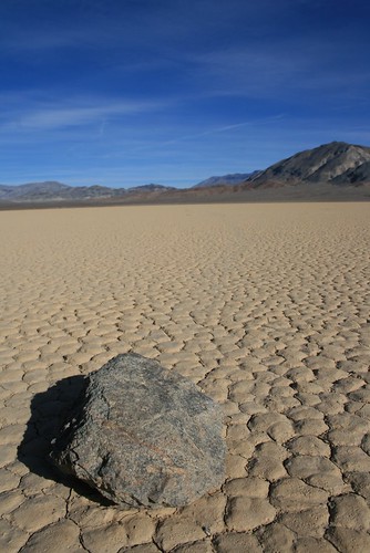
A rock leaves a trail in the mud on Racetrack Playa.


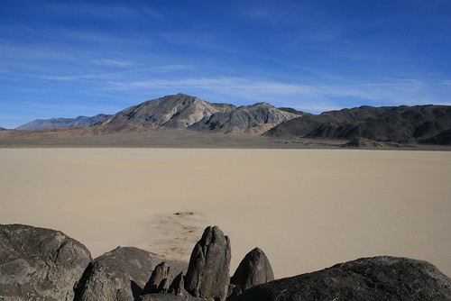
The mystery behind the rocks at Racetrack Playa is that there is evidence that these rocks have moved, but nobody has ever seen them! Geologists have speculated that the extremely flat surface of the playa can get very slippery when it gets wet after rain. In addition, the mountains surrounding the playa act to funnel strong winds across the surface, pushing rocks across the mud. With little friction, the rocks can slide quite a distance before stopping, and during the process, they dig small but noticeable trails behind them.


Racetrack in Death Valley
The extremely flat surface of Racetrack Playa.

Sunday, January 04, 2009

The Drive Home

Here are some interesting pictures from the drive home from Chicago to Oakland.

Sand Dune
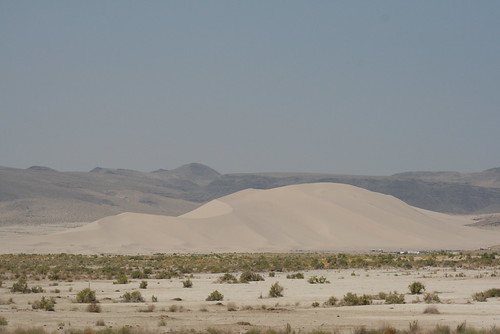
As we were driving through Nevada on Hwy 50 (the only state that we actually took pictures in during the roadtrip) we came across a huge sand dune in the middle of the mountainous Great Basin Desert. We decided to drive towards it, and it just kept getting bigger and bigger. In the picture, you can see some tiny white things along the bottom of the dune to the right. Those are RVs and other trailers camping out next to the base of the dune!

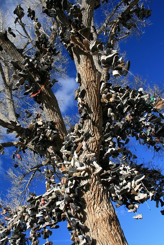
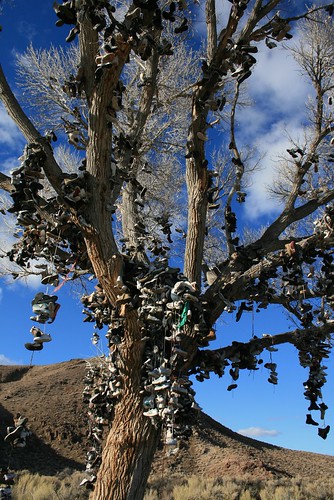
The Shoe Tree
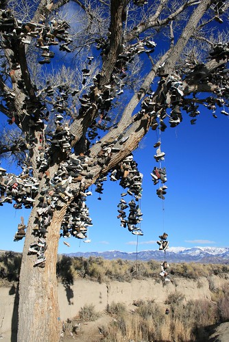
Also while driving down Hwy 50 (which has been nick named the Loneliest Highway in America) we came across a strange tree. From far away, it didn't look right. It looked a little 'clumpy.' As we got closer, we discovered that there were a bunch of shoes hanging off the the cottonwood. It was a very strange collection of shoes, some that looked brand new, others that looked from the 70s. If we had some junky shoes, I guess we would've strung them on too! The mountains in the background have snow on them. Most of the mountains in Nevada had snow while we were driving. In fact, most of the road was covered in ice or snow, and it was pretty cold for being a 'desert.' Although once we got to the western part of Nevada (where that giant sand dune was) it started warming up and the snow disappeared.

The Shoe Tree

The Shoe Tree
Some branches fell off the tree. I am assuming it was because of the weight of all those shoes! I guess there is nothing else in the middle of the desert to do. As strange as this is, we actually saw another shoe tree later on somewhere in the Mojave Desert in California. . .


Sunday, November 30, 2008

Our Thanksgiving Holiday: A Photo Journal

This thanksgiving, we decided to pack the Daewoo and get out of the Bay Area. We didn't know exactly where we were going, but we knew we wanted to see the desert. It was the perfect time to go see the desert because the temperatures were cool and there were less people. We took so many pictures that I decided to make a photo journal and share our thanksgiving adventure!

Cholla Garden
The first place we drove to was Joshua Tree National Park. We didn't go rock climbing here because we were only driving through. It was raining in the desert here. Joshua Tree and most of Southern California is in the Mojave Desert, one of the four great deserts of North America. The Mojave Desert covers most of Southern California. The Great Basin Desert covers most of Nevada. The Sonoran Desert covers South-Western Arizona and parts of Baja California. Finally, the Chihuahuan Desert starts in New Mexico and Texas and extends south into Mexico.

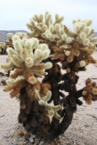
Cholla Garden
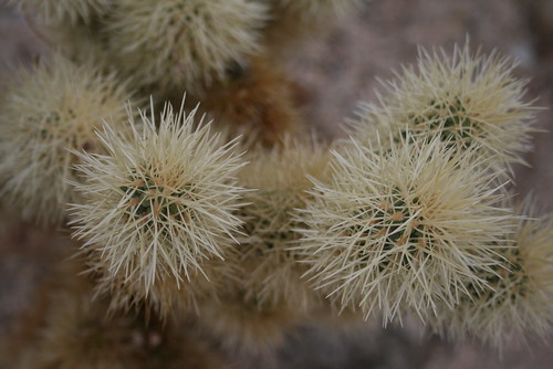
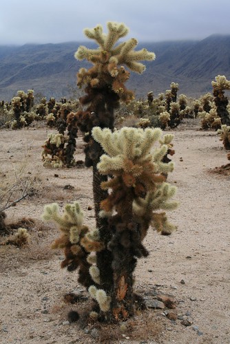
This is a Cholla Cactus. It grows mostly in the Mojave Desert. The needles are very special because if you touch them, they have the ability to embed deep into your skin and break off, leaving the tiny needle buried somewhere in your skin! This is the reason they are sometimes called the 'Jumping Cholla.'

Cholla Garden
The Cholla Cacti grew dense in 'gardens' at Joshua Tree National Park. They grew at the transition zone, where the Mojave Desert transforms into the Sonoran Desert. Joshua Tree NP of course also had Joshua Trees, but we didn't take a picture of one for some reason!

Desert Coyote
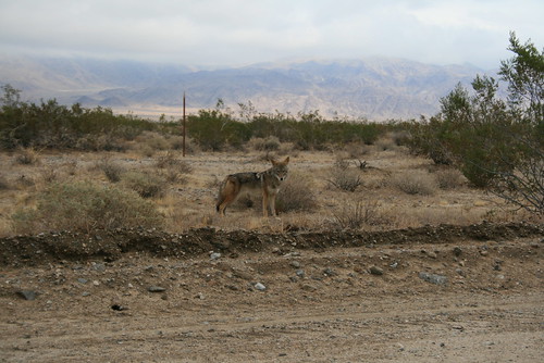
As we were exiting Joshua Tree NP, we saw a coyote along the side of the road. It paused and let us take a picture. It didn't seem afraid of us.

Saguaro NP
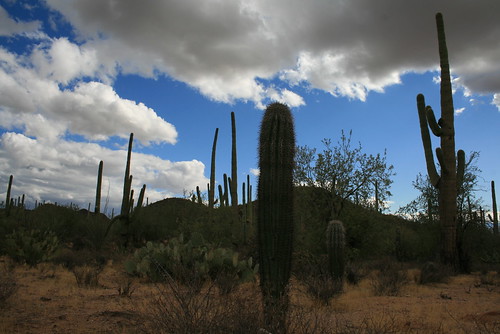
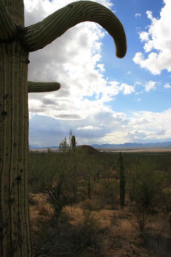
Next, we entered the Sonoran Desert, as we drove into Southern Arizona. Our goal was to go visit Saguaro National Park, where we took a short hike. The weather was great, except it was actually raining and thunderstorming! A very rare event, but it happened while we were there!

Saguaro NP
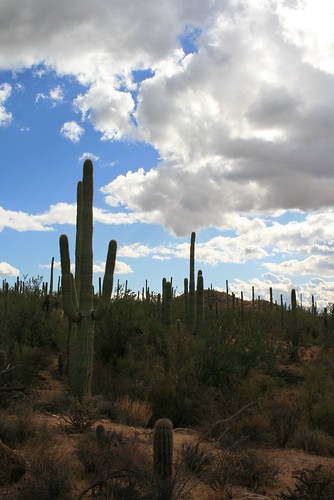
Saguaro cacti are very tall (probably 10 feet or more) and they grow very slowly. It could take up to 75 years for the Saguaro to start growing an arm. The arms are formed when the cactus flowers. In the picture above, you can see many adult Saguaros and one baby in the middle-bottom of the picture.

Disco Saguaro
This Saguaro is disco dancing. Sometimes the arms don't grow upwards, but sideways. Then they really start to look like people! There are strong winds in the desert. There was one research group which concluded that the Saguaro grows ribbed trunks/arms because it makes it stronger against the wind, preventing it from toppling over in the wind.

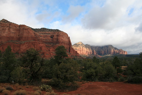
Red Rocks
After visiting Southern Arizona, we headed north towards Phoenix and Flagstaff. On the way we drove through Sedona, Arizona. There were a lot of red rock cliffs in the area.

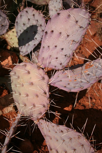
Purple Cactus
While we were hiking around Sedona, Arizona, we found a purple cactus. It was so unusual looking, I had to take a picture! It was even still wet from a short rainshower earlier that morning.

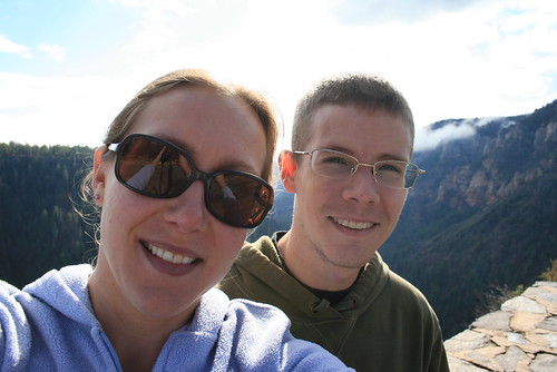
Jenn & Romy
This picture was taken on the way to Flagstaff. We were at about 6,400 ft in elevation. We never knew Arizona had mountains! Haha! The peak in Flagstaff had snow and was around 12,500 ft.

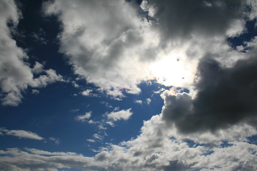
Arizona Sky
The sky in Arizona was so crazy! We saw everything from 'little fluffy clouds' to giant thunderheads.

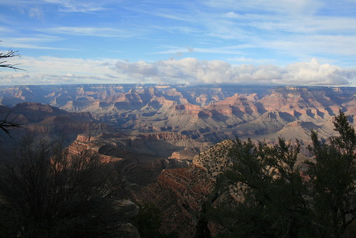
Grand Canyon
As a last minute detour, we decided to visit the Grand Canyon. No visit to Arizona is complete without peering over its edge! It was really cold! The elevation was about 7,500 ft at the south rim. There was some snow. And suprisingly there were a million other people who also wanted to visit the canyon!

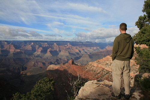
Romy Looking into the Grand Canyon
Romy looking over the canyon egde into the abyss. It was hard to actually see the Colorado River from the south rim. The Grand Canyon was carved over the past 6 million years. It is actually really really deep - almost 6,000 ft to the canyon floor in some places. Thats over one MILE!!!!

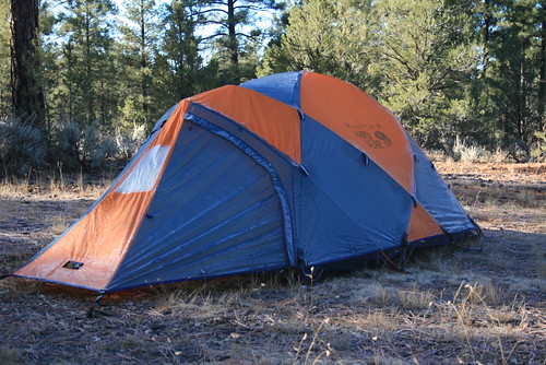
Camping
Even though it was really cold, we decided to camp anyways in the National Forest land near the south rim. When we woke up, the tent was frosted over. It was about 25 degrees over night. But we were warm inside the tent and our sleeping bags!

Sierra Nevadas
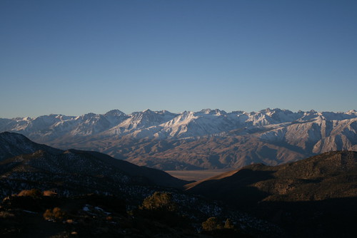
We decided to drive along the east side of the Sierra Nevada mountains on our way back home. From Arizona, we drove to Las Vegas, and then into California. We camped in the Inyo National Forest near the bristle cone pine forest in the White Mounatains. We camped at about 6,000 ft. When the sun came up, we hurried up and packed up the tent and drove up to a lookout in the White Mountains at about 9,500 ft. We saw the sun rise and light up the Sierra Nevadas. They were sprinkled with snow.

White Mountains
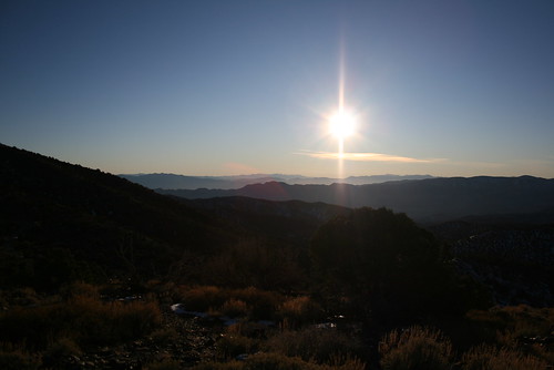
Looking east, into Nevada, you can see the rest of the White Mountains and almost into Death Valley.

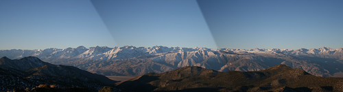
Sierra Panorama
I created this panoramic picture from three pictures that I took of the Sierra Nevadas next to each other. I am standing on top of the White Mountains, looking west over the Owens River Valley and towards the Sierra Nevadas. Mount Whitney is not in the picture. It is a little south. These peaks range from ~10,000 ft to ~14,500 ft.